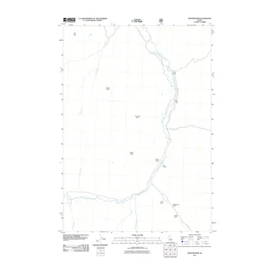
2011 Map of Ziegler Basin
USGS Topo · Published 2011About this map
The East Fork Salmon River carves a deep valley through this Custer County landscape, serving as the primary corridor for human activity and infrastructure. Near the river’s path, the East Fork School stands as a point of community geography in an otherwise vast expanse of high-elevation basins and gulches. The terrain is defined by a series of significant depressions including Ziegler Basin, Joe Jump Basin, and Woods Basin, which contrast with the steep drainages of Spar Canyon and Dry Hollow. Industrial history is represented by the Mule Shoe Mine in the northwest, while the road network is anchored by Herd Creek Rd. Localized water sources like LMB Spring and numerous tributaries such as Road Creek and Fox Creek illustrate the complex drainage patterns feeding into the Salmon River system.
Find a feature on this map
21 named features on this map. Tap any name to fly to it.
Don’t see what you’re looking for? This feature index may not catch every label — zoom into the map to look around manually.
Map Details
Editions of this 2011 Ziegler Basin Map
This is the sole edition of this map. No revisions or reprints were ever made.
Other maps of this area

1929 · Bayhorse
USGS Topo · 1:125,000

1957 · Challis
USGS Topo · 1:250,000

1960 · Challis
USGS Topo · 1:250,000

1963 · Challis
USGS Topo · 1:250,000

1963 · Bald Mountain
USGS Topo · 1:24,000

1963 · Clayton
USGS Topo · 1:24,000
1963 · Ziegler Basin
USGS Topo · 1:24,000
1963 · Bowery Peak
USGS Topo · 1:24,000
1963 · Potaman Peak
USGS Topo · 1:24,000

1963 · Clayton
USGS Topo · 1:62,500