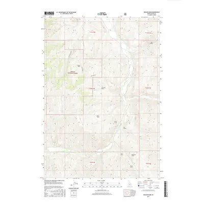
2017 Map of Ziegler Basin
USGS Topo · Published 2017About this map
The Challis National Forest dominates this section of Custer County, where high-elevation basins and steep canyons create a complex drainage system feeding the East Fork Salmon River. The landscape is defined by its dramatic verticality, from the depths of Spar Canyon in the northeast to the broad, elevated flats of Ziegler Basin and Woods Basin. These basins likely served as critical high-country grazing or transit areas, connected by ephemeral water sources like Alkali Springs and LMB Spring.
Find a feature on this map
29 named features on this map. Tap any name to fly to it.
Don’t see what you’re looking for? This feature index may not catch every label — zoom into the map to look around manually.
Map Details
Editions of this 2017 Ziegler Basin Map
This is the sole edition of this map. No revisions or reprints were ever made.
Other maps of this area

1929 · Bayhorse
USGS Topo · 1:125,000

1957 · Challis
USGS Topo · 1:250,000

1960 · Challis
USGS Topo · 1:250,000

1963 · Challis
USGS Topo · 1:250,000

1963 · Bald Mountain
USGS Topo · 1:24,000

1963 · Clayton
USGS Topo · 1:24,000
1963 · Ziegler Basin
USGS Topo · 1:24,000
1963 · Bowery Peak
USGS Topo · 1:24,000
1963 · Potaman Peak
USGS Topo · 1:24,000

1963 · Clayton
USGS Topo · 1:62,500