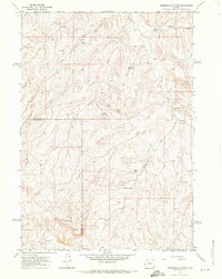
1966 Map of Zimmerman Buttes
USGS Topo · Published 1971About this map
Zimmerman Buttes dominate this high-plains landscape along the border of Hot Springs and Washakie Counties during the mid-1960s. This arid region is defined by a sparse but essential network of water management features, including several small catchment points like Election Reservoir and William Reservoir. The terrain is shaped by numerous ephemeral drainages such as Nowater Creek and Pistol Draw, which cut through the prominent Rimrock formations.
Find a feature on this map
17 named features on this map. Tap any name to fly to it.
Don’t see what you’re looking for? This feature index may not catch every label — zoom into the map to look around manually.
Map Details
Editions of this 1966 Zimmerman Buttes Map
2 editions found
Other maps of this area

1945 · Kirby
USGS Topo · 1:62,500

1946 · Kirby
USGS Topo · 1:62,500

1955 · Thermopolis
USGS Topo · 1:250,000

1955 · Arminto
USGS Topo · 1:250,000

1958 · Thermopolis
USGS Topo · 1:250,000

1958 · Arminto
USGS Topo · 1:250,000

1960 · Coyote Hill
USGS Topo · 1:24,000

1960 · Packsaddle Creek
USGS Topo · 1:24,000

1960 · Red Hole
USGS Topo · 1:24,000

1962 · Thermopolis
USGS Topo · 1:250,000