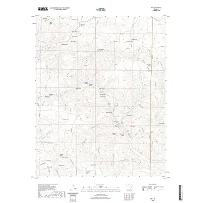
2020 Map of Zinc
USGS Topo · Published 2020About this map
Zinc and Bergman anchor this survey of the northern Arkansas highlands, where the Boone and Marion county line passes through a landscape defined by deep hollows and narrow ridges. The settlement of Zinc sits at a junction of creek valleys and the W Sugarloaf Cr, reflecting the region's mineral-rich history with names like Lead Mine Hollow and Stillhouse Hollow. Small, family-named landmarks and rural institutions such as the New Test Church and the Jackson Cem appear throughout the hills, providing valuable data points for those tracing the lineage of Ozark families.
Find a feature on this map
119 named features on this map. Tap any name to fly to it.
Don’t see what you’re looking for? This feature index may not catch every label — zoom into the map to look around manually.
Map Details
Editions of this 2020 Zinc Map
This is the sole edition of this map. No revisions or reprints were ever made.
Other maps of this area

1893 · Yellville
USGS Topo · 1:125,000

1903 · Yellville
USGS Topo · 1:125,000

1904 · Harrison
USGS Topo · 1:125,000

1905 · Harrison
USGS Topo · 1:125,000

1905 · Yellville
USGS Topo · 1:125,000

1929 · Yellville
USGS Topo · 1:125,000

1945 · Harrison
USGS Topo · 1:250,000

1949 · Harrison
USGS Topo · 1:250,000

1954 · Harrison
USGS Topo · 1:250,000

1958 · Harrison
USGS Topo · 1:250,000