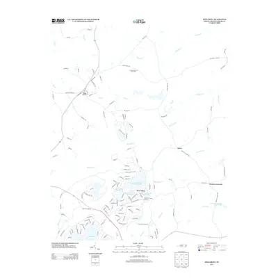
2013 Map of Zion Grove
USGS Topo · Published 2013About this map
The master-planned community of Seven Lakes defines this Moore County landscape, centered around a complex hydrologic network including Seven Lakes Lake Number Two and Seven Lakes Lake Number Three. This modern settlement pattern is marked by curvilinear residential streets and recreational landmarks like Auman Lake and the Pine Lakes Shooting Preserve Lake. In contrast to the developed south, the northern reaches maintain a more rural character, anchored by the Occoneechee Scout Reservation and the crossroads at Zion Grove. The terrain is drained by a series of creeks, most notably McLendons Cr and Suck Cr, which flow toward the Little River. Small settlements such as Harris and Thomas Crossroads appear along the eastern corridors, where timberland and traditional land use meet the expanding residential footprints of the early twenty-first century.
Find a feature on this map
133 named features on this map. Tap any name to fly to it.
Don’t see what you’re looking for? This feature index may not catch every label — zoom into the map to look around manually.
Map Details
Editions of this 2013 Zion Grove Map
This is the sole edition of this map. No revisions or reprints were ever made.
Other maps of this area

1942 · Troy
USGS Topo · 1:125,000

1948 · Southern Pines
USGS Topo · 1:62,500

1949 · West End
USGS Topo · 1:24,000

1949 · Jackson Springs
USGS Topo · 1:62,500

1950 · Southern Pines
USGS Topo · 1:24,000

1950 · Norman
USGS Topo · 1:24,000

1953 · Raleigh
USGS Topo · 1:250,000

1954 · Raleigh
USGS Topo · 1:250,000

1957 · Southern Pines
USGS Topo · 1:62,500
1957 · Southern Pines
USGS Topo · 1:24,000