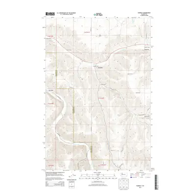
2013 Map of Zumwalt
USGS Topo · Published 2013About this map
Pomeroy and the surrounding agricultural landscape of Garfield County are defined by a complex network of canyons and plateaus documented in this 2013 survey. The terrain transitions from the open stretches of Dutch Flat to the deep incisions of the Tucannon River and Pataha Cr, which carve through the Pataha Valley. Small settlements and named locales like Zumwalt and Marengo are connected by steep, winding paths such as Hartsock Grade Rd and Tatman Mountain Rd, illustrating the challenges of navigating the regional topography. For genealogists and local historians, the Owsley Cem remains a significant landmark near the head of Linville Gulch. The map also captures the intricate web of gulches—including Geiger Gulch, Dry Gulch, and Tatman Gulch—that shape the drainage patterns towards the river valleys.
Find a feature on this map
30 named features on this map. Tap any name to fly to it.
Don’t see what you’re looking for? This feature index may not catch every label — zoom into the map to look around manually.
Map Details
Editions of this 2013 Zumwalt Map
This is the sole edition of this map. No revisions or reprints were ever made.
Other maps of this area

1937 · Pomeroy
USGS Topo · 1:96,000

1942 · Pomeroy
USGS Topo · 1:125,000

1950 · Penawawa
USGS Topo · 1:62,500

1950 · Hay
USGS Topo · 1:62,500

1952 · Hay
USGS Topo · 1:62,500

1955 · Pullman
USGS Topo · 1:250,000

1958 · Pullman
USGS Topo · 1:250,000

1967 · Rose Springs
USGS Topo · 1:24,000

1967 · Hopkins Ridge
USGS Topo · 1:24,000

1967 · Cahill Mtn
USGS Topo · 1:24,000