2016 Map of Zuni
USGS Topo · Published 2016About this map
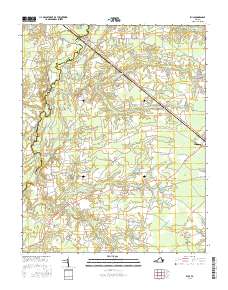
Blackwater River forms the western boundary of this coastal plain landscape, winding through a network of wetlands that includes Antioch Swamp and Seacock Swamp. The map documents the rural character of Isle of Wight County in the mid-2010s, centered on the intersection of major transit corridors like General Mahone Blvd and Windsor Blvd. Small community centers such as Zuni, Walters, and Collosse are connected by a web of local roads, often named for geographical features or local families. Genealogy researchers will find the Antioch Cem located east of the river, while the abundance of named water bodies, including Bows and Arrows Swamp and Jenkins Pond, illustrates the intricate hydrology of the Tidewater region. The landscape transition from the more developed area of Windsor to the dense creek drainages further west highlights the enduring influence of the river basin on local settlement patterns.
Find a feature on this map
88 named features on this map. Tap any name to fly to it.
Don’t see what you’re looking for? This feature index may not catch every label — zoom into the map to look around manually.
Map Details
Editions of this 2016 Zuni Map
This is the sole edition of this map. No revisions or reprints were ever made.
Other maps of this area

1919 · Smithfield
USGS Topo · 1:62,500

1919 · Suffolk
USGS Topo · 1:62,500

1920 · Holland
USGS Topo · 1:62,500

1920 · Ivor
USGS Topo · 1:62,500

1943 · Holland
USGS Topo · 1:62,500

1944 · Windsor
USGS Topo · 1:31,680

1944 · Ivor
USGS Topo · 1:24,000

1944 · Smithfield
USGS Topo · 1:24,000

1944 · Sedley
USGS Topo · 1:24,000

1944 · Raynor
USGS Topo · 1:24,000