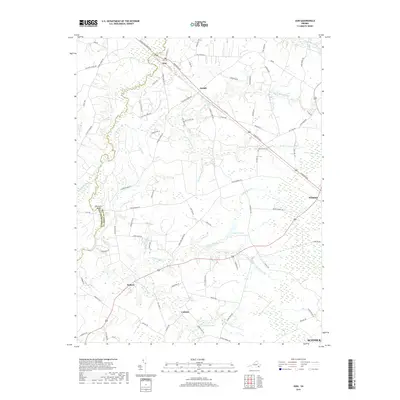
2019 Map of Zuni
USGS Topo · Published 2019About this map
Zuni and Windsor anchor this landscape along the Southampton County and Isle Of Wight County border, where the terrain is defined by a complex network of wetland drainages. The Blackwater River winds through the western portion, fed by numerous named systems such as Horse Swamp, Seacock Swamp, and Antioch Swamp. This 2019 survey documents the modern layout of the rural road network, which remains heavily influenced by the natural watercourses, with routes like W Blackwater Rd following the high ground between the river and Jenkins Pond.
Find a feature on this map
85 named features on this map. Tap any name to fly to it.
Don’t see what you’re looking for? This feature index may not catch every label — zoom into the map to look around manually.
Map Details
Editions of this 2019 Zuni Map
This is the sole edition of this map. No revisions or reprints were ever made.
Other maps of this area

1919 · Smithfield
USGS Topo · 1:62,500

1919 · Suffolk
USGS Topo · 1:62,500

1920 · Holland
USGS Topo · 1:62,500

1920 · Ivor
USGS Topo · 1:62,500

1943 · Holland
USGS Topo · 1:62,500

1944 · Windsor
USGS Topo · 1:31,680

1944 · Ivor
USGS Topo · 1:24,000

1944 · Smithfield
USGS Topo · 1:24,000

1944 · Sedley
USGS Topo · 1:24,000

1944 · Raynor
USGS Topo · 1:24,000