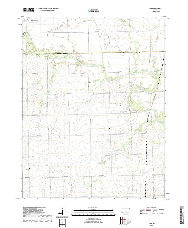
2022 Map of Zyba
USGS Topo · Published 2022About this map
The Ninnescah River winds across the landscape at the boundary of Sedgwick Co and Sumner Co, defining a region shaped by prairie waterways and a systematic road grid. Centered on the small community of Zyba, the map captures a rural Kansas environment where topography is dictated by the slow erosion of drainage systems like Spring Cr and Elm Cr. For family historians, several small burial grounds are preserved in the survey, including Noel Cem in the north and Porter Cem near the center of the quadrangle. The northwest corner touches the outskirts of Clearwater, while the rest of the sheet is dominated by a mesh of section-line roads such as N West Rd and W 119th St S, illustrating the enduring influence of the Public Land Survey System on the modern Kansas countryside.
Find a feature on this map
52 named features on this map. Tap any name to fly to it.
Don’t see what you’re looking for? This feature index may not catch every label — zoom into the map to look around manually.
Map Details
Editions of this 2022 Zyba Map
This is the sole edition of this map. No revisions or reprints were ever made.
Other maps of this area

1889 · Cheney
USGS Topo · 1:125,000

1889 · Wichita
USGS Topo · 1:125,000

1889 · Caldwell
USGS Topo · 1:125,000

1890 · Wellington
USGS Topo · 1:125,000

1891 · Cheney
USGS Topo · 1:125,000

1893 · Caldwell
USGS Topo · 1:125,000

1894 · Wichita
USGS Topo · 1:125,000

1897 · Caldwell
USGS Topo · 1:125,000

1901 · Cheney
USGS Topo · 1:125,000

1943 · Derby
USGS Topo · 1:31,680