1940s Maps of Jackson County, Alabama
Explore 31 historic maps of Jackson County from the 1940s. These maps offer a rare glimpse into what life looked like during the 1940s — showing old roads, neighborhoods, homes, and landmarks that have changed or disappeared over time.
Whether you're researching your family's past, planning a metal detecting trip, or studying how Jackson County's landscape evolved across the 1940s, these high-resolution maps are a powerful tool for exploring the history of this region.
- Focus on a specific era: All maps on this page are from the 1940s, giving you a focused view of this time period.
- See what’s changed: Compare century-old streets, trails, and buildings to today's modern landscape using overlays and satellite layers.
- Research with precision: Use these maps for genealogy, historical research, land use analysis, or educational projects.
- View, download, or print: Maps are fully viewable online in high resolution, and can be downloaded or printed for your own records.
Start exploring Jackson County's history through authentic maps from the 1940s. This is your window into the past.
Jackson County, AL maps
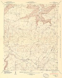
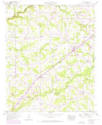
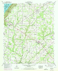
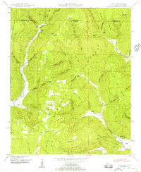
(31)- 1945 Map of Shellmound
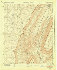
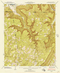 1945 Shellmound1945 Print · USGSThe tri-state border of Tennessee, Alabama, and Georgia was a landscape of remote hollows and mountain gaps at the close of the 1940s. Genealogists can trace family roots through Murphy Cem and Free Home Ch, or locate vanished crossroads at Cole City and Stephensville.2 unique versions available
 - 1945 Map of Bridgeport
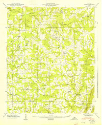
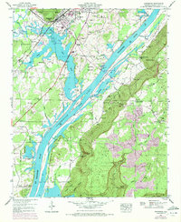
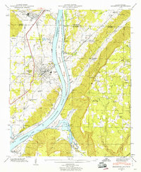 1945 Bridgeport1945 Print · USGSBridgeport and the Tennessee River valley are captured in the mid-1940s as rail and river commerce shaped the Jackson County landscape. Local researchers can trace family sites like Kirkpatrick Cem, the Long Island Sch, and Moore Chapel.3 unique versions available
 - 1946 Map of Bridgeport
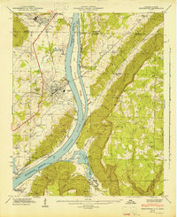 1946 Bridgeport1946 Print · USGSThe Tennessee River valley at Bridgeport is shown here in the mid-1940s, just after the creation of the reservoir. Genealogists can trace family landmarks like Kirkpatrick Cem, Ebenezer Ch, and the crossing at Reese Ferry.2 unique versions available
 - 1946 Map of Shellmound, 1947 Print
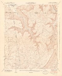 1946 Shellmound1947 Print · USGSSand Mountain and the Tennessee River valley meet in this post-war tri-state survey of the Georgia, Alabama, and Tennessee borders. Researchers can trace rural life and ancestry through sites like State Line Cem, Shanty Town Ch, and the Shellmound Sta along the rail line.2 unique versions available
 - 1946 Map of Trenton, 1947 Print
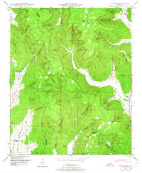
 1946 Trenton1947 Print · USGSNorthwest Georgia and the Alabama borderlands are captured here in the mid-1940s, showing the ridge-and-valley landscape of Dade and DeKalb counties. Researchers can trace rural lineages through numerous landmarks like Countess Cem, Rising Fawn, and Byrds Chapel.5 unique versions available
 - 1946 Map of Flat Rock, 1947 Print
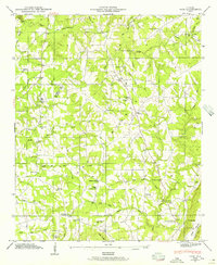
 1946 Flat Rock1947 Print · USGSThe plateau of Sand Mountain in the 1940s was a landscape of remote gulfs and tight-knit rural communities. Genealogists can trace family names through the many small burial grounds and churches like Beulah Chapel, Welden Ch, and Swafford Cem.7 unique versions available
 - 1946 Map of Ider, 1956 Print
 1946 Ider1956 Print · USGSDeKalb County upland life in the mid-1940s centers on the family-named crossroads of Sand Mountain. Researchers can trace rural landmarks from Yorks Mill and Freehill Sch to numerous country churches like New Bethel Ch No 2.2 unique versions available
 - 1946 Map of Grove Oak, 1972 Print
 1946 Grove Oak1972 Print · USGSThe plateaus of DeKalb and Marshall Counties are captured here mid-century, just as rural land use began to shift. Genealogists can locate family landmarks like Bethlehem Sch and several country meeting houses, including Salem Ch and Mt Nebo Ch.2 unique versions available
 - 1946 Map of Fyffe, 1972 Print
 1946 Fyffe1972 Print · USGSDeKalb County enters a period of post-war growth on Sand Mountain as rural settlements like Fyffe and Ten Broeck began to expand. Genealogists and historians can trace family land near Gibson Crossroads, Warren Cem, and several local congregations including Beulah Ch.2 unique versions available
 - 1947 Map of Ider
 1947 Ider1947 Print · USGSDeKalb and Jackson County communities are captured here in the late 1940s, highlighting the intricate network of Sand Mountain crossroads. Local historians can locate Yorks Mill, the Fuller Cem, and several named intersections like Skaggs Corner.2 unique versions available
 - 1947 Map of Grant, 1970 Print
 1947 Grant1970 Print · USGSNortheastern Alabama’s river valleys and mountain ridges are captured here just after the war, showing the rural landscape where three counties meet. Genealogists can trace family landmarks like Keel Cem, Butler Mill, and the many river crossings including Hellum Ford.4 unique versions available
 - 1947 Map of Wannville, 1972 Print
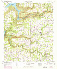
 1947 Wannville1972 Print · USGSNortheastern Alabama’s river valley and steep ridges are shown here as they appeared in the decades following the creation of Guntersville Lake. Genealogists can trace family names through dozens of sites like Shipp Cem, Matthews Chapel, and the Samuel Key Reservation.2 unique versions available
 - 1947 Map of Langston, 1972 Print
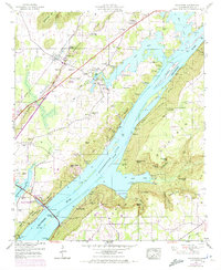
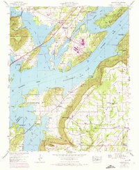 1947 Langston1972 Print · USGSNortheast Alabama during the mid-century transition shows a landscape defined by the Tennessee River and the rising waters of Guntersville Lake. Genealogists and local historians can trace family locations near Langston, explore several churches like Hollis Memorial Church, and find family burial grounds including Finney Cem and Kelly Cem.2 unique versions available
 - 1947 Map of Dutton, 1972 Print
 1947 Dutton1972 Print · USGSSand Mountain settlements and the Guntersville Lake shoreline appear in this mid-century survey as the Tennessee Valley transformed. Trace family roots at Chaney Chapel Cem or locate old community hubs like Gossett Gap and Hancock Crossroads.2 unique versions available
 - 1947 Map of Scottsboro, 1972 Print
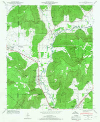
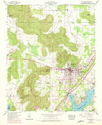 1947 Scottsboro1972 Print · USGSScottsboro and the surrounding Jackson County coves are captured here during a period of mid-century growth and agricultural transition. Researchers can locate family landmarks like Shelton Cem, rural churches such as New Home Ch, and the grounds of the Tri-Counties Tuberculosis Sanatorium.2 unique versions available
 - 1947 Map of Stevenson, 1972 Print
 1947 Stevenson1972 Print · USGSNortheast Alabama during the early post-war years reveals a landscape defined by the Tennessee River and the rise of Sand Mountain. Genealogists and historians can trace old river crossings like Coffeys Ferry and rural congregations at McCoy Grove Church or Rudders Chapel.3 unique versions available
 - 1947 Map of Swearengin, 1972 Print
 1947 Swearengin1972 Print · USGSNortheast Alabama's river-cut plateau comes into focus here just after the mid-century, showing the rugged intersection of Guntersville Lake and the mountain coves. Genealogists and hikers can trace the rural landscape of Swearengin, from the depths of Cathedral Caverns to Zions Rest Cem.2 unique versions available
 - 1947 Map of Hollywood, 1972 Print
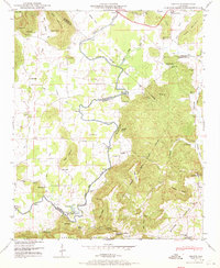
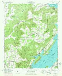
 1947 Hollywood1972 Print · USGSJackson County is shown during a period of transition as the Tennessee River valley matured around Guntersville Lake. Researchers can trace family history through sites like Hollywood School and over a dozen family cemeteries including Finnell Cem and Hudgins Cem.4 unique versions available
 - 1947 Map of Henagar, 1973 Print
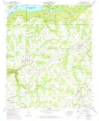 1947 Henagar1973 Print · USGSDeKalb and Jackson Counties are shown here during the late 1940s as rural life centered on the high plateau of Sand Mountain. Genealogists can locate family landmarks like Clark Cem, Morris Mill, and the Pleasant View School.2 unique versions available
 - 1947 Map of Eureka, 1974 Print
 1947 Eureka1974 Print · USGSCrossing the Tennessee-Alabama line in the late forties, this area shows a landscape of highland ridges and productive valleys. Genealogists can trace family names through the Cumberland Cem, Jacoway Cem, and Bell Store near Big Coon Valley.4 unique versions available
 - 1947 Map of Lim Rock, 1974 Print
 1947 Lim Rock1974 Print · USGSJackson County rural life is captured here in the mid-twentieth century, centered on the valley floor between the plateau and the Tennessee River backwaters. Genealogists can locate family landmarks like Peters Cove Cem, Letcher Ch, and the old Lim Rock School.2 unique versions available
 - 1947 Map of Sylvania, 1976 Print
 1947 Sylvania1976 Print · USGSDeKalb County’s plateau communities are shown in detail during the mid-twentieth century as Rainsville and Sylvania began to expand along the highway. Researchers can trace family roots through numerous sites like Double Spring Church, Mahan Cem, and the old Wilkes Store.3 unique versions available
 - 1948 Map of Hytop, 1956 Print
 1948 Hytop1956 Print · USGSThe Alabama-Tennessee borderlands in the late 1940s reveal a landscape of isolated plateau settlements and deep family roots. Genealogists can locate old family burial sites like Knight Cem and Clark Cem or trace the early community at Hytop.2 unique versions available
 - 1948 Map of Hollytree, 1964 Print
 1948 Hollytree1964 Print · USGSJackson County is shown at a mid-century turning point when mountain coves still held isolated family homesteads and local landmarks. Genealogists can trace rural family sites through Maples Cem, Hollytree, and several backcountry churches like Mt Nebo Church.4 unique versions available
 - 1948 Map of Paint Rock, 1966 Print
 1948 Paint Rock1966 Print · USGSThe Paint Rock River valley in the late 1940s reveals a network of small Jackson County communities and riverside crossings. Genealogists and historians can locate numerous family burial sites like Latham Cem and trace the historic Southern RR past the Conyers-Rosenwald School.5 unique versions available
Showing maps 1-25 of 31
Top cities of Jackson County
- Scottsboro historical maps
- Bridgeport historical maps
- Stevenson historical maps
- Hollywood historical maps
- Skyline historical maps
- Section historical maps
See more
Frequently asked questions
- What are the different types of historical maps available for Jackson County?
- What is the oldest map of Jackson County?
- Where can I purchase historical maps of Jackson County for my home or office?
- Where can I download high-res historical maps of Jackson County?
- Are there historical topographic maps available for Jackson County?
- Is there historical aerial imagery available for Jackson County?
- Where are historical maps of Jackson County sourced from?