1960s Maps of Huntsville, Alabama
Explore 10 historic maps of Huntsville from the 1960s. These maps offer a rare glimpse into what life looked like during the 1960s — showing old roads, neighborhoods, homes, and landmarks that have changed or disappeared over time.
Whether you're researching your family's past, planning a metal detecting trip, or studying how Huntsville's landscape evolved across the 1960s, these high-resolution maps are a powerful tool for exploring the history of this region.
- Focus on a specific era: All maps on this page are from the 1960s, giving you a focused view of this time period.
- See what’s changed: Compare century-old streets, trails, and buildings to today's modern landscape using overlays and satellite layers.
- Research with precision: Use these maps for genealogy, historical research, land use analysis, or educational projects.
- View, download, or print: Maps are fully viewable online in high resolution, and can be downloaded or printed for your own records.
Start exploring Huntsville's history through authentic maps from the 1960s. This is your window into the past.
Huntsville, AL maps
(10)- 1960 Map of Gadsden
 1960 Gadsden1960 Print · USGSNorthern Alabama in the mid-1950s is defined by the mighty Tennessee River and its massive reservoirs. Trace the development of Huntsville and Redstone Arsenal or explore the vast William B Bankhead National Forest.2 unique versions available
 - 1963 Map of Gadsden
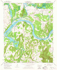
 1963 Gadsden1963 Print · USGSNorthern Alabama underwent a dramatic mid-century transformation as the Tennessee Valley became a hub for defense and industry. Researchers can trace the development of the Redstone Arsenal, the route of the Natchez Trace Parkway, and long-standing rail lines like the Southern Railway.
 - 1963 Map of Greenbrier, 1965 Print
 1963 Greenbrier1965 Print · USGSThe Alabama cotton country of Limestone and Madison Counties is captured here in the early sixties, as the region began its transition toward modern industry. Researchers can find family-named sites like Anderson Cemetery, local industry at the Burgreen Gin, and the early footprint of the Huntsville Madison County Airport.
 - 1963 Map of Tanner, 1966 Print
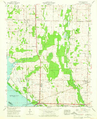 1963 Tanner1966 Print · USGSLimestone County's agrarian landscape meets the Tennessee River in the early sixties, as the region balances traditional farming with new infrastructure. Genealogists and historians can trace family land at Anderson Plantation or locate rural landmarks like Solomons Temple Cem and Mooresville.3 unique versions available
 - 1964 Map of Triana, 1965 Print
 1964 Triana1965 Print · USGSThe Tennessee River corridor south of Huntsville shows a mix of military expansion and rural tradition in the 1960s. Researchers can locate family landmarks such as Lynch Cem, St Thomas Ch, and the riverside Triana Landing.2 unique versions available
 - 1964 Map of Huntsville, 1966 Print
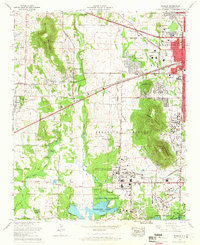
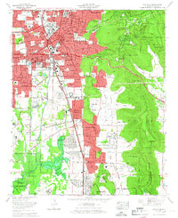 1964 Huntsville1966 Print · USGSHuntsville in the mid-sixties shows a city rapidly expanding south and east as suburban neighborhoods reach into the valleys. Genealogists can locate family sites near Maple Hill Cem, the Old Huntsville-Madison County Airport, and First Church.
 - 1964 Map of Madison, 1966 Print
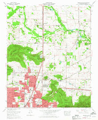
 1964 Madison1966 Print · USGSMadison and West Huntsville are caught in a period of significant growth during the mid-sixties space race. Genealogists and historians can trace the intersection of new suburbs like Skyline Acres with older landmarks such as Fletcher Chapel and the Southern Railway.
 - 1964 Map of Farley, 1966 Print
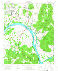 1964 Farley1966 Print · USGSMadison County's riverfront and military expansion are captured here in the mid-sixties as the space age transformed the region south of Huntsville. Researchers can locate family landmarks like Lacey Cem and Farley alongside the Redstone Arsenal and Rocket Siding.3 unique versions available
 - 1964 Map of Meridianville, 1968 Print
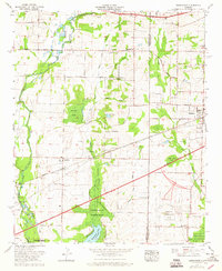
 1964 Meridianville1968 Print · USGSNorthern Alabama at the height of the 1960s suburban boom reveals the transformation of Madison County farmland into residential communities. Researchers can trace family history through sites like Strong Cem or locate the early campus of the Alabama Agricultural and Mechanical College.3 unique versions available
 - 1967 Map of Jeff, 1972 Print
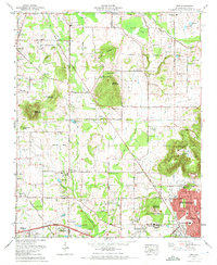 1967 Jeff1972 Print · USGSThe Madison and Huntsville area comes into focus during the late sixties as residential neighborhoods began to edge into the surrounding farmland. Genealogists can trace family landmarks like Pattus Cem, Conley Chapel, and Sparkman High Sch.3 unique versions available
End of results
Showing maps 1-10 of 10
Top cities near Huntsville
- Decatur historical maps
- Madison historical maps
- Athens historical maps
- Hartselle historical maps
- Meridianville historical maps
- Moores Mill historical maps
See more
Top neighborhoods of Huntsville
- Bucks Canyon historical maps
- Forest Park historical maps
- Windsor Manor historical maps
- Valley Park historical maps
- Bluewood Estates historical maps
- Eastridge historical maps
See more
Frequently asked questions
- What are the different types of historical maps available for Huntsville?
- What is the oldest map of Huntsville?
- Where can I purchase historical maps of Huntsville for my home or office?
- Where can I download high-res historical maps of Huntsville?
- Are there historical topographic maps available for Huntsville?
- Is there historical aerial imagery available for Huntsville?
- Where are historical maps of Huntsville sourced from?