Old Maps of Huntsville, Alabama for Hiking & Exploration
Hike through history with 122 historic maps of Huntsville. Explore old trails, ghost towns, and forgotten backroads — perfect for outdoor adventurers and local explorers.
- Rediscover forgotten places: Map out old mining camps, roads, and footpaths that no longer exist on modern maps.
- Layer with modern tools: Combine with LiDAR or satellite views to plan hikes through historical terrain.
- Made for exploration: Popular among hikers, overlanders, and local history lovers.
Use these maps to find adventure and explore the hidden past of Huntsville.
Huntsville, AL maps
(122)- 1888 Map of Scottsboro
 1888 Scottsboro1888 Print · USGSNortheast Alabama is shown in the late nineteenth century as a land of steep plateaus and vital river crossings. Genealogists and researchers can trace the early rail-and-river economy through family landmarks like Caldwell's Ferry and the Bell Factory textile site.
 - 1888 Map of Huntsville
 1888 Huntsville1888 Print · USGSMadison and Limestone counties in the late 1880s showcase a landscape defined by the Tennessee River and major early rail lines. Researchers can trace the layout of Huntsville or locate long-standing communities like Mooresville and Thompsons Mill.
 - 1892 Map of Huntsville
 1892 Huntsville1892 Print · USGSNorth Alabama was a landscape of river ferries and rising rail hubs in the 1890s, caught here just as the region's industry began to modernize. Researchers can locate vanished landmarks like the Monte Sano Hotel and trace old family-named sites from Thompsons Mill to Lemans Ferry.6 unique versions available
 - 1892 Map of Scottsboro
 1892 Scottsboro1892 Print · USGSJackson County and the Tennessee River valley are captured here in the late nineteenth century, just as railroads began to reshape local commerce. Genealogists can trace family-named sites like Owen's Cross Roads, Carrick Mill, and Larkin Landing.5 unique versions available
 - 1936 Map of Jeff
 1936 Jeff1936 Print · USGSMadison County rural life is captured in the mid-1930s, showing a landscape defined by ancestral lines and small-town centers. Trace family roots through Indian Creek Cem, St John Cem, and old schools like Little Indian Creek Sch.
 - 1936 Map of Capshaw
 1936 Capshaw1936 Print · USGSLimestone and Madison counties are captured here in the mid-1930s as the Tennessee Valley Authority and Alabama Power began modernizing the rural landscape. Researchers can locate numerous vanished country schools like Grimett Sch, family landmarks such as McCully Mill, and the community at Wesley Chapel.
 - 1936 Map of Triana
 1936 Triana1936 Print · USGSThe Tennessee River bend near the Madison and Morgan county line is captured here just as the Tennessee Valley Authority era began. Researchers can trace the layout of early rural school districts like Horton Sch and Union Sch or locate congregations at Mt Mariah Ch and Talucah Ch.
 - 1936 Map of New Hope
 1936 New Hope1936 Print · USGSThe Flint River valley in the mid-1930s shows a landscape on the brink of change as the Wheeler Reservoir reaches its high-water mark. Researchers can locate family landmarks like Baker Cem, Owens Cross Roads, and local hubs like Buggs Chapel or Cherokee School.
 - 1936 Map of Madison
 1936 Madison1936 Print · USGSMadison and its surrounding farmstead landscape are captured in the mid-1930s just as the Tennessee Valley Authority began transforming the river valley. Researchers can locate numerous vanished landmarks like Lankford Mill, trace the CHICKASAW BOUNDARY, and find family sites near Brandontown or Fuller Chapel.
 - 1936 Map of Meridianville
 1936 Meridianville1936 Print · USGSMadison County in the mid-1930s is shown here as a landscape of crossroads settlements and small farm communities connected by multiple rail lines. Genealogists and local historians can trace family roots through numerous sites like Pope Cem, Taylor Chapel, and the Meridianville Bottom Sch.
 - 1936 Map of Moontown
 1936 Moontown1936 Print · USGSMadison County at the height of the Great Depression is captured here as a landscape of small river towns and mountain hollows. Family historians can trace ancestral locations near Sublett Mill, Adair Ford, or several rural congregations like Acklin Ch.
 - 1936 Map of Maysville
 1936 Maysville1936 Print · USGSMadison County is documented here in the mid-1930s, showing a rural landscape defined by the Flint River and its tributary branches. Genealogists can trace family roots through numerous sites like Belleview Cem, Deposit, and the Bell Factory.
 - 1936 Map of Mason Ridge
 1936 Mason Ridge1936 Print · USGSThe Tennessee River valley underwent a total transformation in the mid-1930s as the new Wheeler Reservoir filled. Researchers can trace displaced landmarks like Cane Landing or visit upland sites like Needmore Sch and Kolb Cem.
 - 1936 Map of Tanner
 1936 Tanner1936 Print · USGSLimestone County is captured during the transformative years of the Tennessee Valley Authority project. Researchers can trace family sites and rural landmarks like Mooresville, Taylor Pride Cem, and the Alabama State Farm near the rising waters of Wheeler Reservoir.
 - 1936 Map of Greenbrier
 1936 Greenbrier1936 Print · USGSAlabama's Tennessee Valley was undergoing a massive transformation in the mid-1930s as the river was harnessed for power. Genealogists can locate family-named settlements like Peete Corners, small rural schools like Betz Sch, and old spiritual centers like Fletcher Chapel.
 - 1936 Map of Farley
 1936 Farley1936 Print · USGSThe Tennessee River valley is captured here in the mid-1930s during its transformation by the TVA. Researchers can trace historic family names and early rural sites like Gaines Chapel, Whitesburg, and the Old Chickasaw Boundary.
 - 1936 Map of Huntsville
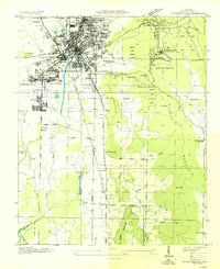 1936 Huntsville1936 Print · USGSHuntsville was a bustling railway and textile hub in the mid-thirties, just before the arrival of the space industry. Genealogists and historians can trace the footprint of early mill villages like Merrimac or locate family plots at Maple Hill Cem and Sivley Cem.
 - 1938 Map of Tanner
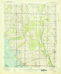 1938 Tanner1938 Print · USGSLimestone County in the late thirties shows a landscape transformed by the new Wheeler Reservoir and its rising waters. Genealogists can trace family holdings and community hubs like Anderson Plantation, Taylor Pride Cem, and Mooresville.
 - 1938 Map of Greenbrier
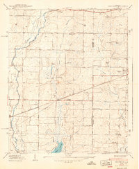 1938 Greenbrier1938 Print · USGSLimestone and Madison Counties are shown in the late 1930s as a landscape of rural schoolhouses and family cemeteries. Genealogists can trace local heritage through sites like Ragland Cem, Mt Pleasant Sch, and the crossroads at Burgreen Corner.3 unique versions available
 - 1947 Map of Farley, 1956 Print
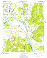 1947 Farley1956 Print · USGSThe Tennessee River valley north of Laceys Spring is captured here just after the war, showing the expansion of federal reservations. Trace family roots at Laceys Spring Cem or locate old community hubs like St Lukes Church and the Cherokee School.
 - 1947 Map of New Hope, 1964 Print
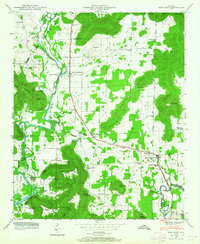 1947 New Hope1964 Print · USGSMadison County at the end of the 1940s reveals a rural landscape defined by the Tennessee River's backwaters and the foothills of the Appalachians. Researchers can trace family history through dozens of named sites like Owens Cross Roads, Cherokee School, and New Hope Cem.3 unique versions available
 - 1948 Map of Moontown, 1952 Print
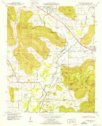 1948 Moontown1952 Print · USGSMadison County's valley floor and mountain ridges appear here in the late 1940s, showing a landscape defined by the FLINT RIVER and small agricultural settlements. Researchers can locate vanished landmarks like Sublett Mill, the Big Cove School, and numerous family cemeteries including Lawler Cem and Stanford Cem.5 unique versions available
 - 1948 Map of Huntsville, 1956 Print
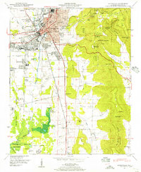 1948 Huntsville1956 Print · USGSHuntsville at the start of its postwar boom reveals a landscape of industrial mill villages and quiet mountain coves. Researchers can trace the original Redstone Arsenal boundary or locate family sites at Maple Hill Cem and Mt Lebanon Ch.
 - 1948 Map of Madison, 1960 Print
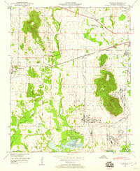 1948 Madison1960 Print · USGSPost-war Madison County shows a landscape transitioning from rural rail towns to a major federal military hub. Trace family history and land changes through the Royal Cem, the Huntsville Arsenal Airfield, and the Southern Railway corridor.2 unique versions available
 - 1948 Map of Triana, 1963 Print
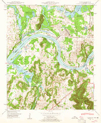 1948 Triana1963 Print · USGSThe Tennessee River valley in the late 1940s reveals the massive military footprint of Huntsville Arsenal alongside traditional river life. Researchers can trace historic family burial sites like Draper Cem and Grantland Cem or locate the rural crossroads at Talucah and Winton.
Showing maps 1-25 of 122
Top cities near Huntsville
- Decatur historical maps
- Madison historical maps
- Athens historical maps
- Hartselle historical maps
- Meridianville historical maps
- Moores Mill historical maps
See more
Top neighborhoods of Huntsville
- Bucks Canyon historical maps
- Forest Park historical maps
- Windsor Manor historical maps
- Valley Park historical maps
- Bluewood Estates historical maps
- Eastridge historical maps
See more
Frequently asked questions
- What are the different types of historical maps available for Huntsville?
- What is the oldest map of Huntsville?
- Where can I purchase historical maps of Huntsville for my home or office?
- Where can I download high-res historical maps of Huntsville?
- Are there historical topographic maps available for Huntsville?
- Is there historical aerial imagery available for Huntsville?
- Where are historical maps of Huntsville sourced from?