1940s Maps of Huntsville, Alabama
Explore 9 historic maps of Huntsville from the 1940s. These maps offer a rare glimpse into what life looked like during the 1940s — showing old roads, neighborhoods, homes, and landmarks that have changed or disappeared over time.
Whether you're researching your family's past, planning a metal detecting trip, or studying how Huntsville's landscape evolved across the 1940s, these high-resolution maps are a powerful tool for exploring the history of this region.
- Focus on a specific era: All maps on this page are from the 1940s, giving you a focused view of this time period.
- See what’s changed: Compare century-old streets, trails, and buildings to today's modern landscape using overlays and satellite layers.
- Research with precision: Use these maps for genealogy, historical research, land use analysis, or educational projects.
- View, download, or print: Maps are fully viewable online in high resolution, and can be downloaded or printed for your own records.
Start exploring Huntsville's history through authentic maps from the 1940s. This is your window into the past.
Huntsville, AL maps
(9)- 1947 Map of Farley, 1956 Print
 1947 Farley1956 Print · USGSThe Tennessee River valley north of Laceys Spring is captured here just after the war, showing the expansion of federal reservations. Trace family roots at Laceys Spring Cem or locate old community hubs like St Lukes Church and the Cherokee School.
 - 1947 Map of New Hope, 1964 Print
 1947 New Hope1964 Print · USGSMadison County at the end of the 1940s reveals a rural landscape defined by the Tennessee River's backwaters and the foothills of the Appalachians. Researchers can trace family history through dozens of named sites like Owens Cross Roads, Cherokee School, and New Hope Cem.3 unique versions available
 - 1948 Map of Moontown, 1952 Print
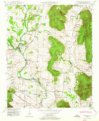
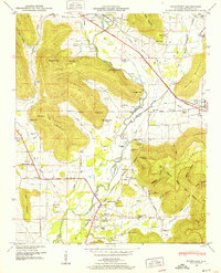 1948 Moontown1952 Print · USGSMadison County's valley floor and mountain ridges appear here in the late 1940s, showing a landscape defined by the FLINT RIVER and small agricultural settlements. Researchers can locate vanished landmarks like Sublett Mill, the Big Cove School, and numerous family cemeteries including Lawler Cem and Stanford Cem.5 unique versions available
 - 1948 Map of Huntsville, 1956 Print
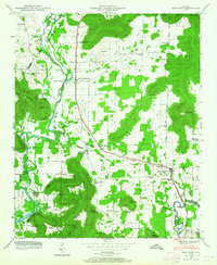
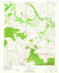
 1948 Huntsville1956 Print · USGSHuntsville at the start of its postwar boom reveals a landscape of industrial mill villages and quiet mountain coves. Researchers can trace the original Redstone Arsenal boundary or locate family sites at Maple Hill Cem and Mt Lebanon Ch.
 - 1948 Map of Madison, 1960 Print
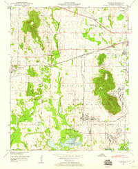 1948 Madison1960 Print · USGSPost-war Madison County shows a landscape transitioning from rural rail towns to a major federal military hub. Trace family history and land changes through the Royal Cem, the Huntsville Arsenal Airfield, and the Southern Railway corridor.2 unique versions available
 - 1948 Map of Triana, 1963 Print
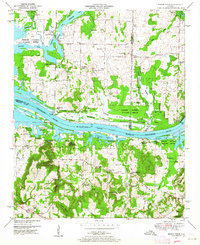
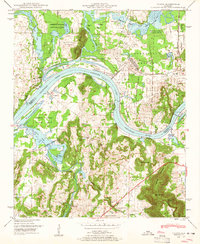 1948 Triana1963 Print · USGSThe Tennessee River valley in the late 1940s reveals the massive military footprint of Huntsville Arsenal alongside traditional river life. Researchers can trace historic family burial sites like Draper Cem and Grantland Cem or locate the rural crossroads at Talucah and Winton.
 - 1948 Map of Maysville, 1964 Print
 1948 Maysville1964 Print · USGSMadison County at the end of the 1940s reveals a rural landscape defined by the Flint River and early industrial sites. Genealogists and historians can locate the Old Cherokee Boundary, trace family names at Jordan Cem, or study the Bell Factory and McCaleb Mill.5 unique versions available
 - 1948 Map of Meridianville, 1964 Print
 1948 Meridianville1964 Print · USGSMadison County's agricultural heartland is documented here just after the war, centered on the growing campus at Normal. Genealogists can locate family names across numerous cemeteries like Strong Cem and Tiller Cem, or trace rural landmarks including Moores Mill and Lewis Chapel.
 - 1949 Map of Mason Ridge, 1964 Print
 1949 Mason Ridge1964 Print · USGSNorthern Alabama’s river bottomlands are captured here in the mid-century, where the Tennessee River valley transitions into rural farmsteads. Trace family history through Swancott, Brooksville, and numerous burial sites like Kolb Cem and Thatch Cem.4 unique versions available
End of results
Showing maps 1-9 of 9
Top cities near Huntsville
- Decatur historical maps
- Madison historical maps
- Athens historical maps
- Hartselle historical maps
- Meridianville historical maps
- Moores Mill historical maps
See more
Top neighborhoods of Huntsville
- Bucks Canyon historical maps
- Forest Park historical maps
- Windsor Manor historical maps
- Valley Park historical maps
- Bluewood Estates historical maps
- Eastridge historical maps
See more
Frequently asked questions
- What are the different types of historical maps available for Huntsville?
- What is the oldest map of Huntsville?
- Where can I purchase historical maps of Huntsville for my home or office?
- Where can I download high-res historical maps of Huntsville?
- Are there historical topographic maps available for Huntsville?
- Is there historical aerial imagery available for Huntsville?
- Where are historical maps of Huntsville sourced from?