1970s Maps of Anchorage, Alaska
Explore 16 historic maps of Anchorage from the 1970s. These maps offer a rare glimpse into what life looked like during the 1970s — showing old roads, neighborhoods, homes, and landmarks that have changed or disappeared over time.
Whether you're researching your family's past, planning a metal detecting trip, or studying how Anchorage's landscape evolved across the 1970s, these high-resolution maps are a powerful tool for exploring the history of this region.
- Focus on a specific era: All maps on this page are from the 1970s, giving you a focused view of this time period.
- See what’s changed: Compare century-old streets, trails, and buildings to today's modern landscape using overlays and satellite layers.
- Research with precision: Use these maps for genealogy, historical research, land use analysis, or educational projects.
- View, download, or print: Maps are fully viewable online in high resolution, and can be downloaded or printed for your own records.
Start exploring Anchorage's history through authentic maps from the 1970s. This is your window into the past.
Anchorage, AK maps
(16)- 1979 Map of Anchorage B-6 NW
 1979 Anchorage B-6 NW1979 Print · USGSThe Matanuska-Susitna region in the late seventies is shown here as a vital corridor for transportation and energy between the peaks and the river. Trace the old routes of The Alaska Railroad and the Glenn Highway past Eklutna Powerhouse toward Eklutna Lake.2 unique versions available
 - 1979 Map of Anchorage B-7 SW
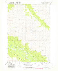
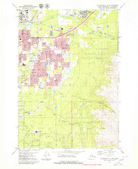
 1979 Anchorage B-7 SW1979 Print · USGSThe community of Eagle River and the neighboring military lands are shown in detail during the late seventies as the region transitioned toward suburban growth. Genealogists and historians can locate Chugiak High Sch, trace the path of the Alaska Railroad, and identify numerous family landmarks near Lower Fire Lake.4 unique versions available
 - 1979 Map of Anchorage B-7 SE
 1979 Anchorage B-7 SE1979 Print · USGSAnchorage's eastern mountain periphery is captured in the late seventies as the region transitioned toward wilderness preservation. Researchers can trace the winding Eagle River, the elevation of Mount Magnificent, and the early route of the Lower Eagle River Trail.2 unique versions available
 - 1979 Map of Anchorage A-8 NW
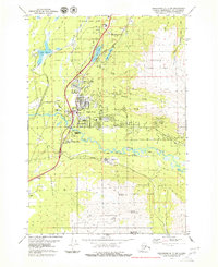
 1979 Anchorage A-8 NW1979 Print · USGSAnchorage and its surrounding neighborhoods are shown during a time of major urban expansion in the late seventies. Researchers can trace the layout of early suburbs like Spenard and Turnagain Heights or locate civic landmarks like Merrill Field and Memorial Park.3 unique versions available
 - 1979 Map of Anchorage B-7 NE
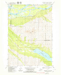
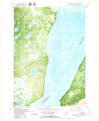
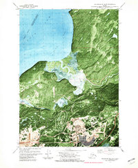
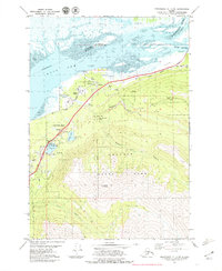 1979 Anchorage B-7 NE1979 Print · USGSThe Eklutna valley in the late seventies serves as a vital corridor where the rail line and highway meet the tidal flats. Researchers can locate the historic Eklutna settlement and its Cem, alongside local landmarks like Thunder Bird Falls and Eklutna Siding.3 unique versions available
 - 1979 Map of Anchorage A-8 SE
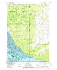 1979 Anchorage A-8 SE1979 Print · USGSThe Cook Inlet coastline and Chugach foothills are captured here in the late seventies as South Anchorage began its suburban expansion. Trace the route of the Alaska Railroad past Potter or locate family-named sites like the Nystrom Landing Strip and O'Malley Sch.2 unique versions available
 - 1979 Map of Anchorage, 1980 Print
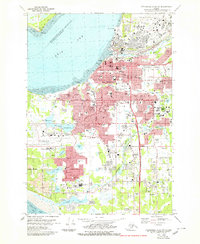
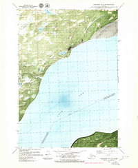
 1979 Anchorage1980 Print · USGSThe Anchorage bowl and Matanuska Valley appear in the late seventies as the region's transportation and military infrastructure matured. Genealogists and historians can trace rail and road evolution through Wasilla, the Matanuska Branch line, and Jonesville.
 - 1979 Map of Anchorage B-7 NW, 1980 Print
 1979 Anchorage B-7 NW1980 Print · USGSThe Knik Arm shoreline comes into focus during the late seventies as the Birchwood community grows between military and state lands. Genealogists and locals can trace the Birchwood Loop Road, the Old Glenn Highway, and sites like Birchwood Camp.3 unique versions available
 - 1979 Map of Tyonek A-1 NW, 1980 Print
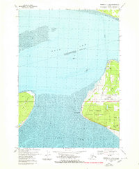
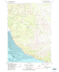
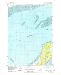 1979 Tyonek A-1 NW1980 Print · USGSFire Island and the surrounding tidal reaches of the Cook Inlet are captured here during the late seventies. Researchers can locate infrastructure like the FAA Facility and Radio Facility, or trace the shoreline near Race Point and West Point.2 unique versions available
 - 1979 Map of Anchorage A-8 SW, 1980 Print
 1979 Anchorage A-8 SW1980 Print · USGSCoastal Anchorage and the Turnagain Arm mudflats are captured in the late seventies as suburban growth pushed south. Trace the development of Klatt and neighborhood landmarks like the Evergreen Memorial Cem or the Alaska Railroad line.
 - 1979 Map of Anchorage B-8 SW, 1980 Print
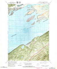
 1979 Anchorage B-8 SW1980 Print · USGSThe northern reaches of the Anchorage area and the Knik Arm are captured in the late seventies as military and recreational sites expanded. Local historians can trace the development of Elmendorf Air Force Base, the Hillberg Ski Area, and the settlement at Tuomi.2 unique versions available
 - 1979 Map of Tyonek A-1 NE, 1980 Print
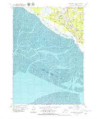
 1979 Tyonek A-1 NE1980 Print · USGSThe Anchorage coastline at the close of the 1970s reveals a strategic landscape of aviation and military infrastructure. Researchers can trace the boundaries of the Point Campbell Military Reservation and the early layout of Anchorage International Airport.2 unique versions available
 - 1979 Map of Anchorage A-8 NE, 1980 Print
 1979 Anchorage A-8 NE1980 Print · USGSAnchorage expands toward the mountains during the late seventies as residential districts and military bases consolidate. Researchers can trace the development of local neighborhoods and schools like Ursa Minor Sch or locate the Alaska Methodist Univ campus and Cheney Lake.3 unique versions available
 - 1979 Map of Anchorage B-8 SE, 1981 Print
 1979 Anchorage B-8 SE1981 Print · USGSAnchorage's northern military and coastal landscape is captured here in the late seventies as the region's defense and transport hubs expanded. Researchers can trace aviation and rail history through Sixmile Seaplane Base, Bryant Field, and the Railroad corridor.2 unique versions available
 - 1979 Map of Anchorage B-8 NE, 1981 Print
 1979 Anchorage B-8 NE1981 Print · USGSThe Matanuska-Susitna coastline and the historic settlement of Knik are frozen in time during the late seventies. Genealogists and researchers can trace the vicinity of Knik, identifying local landmarks like the Graves, Cem, and Goose Bay Road.3 unique versions available
 - 1979 Map of Anchorage A-7 NE, 1993 Print
 1979 Anchorage A-7 NE1993 Print · USGSAnchorage's southern Hillside and the Turnagain Arm shoreline are captured here during a period of suburban expansion in the late seventies. Trace the growth of local neighborhoods through Huffman Sch, Bear Valley Sch, and the winding Rabbit Creek Road.
End of results
Showing maps 1-16 of 16
Top cities of Anchorage
Frequently asked questions
- What are the different types of historical maps available for Anchorage?
- What is the oldest map of Anchorage?
- Where can I purchase historical maps of Anchorage for my home or office?
- Where can I download high-res historical maps of Anchorage?
- Are there historical topographic maps available for Anchorage?
- Is there historical aerial imagery available for Anchorage?
- Where are historical maps of Anchorage sourced from?