Old Maps of Skagway, Alaska for Metal Detecting
Plan your next treasure hunt with 47 historic maps of Skagway. Find old homesites, ghost towns, trails, and gathering spots that may be lost to time — perfect for identifying promising metal detecting locations.
- Locate forgotten sites: Uncover places like long-lost settlements, abandoned rail lines, or gathering spots.
- Plan better hunts: Use map overlays combined with LiDAR or satellite views to narrow in on historically rich areas.
- Made for detectorists: Thousands of hobbyists use these maps to discover relics, coins, and hidden history.
Use these historic maps to boost your research and find new opportunities beneath the surface of Skagway.
Skagway, AK maps
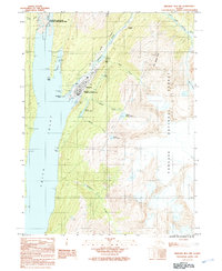
(47)- 1948 Map of Skagway C-2, 1964 Print
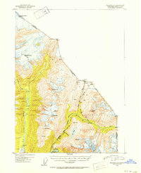
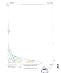
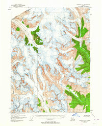 1948 Skagway C-21964 Print · USGSThe international border between Alaska and British Columbia is frozen in time in this mid-century survey of the high Coast Range. Researchers can trace the massive paths of the Chilkat Glacier and Ferebee Glacier as they appeared just after the war.3 unique versions available
 - 1948 Map of Skagway C-1, 1967 Print
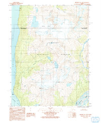
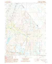
 1948 Skagway C-11967 Print · USGSDuring the late 1940s, the mountainous gateway to the Yukon still centered on the historic Chilkoot Trail and the White Pass and Yukon Route. Researchers can trace the path of early prospectors and rail workers through Finnegans Point, Clifton, and the Inspiration Mine.2 unique versions available
 - 1949 Map of Atlin, 1958 Print
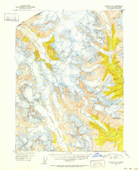
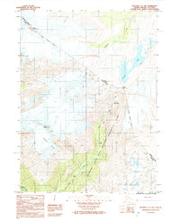
 1949 Atlin1958 Print · USGSThe high borderlands of the Alaskan panhandle are captured here just after the war, detailing the glaciated terrain of the Coast Mountains. Researchers can trace the international boundary as it passes Meade Glacier and prominent summits like Mt Canning and Mt Poletica.
 - 1949 Map of Skagway B-1, 1964 Print
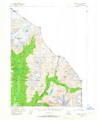
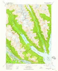
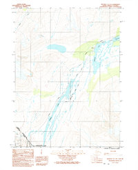
 1949 Skagway B-11964 Print · USGSSkagway at the midpoint of the century remains a vital link between the sea and the interior, dominated by its maritime and rail infrastructure. Researchers can trace the White Pass and Yukon Route railway and find local landmarks like Reid Falls and the Ferry Terminal.3 unique versions available
 - 1949 Map of Skagway D-2, 1965 Print
 1949 Skagway D-21965 Print · USGSThe northern borderlands at the end of the 1940s reveal a landscape of high summits and international boundaries. Trace the precise path of the Canada-United States line as it crosses the peak of Mt Foster near the British Columbia and Alaska border.
 - 1951 Map of Skagway C-1, 1952 Print
 1951 Skagway C-11952 Print · USGSThe borderlands of Southeast Alaska and British Columbia in the early 1950s showcase the famous routes into the interior. Genealogists and historians can trace the White Pass and Yukon railroad and old camp sites like Clifton and Crib.2 unique versions available
 - 1951 Map of Atlin, 1952 Print
 1951 Atlin1952 Print · USGSThe international boundary between Alaska and British Columbia is charted here at the middle of the century, dominated by the Tongass National Forest. Researchers can trace the rugged border line across high peaks like Mt Poletica and the massive flow of Meade Glacier.
 - 1951 Map of Skagway B-1, 1952 Print
 1951 Skagway B-11952 Print · USGSSkagway and the head of Taiya Inlet are captured here in the early 1950s as a vital transportation hub. Trace the White Pass and Yukon Route and find local landmarks like Reid Falls, Lower Dewey Lake, and the town Powder House.2 unique versions available
 - 1951 Map of Skagway C-2, 1952 Print
 1951 Skagway C-21952 Print · USGSThe international boundary between Alaska and British Columbia is traced across massive ice fields in the early fifties. Researchers can study the extent of Chilkat Glacier and locate high-altitude landmarks like Mt Yeatman and the Ferebee Glacier.2 unique versions available
 - 1952 Map of Skagway, 1953 Print
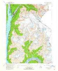
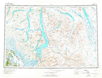
 1952 Skagway1953 Print · USGSThe northern reaches of the Alaska Panhandle come alive in the early fifties, showing the vital rail and road links to the Yukon. Trace the historic White Pass & Yukon Route or locate remote camps like Pleasant Camp and Klukwan.4 unique versions available
 - 1954 Map of Skagway B-2, 1959 Print
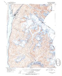
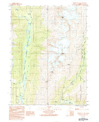
 1954 Skagway B-21959 Print · USGSThe Lynn Canal region of Alaska was a landscape of maritime navigation and glacial mountain passes in the mid-fifties. Genealogists and historians can trace the early footprint of the Yindastuki Indian Res and coastal sites like Tanani and Chilkoot.4 unique versions available
 - 1960 Map of Atlin B-8, 1965 Print
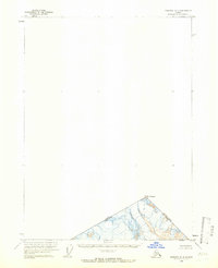
 1960 Atlin B-81965 Print · USGSThe high-altitude frontier of the Alaska Panhandle is captured here in the early 1960s, showing the border with British Columbia. Researchers can trace the Indefinite Boundary through the Tongass National Forest and locate summits like Snow Top and Boundary Peak 108.2 unique versions available
 - 1960 Map of Atlin, 1966 Print
 1960 Atlin1966 Print · USGSThe northern borderlands of Alaska and British Columbia are shown here in the 1960s, documenting the remote lake systems and high mountain passes. Follow the White Pass and Yukon RR or locate historic activity at the Engineer (Site) and the town of Atlin.2 unique versions available
 - 1961 Map of Skagway, 1967 Print
 1961 Skagway1967 Print · USGSThe northern reaches of the Panhandle and the rugged border with British Columbia come into focus in the early sixties. Researchers can trace the historic Chilkoot Trail, the White Pass and Yukon Railway, and coastal outposts like Klukwan.4 unique versions available
 - 1991 Map of Skagway C-1 SW
 1991 Skagway C-1 SW1991 Print · USGSSkagway at the start of the 1990s reveals the convergence of historic gold rush routes and modern wilderness management. Trace the path of prospectors through Dyea and the Chilkoot Trail, or locate the Slide Cemetery and Canyon City (Site).
 - 1991 Map of Skagway B-2 SE
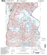
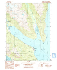 1991 Skagway B-2 SE1991 Print · USGSThe northern Alaskan coast near Haines comes into focus in the early nineties, showing a landscape defined by deep inlets and military infrastructure. Researchers can trace local landmarks like the Haines Fuel Terminal, the Ferry Dock, and the settlement at Tanani.
 - 1991 Map of Skagway B-1 NW
 1991 Skagway B-1 NW1991 Print · USGSThe head of Taiya Inlet comes into focus in the early 1990s as Skagway balances its gold rush history with modern transit. Trace the White Pass and Yukon Railway and find landmarks like the Gold Rush Cemetery and Reid Falls.
 - 1991 Map of Skagway B-1 SW
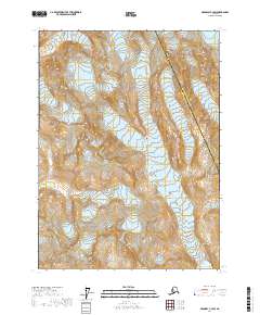
 1991 Skagway B-1 SW1991 Print · USGSThe wilderness north of the Lynn Canal was captured in the early nineties as a landscape of ice and coastal inlets. Researchers can trace the glaciated terrain from Schubee Glacier down to the shores of Taiya Inlet and the Katzehin River.
 - 1992 Map of Skagway C-1 NW
 1992 Skagway C-1 NW1992 Print · USGSThe Chilkoot Trail corridor comes into focus in the early 1990s as it winds through the coastal mountains toward the Canadian border. Researchers can trace the path of gold seekers through Sheep Camp, The Scales, and the steep ascent at Chilkoot Pass.
 - 1992 Map of Skagway C-1 NE
 1992 Skagway C-1 NE1992 Print · USGSThe high mountain passes of the Alaska-Canada border are frozen in time in the early nineties, showcasing the rugged transit corridor into the Yukon. Genealogists and historians can trace the precise path of the White Pass and Yukon Route past Fraser and Summit Lake.
 - 1992 Map of Skagway C-1 SE
 1992 Skagway C-1 SE1992 Print · USGSThe high mountain pass above Skagway is captured here in the early nineties as modern infrastructure follows the historic gold rush trails. Trace the winding White Pass and Yukon Route past Pitchfork Falls or locate the old mountain site of Heney.
 - 2004 Map of Skagway B-1, 2007 Print
 2004 Skagway B-12007 Print · USGSSkagway and the surrounding coastal peaks are shown at a time when its gold rush legacy was preserved through federal parklands. Trace the historic White Pass and Yukon Route and find landmarks like the Gold Rush Cem and Liarsville.
 - 2004 Map of Skagway C-1, 2007 Print
 2004 Skagway C-12007 Print · USGSSkagway and the high passes of the Yukon frontier are documented here in the early twenty-first century as part of the National Historical Park. Trace the legendary path of miners through Dyea and Sheep Camp or follow the narrow-gauge White Pass & Yukon Route through White Pass.
 - 2017 Map of Skagway C-2 SW, 2017 Print
 2017 Skagway C-2 SW2017 Print · USGSSoutheast Alaska’s high wilderness and glacial ice are mapped here in the late twenty-first century. Researchers can trace the municipal boundary through Ferebee Valley and locate the shifting extent of the Ferebee Glacier.
 - 2017 Map of Skagway B-2 SE, 2017 Print
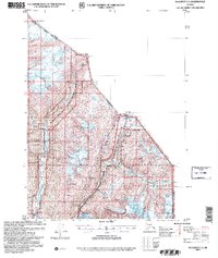
 2017 Skagway B-2 SE2017 Print · USGSThe coastal corridor near the Upper Lynn Canal comes into focus in this recent survey of the Southeast Alaska panhandle. Genealogists and local historians can trace the roads and shorelines connecting Haines and Tanani, from Mt Ripinski down to the waters of Lutak Inlet.
Showing maps 1-25 of 47
Top cities of Skagway
Frequently asked questions
- What are the different types of historical maps available for Skagway?
- What is the oldest map of Skagway?
- Where can I purchase historical maps of Skagway for my home or office?
- Where can I download high-res historical maps of Skagway?
- Are there historical topographic maps available for Skagway?
- Is there historical aerial imagery available for Skagway?
- Where are historical maps of Skagway sourced from?