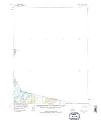
1960 Map of Atlin B-8
USGS Topo · Published 1965About this map
The Tongass National Forest dominates the southwestern corner of this survey, which primarily documents the high-altitude interface between the United States and Canada. The map focuses on a segment of the Alaska and British Columbia border, characterized by an Indefinite Boundary that underscores the difficulty of mapping this remote glaciated terrain. High points like Snow Top and Boundary Peak 108 serve as the primary landmarks in a landscape defined by extreme elevation rather than human settlement. This document is part of a larger international effort to define the frontier, based on photogrammetric methods from 1948 aerial photography and field-annotated in 1960. It captures a moment in the mid-century surveying of the North, where topographical precision met the physical reality of the Pacific Northwest's ice fields and summits such as Boundary Peak 106.
Find a feature on this map
7 named features on this map. Tap any name to fly to it.
Don’t see what you’re looking for? This feature index may not catch every label — zoom into the map to look around manually.
Map Details
Editions of this 1960 Atlin B-8 Map
2 editions found
Other maps of this area

1948 · Skagway A-1
USGS Topo · 1:63,360

1948 · Skagway C-1
USGS Topo · 1:63,360

1949 · Atlin
USGS Topo · 1:250,000

1949 · Skagway B-1
USGS Topo · 1:63,360

1951 · Skagway A-1
USGS Topo · 1:63,360

1951 · Skagway C-1
USGS Topo · 1:63,360

1951 · Atlin
USGS Topo · 1:250,000

1951 · Skagway B-1
USGS Topo · 1:63,360

1952 · Skagway
USGS Topo · 1:250,000

1960 · Atlin A-8
USGS Topo · 1:63,360