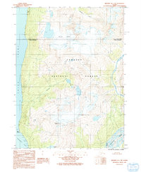
1991 Map of Skagway B-1 SW
USGS Topo · Published 1991About this map
Tongass National Forest dominates this coastal Alaskan landscape, where steep glaciated peaks meet the branching waters of the northern panhandle. The area is defined by the dramatic descent from heights such as Mount Villard and the massive Schubee Glacier down to the sea-level tidal flats of the Chilkoot Inlet and Taiya Inlet. This 1991 provisional survey, based on 1980s aerial photography, captures a wilderness shaped by drainage systems like Kasidaya Creek and Dayehas Creek. The map documents the Skagway Corporate Boundary Haines Borough line as it cuts across this uninhabited terrain. For those studying the geography of Southeast Alaska before significant modern development, the sheet provides exact coordinates for isolated features like Paradise Lake and the wide, braided Katzehin River delta near Low Point.
Find a feature on this map
14 named features on this map. Tap any name to fly to it.
Don’t see what you’re looking for? This feature index may not catch every label — zoom into the map to look around manually.
Map Details
Editions of this 1991 Skagway B-1 SW Map
This is the sole edition of this map. No revisions or reprints were ever made.
Other maps of this area

1948 · Skagway A-1
USGS Topo · 1:63,360

1949 · Skagway B-1
USGS Topo · 1:63,360

1951 · Skagway A-1
USGS Topo · 1:63,360

1951 · Skagway B-1
USGS Topo · 1:63,360

1952 · Skagway
USGS Topo · 1:250,000

1954 · Skagway B-2
USGS Topo · 1:63,360

1954 · Skagway A-2
USGS Topo · 1:63,360

1961 · Skagway
USGS Topo · 1:250,000
1991 · Skagway A-1 NW
USGS Topo · 1:25,000
1991 · Skagway B-2 SE
USGS Topo · 1:25,000