Old Maps of St. Paul, Alaska
Explore 13 old maps of St. Paul, spanning from 1948 to today. These high-resolution historic maps reveal how streets, neighborhoods, landmarks, and natural features evolved over time — perfect for genealogy, metal detecting, research, and local history exploration.
What you can do with these maps:
- See how St. Paul changed over time: Compare historical maps to modern-day views to trace roads, homesites, rail lines & more.
- View detailed metadata: Each map includes creators, publishers, year, scale, and archive source.
- Overlay maps with satellite & LiDAR: Visualize the past alongside modern tools to explore terrain & human change.
- Trusted historical sources: Maps sourced from the USGS, Library of Congress, and other archives.
- Access maps your way: View online, download high-res files, or order prints for personal or research use.
Start exploring old maps of St. Paul to uncover forgotten places, hidden landmarks, and the deep history beneath your feet.
St. Paul, AK maps
(13)- 1948 Map of Pribilof Islands, 1955 Print
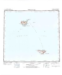 1948 Pribilof Islands1955 Print · USGSThe remote Pribilof Islands are documented here just after the war, showing the essential settlements and coastal geography of this Bering Sea archipelago. Researchers can trace the landing sites and terrain at St Paul, St. George, Village Cove, and Garden Cove.4 unique versions available
 - 1949 Map of Pribilof Islands
 1949 Pribilof Islands1949 Print · USGSThe Bering Sea islands of St. Paul and St. George are shown in the late 1940s during a pivotal era for Alaska’s maritime territory. Researchers can trace remote coastal points and settlements like St Paul and St. George, or locate landmarks such as Walrus Island and Village Cove.2 unique versions available
 - 1958 Map of Pribilof Islands
 1958 Pribilof Islands1958 Print · USGSThe isolated Pribilof archipelago appears here in the late fifties, detailing the rugged coasts of St. Paul Island and St. George Island. Researchers can locate the primary settlements of St Paul and St. George alongside remote landmarks like Rush Hill and Walrus Island.
 - 1969 Map of Pribilof Islands
 1969 Pribilof Islands1969 Print · USGSThe remote Pribilof archipelago appears during the late sixties, centered on the vital maritime outposts of St Paul and St. George. Researchers can trace the volcanic topography from Rush Hill to coastal features like Village Cove and English Bay.
 - 2001 Map of Saint Paul Island East, 2002 Print
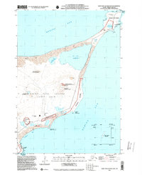 2001 Saint Paul Island East2002 Print · USGSSaint Paul Island in the Bering Sea is shown at the start of the millennium during a period of significant environmental restoration. Researchers can trace the intersection of maritime infrastructure and wildlife conservation at Northeast Point Rookery and the St Paul Island Airport.
 - 2001 Map of Saint Paul Island West, 2002 Print
 2001 Saint Paul Island West2002 Print · USGSSaint Paul Island in the Pribilof chain appears at the start of the millennium, documenting the remote Bering Sea settlement and its surrounding rookeries. Trace the local landscape from the village of St Paul to landmarks like Telegraph Hill and Antone Lake.
 - 2020 Map of Pribilof Islands D-4 SW, 2020 Print
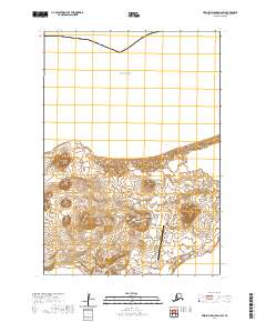 2020 Pribilof Islands D-4 SW2020 Print · USGSThe volcanic landscape of the Pribilof Islands comes into focus in this contemporary survey of the Alaska coast. Researchers can trace the modern roads and island terrain from the settlement at St. Paul to landmarks like Polovina Hill and St Paul Island Airport.
 - 2020 Map of Pribilof Islands D-5 SE, 2020 Print
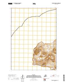 2020 Pribilof Islands D-5 SE2020 Print · USGSThe western reaches of St. Paul Island are captured here in the twenty-first century, showcasing a landscape of volcanic hills and maritime bluffs. Researchers can trace the path of SW Point Road as it winds past Rush Hill and Fox Hill toward the sea.
 - 2020 Map of Pribilof Islands D-4 SE, 2020 Print
 2020 Pribilof Islands D-4 SE2020 Print · USGSThe northern tip of this Pribilof Island landscape is captured during the modern era, showing its isolated coastal geography and local landmarks. Researchers can trace the path of Ne Point Road as it winds past Hutchinson Hill and Lake Dune.
 - 2020 Map of Pribilof Islands C-4 NE, 2020 Print
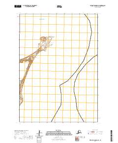
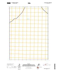 2020 Pribilof Islands C-4 NE2020 Print · USGSThe Pribilof Islands shoreline in the Aleutians West region is documented in this 2020 coastal survey. Researchers can trace the exact land-water interface and administrative boundaries defined by T35S R131W along the edge of the Bering Sea.
 - 2020 Map of Pribilof Islands C-3 NW, 2020 Print
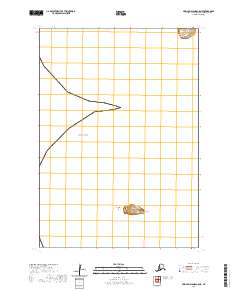
 2020 Pribilof Islands C-3 NW2020 Print · USGSThe Pribilof Islands meet the north Pacific in this recent survey of the Aleutians West area. Researchers can trace the coastline of St. Paul island against the Bering Sea and locate specific sections within T35S R129W.
 - 2020 Map of Pribilof Islands C-5 NE, 2020 Print
 2020 Pribilof Islands C-5 NE2020 Print · USGSThe remote Pribilof Islands appear in high detail during the early twenty-first century, showing the isolated maritime landscape of the Bering Sea. Researchers can locate specific coastal landmarks like Otter Island, Zapadni Point, and the hazards of Northwest Reef.
 - 2020 Map of Pribilof Islands C-4 NW, 2020 Print
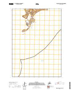 2020 Pribilof Islands C-4 NW2020 Print · USGSThe remote island community of St. Paul in the Bering Sea is documented here in the early twenty-first century. Researchers can trace the local road system and coastal features like Salt Lagoon, Black Bluffs, and the sands at Tolstoi Sands.
End of results
Showing maps 1-13 of 13
Top neighborhoods of St. Paul
Frequently asked questions
- What are the different types of historical maps available for St. Paul?
- What is the oldest map of St. Paul?
- Where can I purchase historical maps of St. Paul for my home or office?
- Where can I download high-res historical maps of St. Paul?
- Are there historical topographic maps available for St. Paul?
- Is there historical aerial imagery available for St. Paul?
- Where are historical maps of St. Paul sourced from?