1970s Maps of Gila County, Arizona
Explore 32 historic maps of Gila County from the 1970s. These maps offer a rare glimpse into what life looked like during the 1970s — showing old roads, neighborhoods, homes, and landmarks that have changed or disappeared over time.
Whether you're researching your family's past, planning a metal detecting trip, or studying how Gila County's landscape evolved across the 1970s, these high-resolution maps are a powerful tool for exploring the history of this region.
- Focus on a specific era: All maps on this page are from the 1970s, giving you a focused view of this time period.
- See what’s changed: Compare century-old streets, trails, and buildings to today's modern landscape using overlays and satellite layers.
- Research with precision: Use these maps for genealogy, historical research, land use analysis, or educational projects.
- View, download, or print: Maps are fully viewable online in high resolution, and can be downloaded or printed for your own records.
Start exploring Gila County's history through authentic maps from the 1970s. This is your window into the past.
Gila County, AZ maps
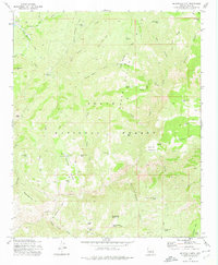
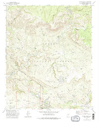
(32)- 1972 Map of Buzzard Roost Mesa, 1973 Print
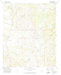
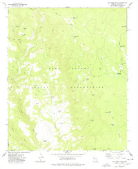
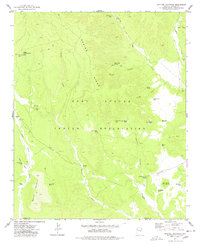
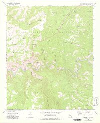
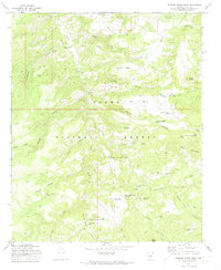 1972 Buzzard Roost Mesa1973 Print · USGSGila County's canyon-and-mesa ranching country is documented here in the early 1970s, showing a landscape defined by water tanks and remote camps. Researchers can locate the Spring Creek Mine, the Houdon Cabin, and the high-desert Landing Strip used to reach these isolated forest lands.2 unique versions available
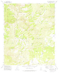
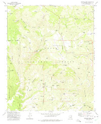
 - 1972 Map of Knoll Lake, 1974 Print
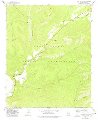
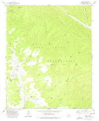
 1972 Knoll Lake1974 Print · USGSHigh in the Coconino National Forest during the early seventies, this area reveals a remote landscape of ranching outposts and high-country water sources. Trace historical sites like Limestone Ranch, O Haco Cabins, and the waters of Knoll Lake.2 unique versions available
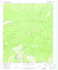
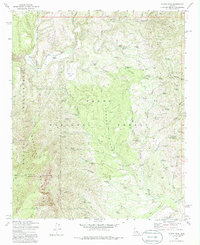
 - 1972 Map of Kehl Ridge, 1974 Print
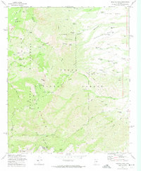
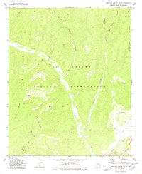
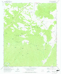
 1972 Kehl Ridge1974 Print · USGSCentral Arizona's high rim country in the early seventies shows a landscape defined by the great Mogollon Rim escarpment. Trace the early routes and remote outposts of the region, from General Springs Cabin and Camp Geronimo to the winding Verde River.2 unique versions available
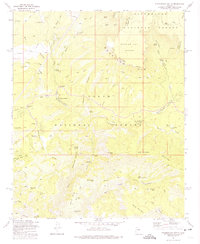
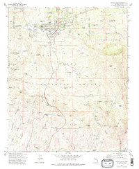
 - 1972 Map of Sheep Basin Mtn., 1974 Print
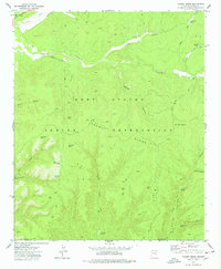
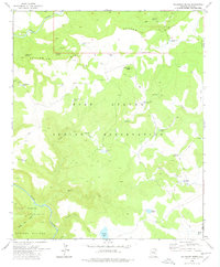
 1972 Sheep Basin Mtn.1974 Print · USGSGila County high country in the early seventies reveals a landscape of cattle camps and mountain trails. Genealogists and historians can trace family-named landmarks like Fred Pranty Cabin, Conway Corral, and the seasonal site at Soldier Camp.2 unique versions available
 - 1972 Map of Gisela, 1974 Print
 1972 Gisela1974 Print · USGSGisela and the surrounding Tonto National Forest are captured here in the early seventies, a landscape defined by cattle ranching and canyon terrain. Trace the locations of legacy holdings like Seventy Six Ranch or the Pittsburg Tonto Mine, and locate remote sites such as the Cocomunga Curry Basin.3 unique versions available
 - 1972 Map of Mazatzal Peak, 1974 Print
 1972 Mazatzal Peak1974 Print · USGSThe high Mazatzal range of central Arizona is captured here in the early 1970s, marking a rugged landscape of national forest and wilderness. Local historians can trace old ranching and forest camps like Chilson Camp or search for the isolated Grave near Deer Creek.3 unique versions available
 - 1972 Map of Dane Canyon, 1974 Print
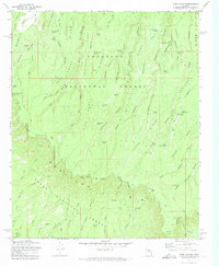 1972 Dane Canyon1974 Print · USGSThe Mogollon Rim divides the Coconino and Tonto National Forests in the early 1970s. Researchers can locate remote historical sites like the Holder Cabin (Site), the Battle of Big Dry Wash Historical Marker, and the Buck Springs Guard Station.3 unique versions available
 - 1973 Map of Diamond Point, 1975 Print
 1973 Diamond Point1975 Print · USGSGila County ranching and forest lands are detailed in this early 1970s survey. Genealogists and local historians can trace family-named sites like Pyle Ranch, Yunker Ranch Well, and the prominent lookout at Diamond Point.2 unique versions available
 - 1973 Map of McDonald Mtn, 1975 Print
 1973 McDonald Mtn1975 Print · USGSGila County ranching and forest lands are captured here in the 1970s, revealing the isolated homesteads and livestock tanks of the Arizona high country. Researchers can trace the location of the Old Rock House, Neal Cabin, and the sprawling Green Valley cattle country.
 - 1973 Map of Diamond Butte, 1975 Print
 1973 Diamond Butte1975 Print · USGSGila County ranching and mining sites are documented here in the mid-seventies amidst the steep canyons of the Tonto National Forest. You can trace the locations of the Ellison Mine, Ellinwood Ranch, and the Spurlock (Site) among the isolated mesas.
 - 1973 Map of Pine, 1975 Print
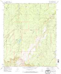
 1973 Pine1975 Print · USGSIn the early seventies, the mountain communities of Pine and Strawberry were defined by their proximity to the great Mogollon Rim. Local historians can trace the paths of the Zane Grey Highway and discover the locations of Camp Geronimo and the town Cem.3 unique versions available
 - 1973 Map of Promontory Butte, 1975 Print
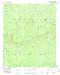
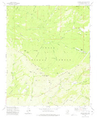
 1973 Promontory Butte1975 Print · USGSThe Mogollon Rim defines this Gila County landscape in the early seventies, marking the dramatic transition between high forests and deep canyons. Trace historical routes like the High Line Trail and find local landmarks such as Kohls Ranch and the Lookout Tower Promontory.4 unique versions available
 - 1973 Map of Payson North, 1975 Print
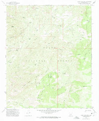
 1973 Payson North1975 Print · USGSThe Gila County high country comes into focus in the 1970s as Payson expands toward the northern wilderness. Researchers can trace early residential developments and find specialized sites like the Seismological Observatory and the Sycamore Forest Camp.2 unique versions available
 - 1973 Map of Buckhead Mesa, 1975 Print
 1973 Buckhead Mesa1975 Print · USGSGila County high country in the early seventies reveals a landscape of rugged ranching and mining activity. Genealogists and historians can trace old mining claims like the White Mountain Mine or locate early water sources such as Dripping Springs and Tonto Natural Bridge.3 unique versions available
 - 1973 Map of North Peak, 1975 Print
 1973 North Peak1975 Print · USGSThe Mazatzal Mountains in the early 1970s reveal a landscape of remote mining claims and high desert ranching. Genealogists and historians can trace old routes like the Marysville Trail and locate historic workings such as the Zulu Mine and Doll Baby Ranch.3 unique versions available
 - 1973 Map of Payson South, 1975 Print
 1973 Payson South1975 Print · USGSThe high country of Gila County is captured here in the early seventies, showing Payson as it expands into the Tonto National Forest. Researchers can locate Ft McDonald (Ruins), the Payson Cem, and numerous historic workings like the Golden Wonder Mine.2 unique versions available
 - 1977 Map of Oak Creek Ranch, 1978 Print
 1977 Oak Creek Ranch1978 Print · USGSThe Fort Apache Indian Reservation is captured here in the late 1970s, documenting a landscape of remote ranching and ancient sites. Genealogists and historians can trace the paths of the Gentry Trail and locate landmarks like Oak Creek Ranch and the Ruins near Grasshopper.
 - 1977 Map of Long Tom Canyon, 1978 Print
 1977 Long Tom Canyon1978 Print · USGSThe high plateau and deep canyons of the Fort Apache Indian Reservation are shown here as they were managed in the late 1970s. Researchers can locate remote ranching and aviation landmarks such as Bull Pasture Tank, Dripping Spring, and the isolated Landing Strip.
 - 1977 Map of Limestone Canyon South, 1978 Print
 1977 Limestone Canyon South1978 Print · USGSThe high plateau of the Fort Apache Indian Reservation is captured here in the late seventies as the Bureau of Indian Affairs updated its land records. Researchers can trace remote water sources and infrastructure like Rotten Spring, Cedar Mesa Tanks, and a lone Grave.
 - 1977 Map of Faught Ridge, 1978 Print
 1977 Faught Ridge1978 Print · USGSThe Fort Apache Indian Reservation is captured in the late seventies as a landscape of remote ranching outposts and rugged canyons. Local historians can trace old livestock routes and water sources like West Ranch, Bear Playground Spring, and Dry Valley Tank.
 - 1977 Map of Spotted Mountain, 1978 Print
 1977 Spotted Mountain1978 Print · USGSThe Fort Apache Indian Reservation comes into focus during the late 1970s as ranching and tribal lands are meticulously documented across Navajo and Gila Counties. Researchers can locate remote outposts like Martinez Ranch, trace the Salt River corridor, and identify high-country landmarks including Spotted Mountain and Grasshopper Butte.
 - 1977 Map of Cibecue, 1978 Print
 1977 Cibecue1978 Print · USGSThe settlement of Cibecue and its surrounding canyonlands are documented here in the late 1970s following revisions by the Bureau of Indian Affairs. Researchers can trace the layout of the Apache Mission Sch, local cemeteries, and remote water sources like Ice Cream Cone Tank.
 - 1978 Map of Cone Butte
 1978 Cone Butte1978 Print · USGSThe Fort Apache Indian Reservation in the late seventies was a landscape of remote ranching outposts and vital water sources. Genealogists and historians can trace family-named landmarks like Sam Green Tank or visit the site of the R-14 Ranch.
 - 1978 Map of Velasquez Butte
 1978 Velasquez Butte1978 Print · USGSThe high plateaus and deep river canyons of the Apache lands are captured here in the late seventies. Researchers can trace remote water sources and cattle landmarks like Navajo Bill Spring, Velasquez Butte, and the convergence of the White River.
 - 1978 Map of Beckers Butte
 1978 Beckers Butte1978 Print · USGSThe border of the Fort Apache and San Carlos Indian Reservations was defined by the winding Salt River in the late seventies. Researchers can trace remote desert landmarks like Beckers Butte, Frog Pond, and family-named cattle tanks.
Showing maps 1-25 of 32
Top cities of Gila County
- Payson historical maps
- Globe historical maps
- San Carlos historical maps
- Star Valley historical maps
- Pine historical maps
- Miami historical maps
See more
Frequently asked questions
- What are the different types of historical maps available for Gila County?
- What is the oldest map of Gila County?
- Where can I purchase historical maps of Gila County for my home or office?
- Where can I download high-res historical maps of Gila County?
- Are there historical topographic maps available for Gila County?
- Is there historical aerial imagery available for Gila County?
- Where are historical maps of Gila County sourced from?