1990s Maps of Gila County, Arizona
Explore 12 historic maps of Gila County from the 1990s. These maps offer a rare glimpse into what life looked like during the 1990s — showing old roads, neighborhoods, homes, and landmarks that have changed or disappeared over time.
Whether you're researching your family's past, planning a metal detecting trip, or studying how Gila County's landscape evolved across the 1990s, these high-resolution maps are a powerful tool for exploring the history of this region.
- Focus on a specific era: All maps on this page are from the 1990s, giving you a focused view of this time period.
- See what’s changed: Compare century-old streets, trails, and buildings to today's modern landscape using overlays and satellite layers.
- Research with precision: Use these maps for genealogy, historical research, land use analysis, or educational projects.
- View, download, or print: Maps are fully viewable online in high resolution, and can be downloaded or printed for your own records.
Start exploring Gila County's history through authentic maps from the 1990s. This is your window into the past.
Gila County, AZ maps
(12)- 1990 Map of Gentry Mountain, 1991 Print
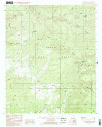
 1990 Gentry Mountain1991 Print · USGSHigh mesas and deep canyons define this Gila County territory during the 1990s as it transitions from national forest to tribal lands. Genealogists and historians can locate a remote grave near Pine Spring or trace mining activity through several adits and prospects.
 - 1990 Map of Young, 1991 Print
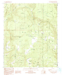
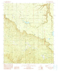
 1990 Young1991 Print · USGSYoung and Pleasant Valley are captured here in the 1990s as a high-country ranching and forest community. Researchers can trace local landmarks like the Pleasant Valley Sch, the Cem, and various water features such as Cherry Creek and Hog Canyon Tank.2 unique versions available
 - 1990 Map of O W Point, 1991 Print
 1990 O W Point1991 Print · USGSThe Mogollon Rim country comes into sharp focus during the early 1990s as forest communities and mountain recreation areas expanded. Researchers can trace the development of Forest Lakes, find the Gravel Pit, and locate remote landmarks like Willow Springs Lake and North Ow Point.3 unique versions available
 - 1990 Map of Parallel Canyon, 1991 Print
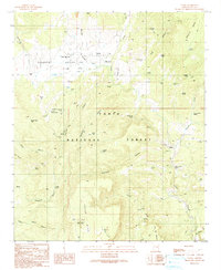
 1990 Parallel Canyon1991 Print · USGSGila County ranching and forest lands are captured in this late twentieth-century study, showcasing the high-elevation terrain before modern developments. Researchers can trace remote sites like Oak Creek Ranch, the Red Lake FS Station, and the Redman Cave Grave.
 - 1990 Map of Woods Canyon, 1991 Print
 1990 Woods Canyon1991 Print · USGSArizona's high country is defined by the massive escarpment of the Mogollon Rim during the late twentieth century. Researchers can trace the developed recreation landscape of the era, from the Woods Canyon Dam and Willow Springs Lake to the rugged Military Sinkhole.2 unique versions available
 - 1990 Map of Oxbow Mountain, 1991 Print
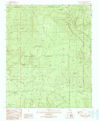
 1990 Oxbow Mountain1991 Print · USGSGila County ranching and recreation are captured in the late twentieth century as the high country of the Tonto National Forest meets the desert. Researchers can trace water resources like Dry Creek Tank and Pine Creek Well or find remote landmarks such as Gillette and the Pleasant Valley Airstrip.2 unique versions available
 - 1992 Map of Seneca, 1993 Print
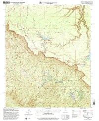
 1992 Seneca1993 Print · USGSGila County in the early nineties remains a wild landscape of tribal reservations and national forest. Researchers can trace historic mining at the Old Owen McMillenville Mine, locate the remote settlement of Cibecue, and map the rugged drainages of the Salt River.2 unique versions available
 - 1994 Map of Mesa
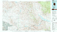
 1994 Mesa1994 Print · USGSThe Phoenix and Mesa metropolitan area meets the desert wilderness in the 1990s as urban growth pushes toward the Superstition Mountains. Researchers can trace the path of the Southern Pacific railroad or locate heritage sites like Casa Grande Ruins Nat Mon and Williams Air Force Base.2 unique versions available
 - 1994 Map of Theodore Roosevelt Lake, 1995 Print
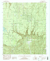
 1994 Theodore Roosevelt Lake1995 Print · USGSCentral Arizona in the early nineties reveals the sprawling growth of the Valley of the Sun against the high desert wilderness. Researchers can trace the development of Scottsdale and Carefree or locate remote outposts like Sunflower and Punkin Center near the Mazatzal Wilderness.3 unique versions available
 - 1998 Map of Knoll Lake, 2000 Print
 1998 Knoll Lake2000 Print · USGSThe Mogollon Rim country of northern Arizona is captured here during the late nineties, showing the intersection of three major national forests. Researchers can trace historic sites like the Zane Grey Lodge (Site), the O'Haco Lookout, and various crossings like Besemer Crossing.
 - 1998 Map of Woods Canyon, 2001 Print
 1998 Woods Canyon2001 Print · USGSThe Mogollon Rim forms a dramatic divide through the Arizona high country during the late twentieth century. Researchers can trace historic routes like the General George Crook Road and locate mountain communities at Colcord Estates or Ponderosa Estates.
 - 1998 Map of Promontory Butte, 2001 Print
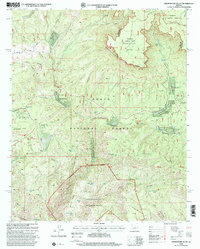 1998 Promontory Butte2001 Print · USGSGila County during the late nineties shows a landscape defined by the towering Mogollon Rim and the clear waters of Tonto Creek. Genealogists and local historians can trace the development of seasonal communities like Kohls Ranch or Bear Flat Subdivision and find family landmarks along the Highline Trail.
End of results
Showing maps 1-12 of 12
Top cities of Gila County
- Payson historical maps
- Globe historical maps
- San Carlos historical maps
- Star Valley historical maps
- Pine historical maps
- Miami historical maps
See more
Frequently asked questions
- What are the different types of historical maps available for Gila County?
- What is the oldest map of Gila County?
- Where can I purchase historical maps of Gila County for my home or office?
- Where can I download high-res historical maps of Gila County?
- Are there historical topographic maps available for Gila County?
- Is there historical aerial imagery available for Gila County?
- Where are historical maps of Gila County sourced from?