1960s Maps of Gila County, Arizona
Explore 69 historic maps of Gila County from the 1960s. These maps offer a rare glimpse into what life looked like during the 1960s — showing old roads, neighborhoods, homes, and landmarks that have changed or disappeared over time.
Whether you're researching your family's past, planning a metal detecting trip, or studying how Gila County's landscape evolved across the 1960s, these high-resolution maps are a powerful tool for exploring the history of this region.
- Focus on a specific era: All maps on this page are from the 1960s, giving you a focused view of this time period.
- See what’s changed: Compare century-old streets, trails, and buildings to today's modern landscape using overlays and satellite layers.
- Research with precision: Use these maps for genealogy, historical research, land use analysis, or educational projects.
- View, download, or print: Maps are fully viewable online in high resolution, and can be downloaded or printed for your own records.
Start exploring Gila County's history through authentic maps from the 1960s. This is your window into the past.
Gila County, AZ maps
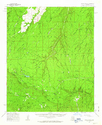
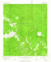
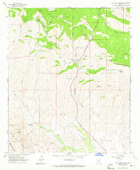
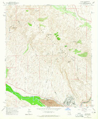
(69)- 1960 Map of Holbrook
 1960 Holbrook1960 Print · USGSNorthern Arizona is captured here just as modern highways began to reshape the cattle and timber country of the Colorado Plateau. Genealogists and historians can trace the early footprints of Snowflake, Sedona, and Payson, alongside the Atchison Topeka & Santa Fe RR rail line.
 - 1960 Map of Mesa
 1960 Mesa1960 Print · USGSThe Salt River Valley and Superstition wilderness are captured here during a era of rapid post-war growth. Researchers can trace the mid-century footprints of Williams AF Base and Arizona State College or locate the deep-rock shafts of the Old Dominion Mine and Magma Mine.
 - 1961 Map of Woods Canyon, 1963 Print
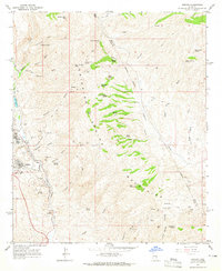
 1961 Woods Canyon1963 Print · USGSThe high plateau meets the dramatic drop of the Mogollon Rim in the early sixties, a landscape of isolated ranching and forestry. Researchers can trace historic outposts like Dutch Joe Ranch and OW Ranch or locate the Rainbow Mines.3 unique versions available
 - 1961 Map of Show Low, 1963 Print
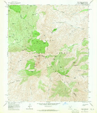
 1961 Show Low1963 Print · USGSShow Low and the northern reaches of the White Mountains are captured here in the early sixties as the region's modern infrastructure began to take shape. Researchers can trace early ranching outposts like West Ranch and find local landmarks such as the Forestdale Trading Post and Show Low Lake.2 unique versions available
 - 1961 Map of Cibecue, 1963 Print
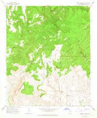
 1961 Cibecue1963 Print · USGSThe Fort Apache Indian Reservation and Sitgreaves National Forest converge in the early sixties, showing a landscape defined by deep canyons and remote settlements. Genealogists and historians can trace the community of Cibecue, the Apache Mission School, and the local Cem.2 unique versions available
 - 1961 Map of Chediski Peak, 1963 Print
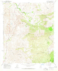
 1961 Chediski Peak1963 Print · USGSNavajo and Gila counties are shown here in the early 1960s, documenting the high-country landscape of the Fort Apache Indian Reservation. Genealogists and historians can trace old ranching infrastructure and remote sites like Grasshopper, Oak Creek Ranch, and the Chediski Peak Lookout.2 unique versions available
 - 1961 Map of Young, 1963 Print
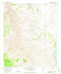
 1961 Young1963 Print · USGSPleasant Valley and the high mesas of Gila County are captured here in the early sixties as cattle ranching and forestry shaped the local economy. Researchers can locate the Young settlement, Nail Ranch, and the Asbestos Mill along the rugged Cherry Creek corridor.2 unique versions available
 - 1962 Map of Tucson
 1962 Tucson1962 Print · USGSSouthern Arizona in the early sixties showcases a landscape defined by burgeoning desert cities and massive military installations. Researchers can trace tribal settlements like Schuchk, legacy mining sites at Silver Bell Mine, and the early footprint of Davis-Monthan Air Force Base.
 - 1962 Map of San Carlos Reservoir, 1963 Print
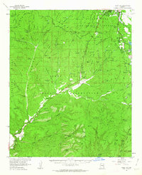
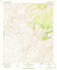
 1962 San Carlos Reservoir1963 Print · USGSThe Graham and Gila County borderlands are captured here in the early sixties, showing the vital San Carlos Reservoir and the surrounding desert rangeland. Researchers can trace remote habitations and industry through the Copper Reef Mine, Indian Cemetery, and several historic ranch sites like Bowman Ranch.3 unique versions available
 - 1963 Map of Mine Mountain, 1965 Print
 1963 Mine Mountain1965 Print · USGSThe Mazatzal Mountains in the early 1960s were a landscape of remote pack trails and isolated springs on the Maricopa and Gila County line. Researchers can locate remote landmarks like Cline Cabin, trace the Soldier Camp Trail, and find old workings at the Mine.4 unique versions available
 - 1964 Map of Tucson
 1964 Tucson1964 Print · USGSSouthern Arizona in the mid-1960s shows a landscape of burgeoning desert cities and industrial-scale copper mining. Researchers can trace the development of Tucson and its outlying mining districts, including the Silver Bell Mine and San Manuel Mine.
 - 1964 Map of Mesa
 1964 Mesa1964 Print · USGSCentral Arizona in the mid-1960s reveals a landscape defined by rapid desert urbanization and a massive copper mining industry. Genealogists and historians can trace the growth of Phoenix or explore the mining camps and operations at Miami Mine and Magma Mine.
 - 1964 Map of Kayler Butte, 1965 Print
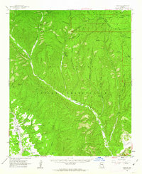
 1964 Kayler Butte1965 Print · USGSGila County ranching and military history meet along Tonto Creek in the mid-1960s. Genealogists and historians can locate family landmarks like Branson Ranch or the H Four Cem, and trace the grounds of Old Fort Reno (Site).3 unique versions available
 - 1964 Map of Armer Mountain, 1965 Print
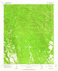
 1964 Armer Mountain1965 Print · USGSGila County's high desert peaks and canyons are captured here in the mid-1960s, showing the remote reaches of the Tonto National Forest. Researchers can locate isolated ranching and mining outposts such as Boyer Cabin, Tucker Box, and several unidentified ruins along the gulches.3 unique versions available
 - 1964 Map of Greenback Creek, 1965 Print
 1964 Greenback Creek1965 Print · USGSCentral Arizona ranching and mining country comes into focus in the mid-1960s. Researchers can locate remote homesteads like Bouquet Ranch, early mining sites including the Bluebird Mine, and numerous springs such as Jernigan Spr.3 unique versions available
 - 1964 Map of Tonto Basin, 1965 Print
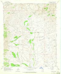
 1964 Tonto Basin1965 Print · USGSArizona's high desert cattle country and the northern reaches of Roosevelt Lake are captured in the mid-1960s. Researchers can trace historic ranching infrastructure and early human sites, from the Tonto Basin Post Office to numerous petroglyphs and corrals along Sycamore Creek.2 unique versions available
 - 1964 Map of Boulder Mtn, 1965 Print
 1964 Boulder Mtn1965 Print · USGSArizona's high desert peaks and ranching country are documented here in the early sixties, showing the remote edges of the Tonto National Forest. Researchers can find old mining sites like the El Oso Mine, the remote Boulder Bobs Cabin, and the ranching hub at Diamond Ranch.3 unique versions available
 - 1964 Map of Four Peaks, 1965 Print
 1964 Four Peaks1965 Print · USGSThe high Mazatzal range and the Tonto National Forest were carefully charted in the early sixties, detailing a land of high peaks and hidden springs. Researchers can find old backcountry landmarks like Three Bar Cabin, several Prospect sites, and the remote Soldier Camp.5 unique versions available
 - 1964 Map of El Capitan Mtn, 1965 Print
 1964 El Capitan Mtn1965 Print · USGSGila County's mountainous mining landscape comes into focus during the early 1960s, showing the intersection of the Pinal and Mescal ranges. Researchers can trace historic prospecting sites like Silver Dime Mine and Cowboy Mine along with cattle ranching landmarks like Trap Corral.2 unique versions available
 - 1964 Map of Theodore Roosevelt Dam, 1965 Print
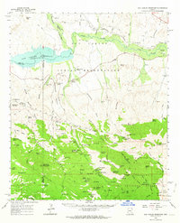
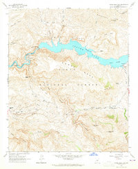
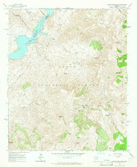
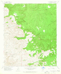
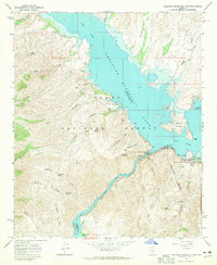 1964 Theodore Roosevelt Dam1965 Print · USGSThe Salt River Canyon at the height of the mid-century recreation boom shows a landscape transformed by the Theodore Roosevelt Dam. Trace the original winding path of the Apache Trail as it connects the town of Roosevelt to landmarks like Inspiration Point and Tonto National Monument.2 unique versions available
 - 1964 Map of Horse Mesa Dam, 1965 Print
 1964 Horse Mesa Dam1965 Print · USGSThe Salt River canyon in the early 1960s reveals a landscape of high-desert engineering and remote wilderness. Trace the infrastructure of Apache Lake and find historic sites like Adams Camp, Browns Cave, and the Painted Cliffs.5 unique versions available
 - 1964 Map of Pinyon Mountain, 1965 Print
 1964 Pinyon Mountain1965 Print · USGSThe high desert canyons of the Tonto National Forest in the mid-1960s reveal a landscape of remote springs and ridgelines. Trace the rugged terrain of Two Bar Ridge down to Apache Lake, locating local landmarks like Castle Dome and several identified Ruins.4 unique versions available
 - 1964 Map of Hayden, 1965 Print
 1964 Hayden1965 Print · USGSGila County industrial and mountain landscapes are captured here in the mid-1960s as mining operations dominated the Gila River corridor. Genealogists and industrial historians can trace the rail network of the Southern Pacific serving Hayden and local extraction sites like the 79 Mine or Santa Monica Camp.3 unique versions available
 - 1964 Map of Sonora, 1965 Print
 1964 Sonora1965 Print · USGSThe Pinal County copper belt and high desert ranchlands are captured here in the mid-sixties as industrial mining transformed the landscape. Researchers can trace the footprints of Ray and Sonora alongside working sites like the Ray Mine and Slash S Ranch.3 unique versions available
 - 1964 Map of Picture Mountain, 1965 Print
 1964 Picture Mountain1965 Print · USGSGila County's high wilderness is documented in the mid-1960s as a land of rugged peaks and essential water sources. Researchers can trace the layout of Oak Creek Ranch, locate numerous Ruins, and identify remote mining Prospects near Picture Mountain and Mistake Peak.2 unique versions available
Showing maps 1-25 of 69
Top cities of Gila County
- Payson historical maps
- Globe historical maps
- San Carlos historical maps
- Star Valley historical maps
- Pine historical maps
- Miami historical maps
See more
Frequently asked questions
- What are the different types of historical maps available for Gila County?
- What is the oldest map of Gila County?
- Where can I purchase historical maps of Gila County for my home or office?
- Where can I download high-res historical maps of Gila County?
- Are there historical topographic maps available for Gila County?
- Is there historical aerial imagery available for Gila County?
- Where are historical maps of Gila County sourced from?