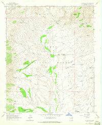
1964 Map of Kayler Butte
USGS Topo · Published 1965About this map
Tonto Creek flows southward through the heart of the Tonto National Forest in this mid-1960s survey of central Arizona. The landscape is marked by the remnants of late 19th-century frontier life, most notably the Old Fort Reno (Site) near Reno Creek. This military site, along with the H Four Cem and scattered ruins, provides a window into the historical settlement patterns of Gila County before modern development.
Find a feature on this map
44 named features on this map. Tap any name to fly to it.
Don’t see what you’re looking for? This feature index may not catch every label — zoom into the map to look around manually.
Map Details
Editions of this 1964 Kayler Butte Map
3 editions found
Other maps of this area

1887 · Verde
USGS Topo · 1:250,000

1892 · Verde
USGS Topo · 1:250,000

1907 · Roosevelt
USGS Topo · 1:125,000

1909 · Four Peaks
USGS Topo · 1:125,000

1912 · Roosevelt
USGS Topo · 1:125,000

1936 · Payson
USGS Topo · 1:48,000

1937 · Diamond Butte
USGS Topo · 1:48,000

1942 · Payson
USGS Topo · 1:62,500

1943 · Diamond Butte
USGS Topo · 1:62,500

1954 · Holbrook
USGS Topo · 1:250,000