Old Maps of Maricopa County, Arizona
Explore 397 old maps of Maricopa County, spanning from 1887 to today. These high-resolution historic maps reveal how streets, neighborhoods, landmarks, and natural features evolved over time — perfect for genealogy, metal detecting, research, and local history exploration.
What you can do with these maps:
- See how Maricopa County changed over time: Compare historical maps to modern-day views to trace roads, homesites, rail lines & more.
- View detailed metadata: Each map includes creators, publishers, year, scale, and archive source.
- Overlay maps with satellite & LiDAR: Visualize the past alongside modern tools to explore terrain & human change.
- Trusted historical sources: Maps sourced from the USGS, Library of Congress, and other archives.
- Access maps your way: View online, download high-res files, or order prints for personal or research use.
Start exploring old maps of Maricopa County to uncover forgotten places, hidden landmarks, and the deep history beneath your feet.
Maricopa County, AZ maps
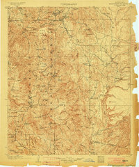
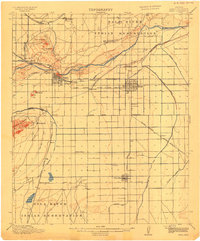
(397)- 1887 Map of Verde
 1887 Verde1887 Print · USGSCovers Maricopa County, including Payson, Cottonwood, and other nearby areas
 - 1887 Map of Prescott
 1887 Prescott1887 Print · USGSCovers Maricopa County, including Prescott, Prescott Valley, and other nearby areas
 - 1892 Map of Verde
 1892 Verde1892 Print · USGSCovers Maricopa County, including Payson, Cottonwood, and other nearby areas5 unique versions available
 - 1892 Map of Prescott, 1898 Print
 1892 Prescott1898 Print · USGSCovers Maricopa County, including Prescott, Prescott Valley, and other nearby areas5 unique versions available
 - 1900 Map of Florence, 1956 Print
 1900 Florence1956 Print · USGSCovers Maricopa County, including Apache Junction, Florence, and other nearby areas
 - 1902 Map of Florence
 1902 Florence1902 Print · USGSCovers Maricopa County, including Apache Junction, Florence, and other nearby areas5 unique versions available
 - 1903 Map of Bradshaw Mountains
 1903 Bradshaw Mountains1903 Print · USGSCovers Maricopa County, including Dewey-Humboldt, Cordes Lakes, and other nearby areas5 unique versions available
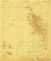
 - 1903 Map of Congress, 1962 Print
 1903 Congress1962 Print · USGSCovers Maricopa County, including Wickenburg, Congress, and other nearby areas
 - 1904 Map of Camelback
 1904 Camelback1904 Print · USGSCovers Maricopa County, including Phoenix, Scottsdale, and other nearby areas
 - 1904 Map of Congress
 1904 Congress1904 Print · USGSCovers Maricopa County, including Wickenburg, Congress, and other nearby areas3 unique versions available
 - 1904 Map of Desert Well, 1958 Print
 1904 Desert Well1958 Print · USGSCovers Maricopa County, including Mesa, Gilbert, and other nearby areas
 - 1904 Map of Ft. McDowell, 1960 Print
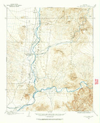 1904 Ft. McDowell1960 Print · USGSCovers Maricopa County, including Mesa, Fountain Hills, and other nearby areas
 - 1906 Map of Camelsback
 1906 Camelsback1906 Print · USGSCovers Maricopa County, including Phoenix, Scottsdale, and other nearby areas3 unique versions available
 - 1906 Map of Ft. McDowell
 1906 Ft. McDowell1906 Print · USGSCovers Maricopa County, including Mesa, Fountain Hills, and other nearby areas3 unique versions available
 - 1906 Map of Desert Well
 1906 Desert Well1906 Print · USGSCovers Maricopa County, including Mesa, Gilbert, and other nearby areas3 unique versions available
 - 1907 Map of Sacaton
 1907 Sacaton1907 Print · USGSCovers Maricopa County, including Gilbert, San Tan Valley, and other nearby areas4 unique versions available
 - 1907 Map of Roosevelt, 1956 Print
 1907 Roosevelt1956 Print · USGSCovers Maricopa County, including Roosevelt Lake Estates, North Bay Estates, and other nearby areas2 unique versions available
 - 1909 Map of Four Peaks
 1909 Four Peaks1909 Print · USGSCovers Maricopa County, including Roosevelt Lake Estates, North Bay Estates, and other nearby areas2 unique versions available
 - 1912 Map of Roosevelt
 1912 Roosevelt1912 Print · USGSCovers Maricopa County, including Roosevelt Lake Estates, North Bay Estates, and other nearby areas4 unique versions available
 - 1912 Map of Phoenix, 1955 Print
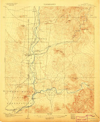
 1912 Phoenix1955 Print · USGSCovers Maricopa County, including Phoenix, Tolleson, and other nearby areas
 - 1913 Map of Mesa, 1955 Print
 1913 Mesa1955 Print · USGSCovers Maricopa County, including Phoenix, Mesa, and other nearby areas
 - 1913 Map of Maricopa, 1958 Print
 1913 Maricopa1958 Print · USGSCovers Maricopa County, including Goodyear, Maricopa, and other nearby areas
 - 1914 Map of Gila Butte
 1914 Gila Butte1914 Print · USGSCovers Maricopa County, including Chandler, Gilbert, and other nearby areas
 - 1914 Map of Phoenix
 1914 Phoenix1914 Print · USGSCovers Maricopa County, including Phoenix, Tolleson, and other nearby areas4 unique versions available
 - 1915 Map of Mesa
 1915 Mesa1915 Print · USGSCovers Maricopa County, including Phoenix, Mesa, and other nearby areas2 unique versions available
Showing maps 1-25 of 397
Top cities of Maricopa County
- Phoenix historical maps
- Mesa historical maps
- Chandler historical maps
- Glendale historical maps
- Scottsdale historical maps
- Gilbert historical maps
See more
Frequently asked questions
- What are the different types of historical maps available for Maricopa County?
- What is the oldest map of Maricopa County?
- Where can I purchase historical maps of Maricopa County for my home or office?
- Where can I download high-res historical maps of Maricopa County?
- Are there historical topographic maps available for Maricopa County?
- Is there historical aerial imagery available for Maricopa County?
- Where are historical maps of Maricopa County sourced from?