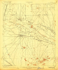
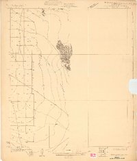
1900s (20th Century) Maps of Maricopa County, Arizona
Explore 356 historic maps of Maricopa County from the 1900s (20th Century). These maps offer a rare glimpse into what life looked like during the 1900s — showing old roads, neighborhoods, homes, and landmarks that have changed or disappeared over time.
Whether you're researching your family's past, planning a metal detecting trip, or studying how Maricopa County's landscape evolved across the 1900s, these high-resolution maps are a powerful tool for exploring the history of this region.
- Focus on a specific era: All maps on this page are from the 1900s, giving you a focused view of this time period.
- See what’s changed: Compare century-old streets, trails, and buildings to today's modern landscape using overlays and satellite layers.
- Research with precision: Use these maps for genealogy, historical research, land use analysis, or educational projects.
- View, download, or print: Maps are fully viewable online in high resolution, and can be downloaded or printed for your own records.
Start exploring Maricopa County's history through authentic maps from the 1900s. This is your window into the past.
Maricopa County, AZ maps
(356)- 1900 Map of Florence, 1956 Print
 1900 Florence1956 Print · USGSArizona's mining and ranching frontiers are mapped here at the dawn of the century as the Gila River valley begins its growth. Researchers can trace historic family holdings like Arnett Ranch and early industrial camps at Silver King or the Silver Bell Mine.
 - 1902 Map of Florence
 1902 Florence1902 Print · USGSFlorence and the Gila River valley are captured here at the turn of the century during the peak of early Arizona mining and ranching. Researchers can locate vanished settlements and family sites like Silver King, Adamsville, and the Silver Bell Mine.5 unique versions available
 - 1903 Map of Bradshaw Mountains
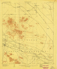
 1903 Bradshaw Mountains1903 Print · USGSArizona's mining heartland comes into focus during the territorial era as high-altitude camps and smelters reached their peak. Trace the early footprints of Crown King, Walker, and Tiptop alongside the winding route of the Prescott and Eastern R.R.4 unique versions available
 - 1903 Map of Congress, 1962 Print
 1903 Congress1962 Print · USGSYavapai County's high desert mining camps and cattle ranches are captured here at the turn of the century. Genealogists and historians can trace the early rail-and-mine economy through sites like Congress Junction, Octave, and the Walnut Grove Dam.
 - 1904 Map of Camelback
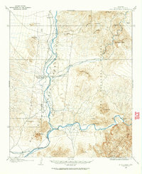
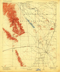
 1904 Camelback1904 Print · USGSMaricopa County is captured at the dawn of the twentieth century, showing a desert landscape before the rise of the Phoenix suburbs. Researchers can trace the foundational Arizona Canal and early landmarks like Camelback Mtn and Thompson Pk.
 - 1904 Map of Congress
 1904 Congress1904 Print · USGSArizona's mining heartland in Yavapai County comes alive during this early boom era. Genealogists and historians can trace the foundations of Congress Junction, the bustling Congress Mine, and the legendary gold camp at Stanton along the Hassayampa River.3 unique versions available
 - 1904 Map of Desert Well, 1958 Print
 1904 Desert Well1958 Print · USGSArizona's Salt River Valley comes to life in the early 1900s as a landscape of irrigation canals and desert outposts. Local historians can trace the early footprint of Higley, locate the specific Desert Well, and follow the path of the Santa Fe Prescott and Phoenix RR.
 - 1904 Map of Ft. McDowell, 1960 Print
 1904 Ft. McDowell1960 Print · USGSMaricopa County's river valleys and early ranching outposts are captured here at the turn of the century. Genealogists and historians can locate early homesteads like Asher's Ranch and the site of the Limekiln near the Salt River.
 - 1906 Map of Camelsback
 1906 Camelsback1906 Print · USGSArizona's high desert near Phoenix is captured here at the turn of the century, when the landscape was defined by mountain ranges and early water infrastructure. Genealogists and historians can trace the paths of the Old Verde Canal and the Arizona Canal or locate landmarks like Thompson Pk and Mountain Spring.3 unique versions available
 - 1906 Map of Ft. McDowell
 1906 Ft. McDowell1906 Print · USGSMaricopa County's river valleys and desert foothills were defined by a network of ranching homesteads and tribal lands in the early 1900s. Researchers can trace the early foundations of Arizona water management near the Arizona Dam and locate family outposts like Otero's Ranch and Stewarts Ranch.3 unique versions available
 - 1906 Map of Desert Well
 1906 Desert Well1906 Print · USGSArizona's Salt River valley was transitioning from open range to an irrigated landscape in the years after the turn of the century. Trace the early routes of the Santa Fe Prescott and Phoenix RR and locate pioneer outposts like Buchanan's Ranch and the Desert Well.3 unique versions available
 - 1907 Map of Sacaton
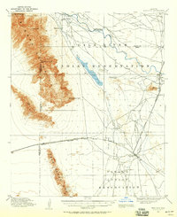
 1907 Sacaton1907 Print · USGSThe Gila River Valley comes alive in this survey from the early 1900s, showing the early infrastructure of the Gila River Indian Reservation. Trace the legacy of desert ranching at Andrada's Ranch or find the early site of Blackwater Chapel.4 unique versions available
 - 1907 Map of Roosevelt, 1956 Print
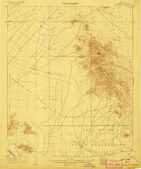
 1907 Roosevelt1956 Print · USGSCentral Arizona at the birth of the reclamation era centers on the engineering of the Roosevelt Dam and the waters of the Salt River. Genealogists and historians can trace numerous early family holdings like Clanton's Ranch, the stage stop at Schells Station, and the remote settlement of Apacheria.2 unique versions available
 - 1909 Map of Four Peaks
 1909 Four Peaks1909 Print · USGSThe central Arizona wilderness at the start of the century reveals a land of isolated ranching outposts and rugged mountain passes. Researchers can trace the early cattle frontier at Sunflower Ranch, find the original Mormon Flats, and locate the historic Schells Station.2 unique versions available
 - 1912 Map of Roosevelt
 1912 Roosevelt1912 Print · USGSCentral Arizona is captured here during the transformative years following the completion of the Roosevelt Dam. You can trace early ranching homesteads such as Clines Ranch and Howell's Ranch or locate the site of Schell's Station.4 unique versions available
 - 1912 Map of Phoenix, 1955 Print
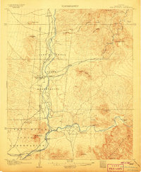
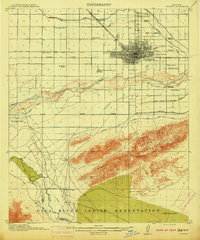
 1912 Phoenix1955 Print · USGSEarly 1900s Phoenix is depicted as an emerging agricultural and rail hub defined by its extensive canal system and desert surroundings. Genealogists and local researchers can trace early homesteads and community centers like Alhambra, St Johns Chapel, and the County Poor Farm.
 - 1913 Map of Mesa, 1955 Print
 1913 Mesa1955 Print · USGSMaricopa County's irrigation and early rail networks are meticulously detailed in this pre-war survey of the Salt River Valley. Genealogists can trace family names at local landmarks like Alma School, the settlement of Creamery, and the Kyrene School.
 - 1913 Map of Maricopa, 1958 Print
 1913 Maricopa1958 Print · USGSArizona's desert interior comes to life in this early twentieth-century survey of the Gila River Valley. Researchers can trace the shifting rail lines through Maricopa and locate the historic site of Maricopa Wells (Abandoned) or Pima Village.
 - 1914 Map of Gila Butte
 1914 Gila Butte1914 Print · USGSThe Gila River valley in the early twentieth century shows a landscape defined by desert trading posts and the rise of managed irrigation. Researchers can locate family roots and early commerce at the Sweetwater Store Indian Trading Post, Snaketown, and the Casa Blanca Indian School.
 - 1914 Map of Phoenix
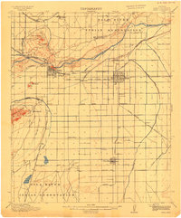
 1914 Phoenix1914 Print · USGSPhoenix and its surrounding valley are documented here at a pivotal moment of irrigation-driven growth before the mid-century boom. Genealogists and historians can locate early landmarks like the State Hospital, Maricopa Village, and numerous rural schoolhouses such as Isaac School and Fowler School.4 unique versions available
 - 1915 Map of Mesa
 1915 Mesa1915 Print · USGSMaricopa County's agricultural heartland was defined by a complex web of gravity-fed water systems before the era of modern expansion. Genealogists and historians can trace early settlements and school districts like Kyrene School, Falfa, and the Arizona State Normal School.2 unique versions available
 - 1915 Map of Maricopa
 1915 Maricopa1915 Print · USGSThe Gila River Valley and its early twentieth-century reservations are captured here as the railroad began to redefine Arizona's desert hubs. Genealogists and historians can trace old stops like Maricopa Wells (Abandoned), the rail junction at Maricopa, and the peaks of the Sierra Estrella.2 unique versions available
 - 1917 Map of Gila Butte
 1917 Gila Butte1917 Print · USGSThe Pinal County desert comes into focus during the early twentieth century as irrigation and rail lines began to reshape the Gila River valley. Genealogists and historians can locate early trading hubs like the North Line Trading Post and tribal landmarks including Snaketown and the Casa Blanca Indian School.2 unique versions available
 - 1923 Map of Signal
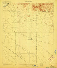
 1923 Signal1923 Print · USGSWestern Arizona in the early twenties was a landscape of isolated mining camps and vital desert springs. Genealogists and historians can trace the footprint of early settlements like Signal and Swansea or locate remote outposts such as Owen and Butler well.
 - 1927 Map of Aguila Mountains
 1927 Aguila Mountains1927 Print · USGSThe desert of Yuma County is captured in the late twenties, showing the region as a wide-open basin organized by early township surveys. Researchers can trace the original path of Yager Road as it cuts across the San Cristobal Valley.2 unique versions available
Showing maps 1-25 of 356
Top cities of Maricopa County
- Phoenix historical maps
- Mesa historical maps
- Chandler historical maps
- Glendale historical maps
- Scottsdale historical maps
- Gilbert historical maps
See more
Frequently asked questions
- What are the different types of historical maps available for Maricopa County?
- What is the oldest map of Maricopa County?
- Where can I purchase historical maps of Maricopa County for my home or office?
- Where can I download high-res historical maps of Maricopa County?
- Are there historical topographic maps available for Maricopa County?
- Is there historical aerial imagery available for Maricopa County?
- Where are historical maps of Maricopa County sourced from?