1940s Maps of Maricopa County, Arizona
Explore 17 historic maps of Maricopa County from the 1940s. These maps offer a rare glimpse into what life looked like during the 1940s — showing old roads, neighborhoods, homes, and landmarks that have changed or disappeared over time.
Whether you're researching your family's past, planning a metal detecting trip, or studying how Maricopa County's landscape evolved across the 1940s, these high-resolution maps are a powerful tool for exploring the history of this region.
- Focus on a specific era: All maps on this page are from the 1940s, giving you a focused view of this time period.
- See what’s changed: Compare century-old streets, trails, and buildings to today's modern landscape using overlays and satellite layers.
- Research with precision: Use these maps for genealogy, historical research, land use analysis, or educational projects.
- View, download, or print: Maps are fully viewable online in high resolution, and can be downloaded or printed for your own records.
Start exploring Maricopa County's history through authentic maps from the 1940s. This is your window into the past.
Maricopa County, AZ maps
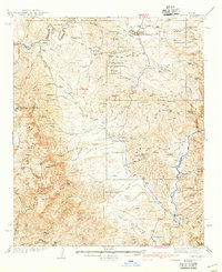
(17)- 1941 Map of Vekol Mountains
 1941 Vekol Mountains1941 Print · USGSMining activity and tribal settlements characterize this desert region in the late 1930s. Genealogists and historians can trace indigenous communities at Sif Vaya and Kohatk alongside early mineral prospects like the Vekol Mine and Reward Mine.
 - 1942 Map of Vekol Mountains
 1942 Vekol Mountains1942 Print · USGSThe high desert of southern Arizona comes into focus during the late 1930s as a hub for mineral exploration and tribal settlement. Miners and genealogists can trace the locations of the Vekol Mine, Copperosity Mine, and the settlement of Sif Vaya.
 - 1942 Map of Signal
 1942 Signal1942 Print · USGSNorthwestern Arizona was a rugged network of mining camps and river crossings during the early years of the war. Researchers can trace the isolated roads connecting Signal, the mines at Bagdad, and the remote desert outposts of Swansea and Alamo.
 - 1942 Map of Payson
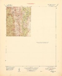
 1942 Payson1942 Print · USGSThe Mazatzal Mountains and Tonto Creek watershed come alive in the mid-1930s, showing a landscape of mining claims and remote ranching. Trace old family names at the Bar T Bar Ranch, find historic Indian Ruins, or locate the Gisela Sch.2 unique versions available
 - 1942 Map of Vicksburg
 1942 Vicksburg1942 Print · USGSWestern Arizona's desert landscape during the early war years is defined here by isolated rail stops and vital water points. Researchers can trace the Atchison Topeka and Santa Fe line through Salome and Vicksburg or locate remote sites like Reids Ranch and the Kofa Mine.
 - 1946 Map of Antelope Peak, 1955 Print
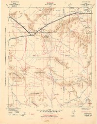
 1946 Antelope Peak1955 Print · USGSThe high desert of Pinal County in the late 1940s is captured here, showing the intersection of tribal lands and the open basin. Researchers can trace early routes like Route 84 past prominent landmarks like Antelope Peak, Table Top, and the watering holes of Hidden Valley.3 unique versions available
 - 1946 Map of Avondale, 1963 Print
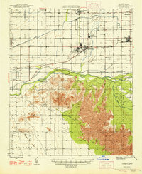
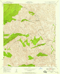
 1946 Avondale1963 Print · USGSIn the postwar Salt River Valley, desert agriculture and military aviation began to reshape the landscape around Coldwater. Researchers can trace the early footprints of Litchfield Park, the U S Naval Air Facility, and rural sites like Liberty Siding.2 unique versions available
 - 1947 Map of Bumblebee, 1955 Print
 1947 Bumblebee1955 Print · USGSArizona's mining heart is on full display in the late 1940s within the rugged Bradshaw Mountains and Prescott National Forest. Genealogists and historians can trace the foundations of Poland and Bumblebee or locate legacy claims like the Thunderbolt Mine and 88 Mine.2 unique versions available
 - 1948 Map of Cashion
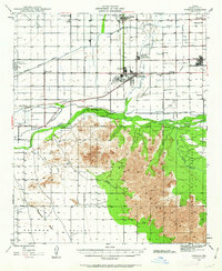
 1948 Cashion1948 Print · USGSMaricopa County's western valley is captured here in the late 1940s as agricultural irrigation and military aviation began to reshape the desert. Researchers can locate early schools and aviation landmarks like Pendergast Sch, the U S Naval Air Facility, and the state's geographic Initial Point.2 unique versions available
 - 1948 Map of Bumblebee
 1948 Bumblebee1948 Print · USGSYavapai County mining camps and ranching outposts are documented in this post-war survey of the Bradshaw Mountains. Researchers can trace the locations of the Thunderbolt Mine, the settlement of Bumblebee, and historic sites like Cordes Cabin and Poland.
 - 1948 Map of Antelope Peak
 1948 Antelope Peak1948 Print · USGSThe high desert south of Phoenix comes alive in the late 1940s, showing the dramatic rise of Antelope Peak and Table Top above the valley floor. Researchers can trace the early borders of the Maricopa Indian Reservation and locate isolated desert Well sites and the winding Vekol Wash.2 unique versions available
 - 1948 Map of Superior, 1953 Print
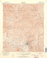 1948 Superior1953 Print · USGSSuperior was a thriving copper mining hub in the late 1940s, anchored by massive industrial works and a specialized rail network. Researchers can trace the legacy of the Magma Copper Co, locate the historic Silver King Mine, and find old stops like Hewitt Sta.3 unique versions available
 - 1948 Map of Iron Mountain, 1957 Print
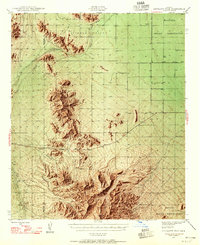
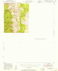
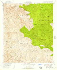 1948 Iron Mountain1957 Print · USGSCentral Arizona's high desert peaks and canyons appear here in the late 1940s as a landscape of remote ranches and ancient sites. Researchers can locate the Reevis Grave, the Cliff Dwellings, and the old mill site at Rogers Troughs (Old Mill).5 unique versions available
 - 1948 Map of Haunted Canyon, 1958 Print
 1948 Haunted Canyon1958 Print · USGSThe Tonto National Forest backcountry is mapped here in the late 1940s, documenting a landscape of remote cattle ranges and named springs. Researchers can locate isolated homesteads like Miles Ranch and trace the rugged drainages of Haunted Canyon and Powers Gulch.4 unique versions available
 - 1949 Map of Iron Mountain
 1949 Iron Mountain1949 Print · USGSThe Pinal and Maricopa county lines meet in this high desert landscape during the late 1940s, where cattle ranching and ancient history intersect. Researchers can locate remote sites like the Cliff Dwellings, Reevis Ranch, and the Reevis Grave.2 unique versions available
 - 1949 Map of Haunted Canyon
 1949 Haunted Canyon1949 Print · USGSThe Arizona high country in the late 1940s reveals a network of remote ranching outposts and vital desert springs. Local historians can trace early land use at Miles Ranch and Tony Ranch or locate named water sources like Mowing Machine Spr and Case Knife Spr.2 unique versions available
 - 1949 Map of Sentinel, 1961 Print
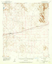 1949 Sentinel1961 Print · USGSDesert outposts and railroad stops define this Maricopa County corridor shortly after the war. Local historians can trace the path of the Southern Pacific rail line through Sentinel, Tartron, and the Ajo Gila Bend Military Reservation.2 unique versions available
End of results
Showing maps 1-17 of 17
Top cities of Maricopa County
- Phoenix historical maps
- Mesa historical maps
- Chandler historical maps
- Glendale historical maps
- Scottsdale historical maps
- Gilbert historical maps
See more
Frequently asked questions
- What are the different types of historical maps available for Maricopa County?
- What is the oldest map of Maricopa County?
- Where can I purchase historical maps of Maricopa County for my home or office?
- Where can I download high-res historical maps of Maricopa County?
- Are there historical topographic maps available for Maricopa County?
- Is there historical aerial imagery available for Maricopa County?
- Where are historical maps of Maricopa County sourced from?