1980s Maps of Maricopa County, Arizona
Explore 49 historic maps of Maricopa County from the 1980s. These maps offer a rare glimpse into what life looked like during the 1980s — showing old roads, neighborhoods, homes, and landmarks that have changed or disappeared over time.
Whether you're researching your family's past, planning a metal detecting trip, or studying how Maricopa County's landscape evolved across the 1980s, these high-resolution maps are a powerful tool for exploring the history of this region.
- Focus on a specific era: All maps on this page are from the 1980s, giving you a focused view of this time period.
- See what’s changed: Compare century-old streets, trails, and buildings to today's modern landscape using overlays and satellite layers.
- Research with precision: Use these maps for genealogy, historical research, land use analysis, or educational projects.
- View, download, or print: Maps are fully viewable online in high resolution, and can be downloaded or printed for your own records.
Start exploring Maricopa County's history through authentic maps from the 1980s. This is your window into the past.
Maricopa County, AZ maps
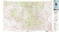
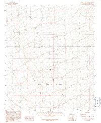
(49)- 1980 Map of Dateland, 1996 Print
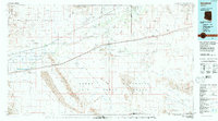 1980 Dateland1996 Print · USGSThe Yuma County desert during the late twentieth century is defined by the vital transit corridor along the Gila River. Researchers can trace the Southern Pacific rail line through remote stops like Sentinel and Aztec or locate the Sheep Mine in the rugged backcountry.
 - 1981 Map of Antelope Peak
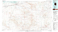
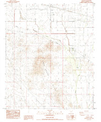
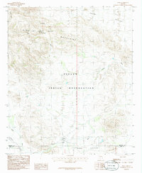
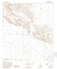
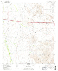 1981 Antelope Peak1981 Print · USGSThe Arizona desert at the start of the 1980s reveals a landscape of high peaks and vast drainage basins along the Maricopa and Pinal county lines. Trace local landmarks like the Hidden Valley Interchange, the heights of Antelope Peak, and an old Corral in the Vekol Valley.2 unique versions available
 - 1981 Map of Phoenix South
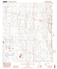
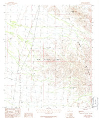
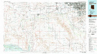 1981 Phoenix South1981 Print · USGSThe desert south of Phoenix in the early eighties shows a unique mix of tribal lands, military outposts, and agricultural growth. Genealogists and historians can trace settlements like Ak Chin and Valencia or locate the Buckeye Copper Mine and Luke Aux Field No 6.2 unique versions available
 - 1981 Map of Payson
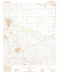
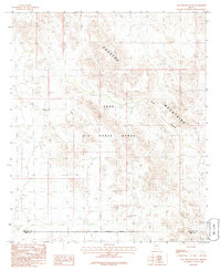
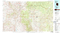 1981 Payson1981 Print · USGSCentral Arizona's mountain country comes into focus in the early eighties, centered on the growing town of Payson. Trace the mining history at Gowan Mine, find old forest outposts like Kohls Ranch, and see the rugged Mogollon Rim terrain.2 unique versions available
 - 1981 Map of Little Table Top
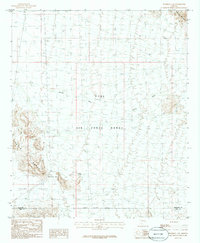
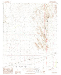
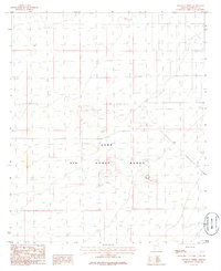
 1981 Little Table Top1981 Print · USGSThe Papago Indian Reservation and the Vekol Valley are captured here in the early 1980s, showcasing the high desert of Pinal and Maricopa counties. Researchers can trace remote desert outposts and water sources like South Vekol Well, Black Mountain Well, and the seasonal Vekol Wash.
 - 1981 Map of Haley Hills
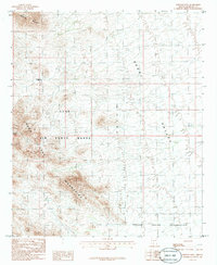
 1981 Haley Hills1981 Print · USGSThe desert landscape of the Pinal and Maricopa county line is captured here in the early eighties. Researchers can trace land use through isolated sites like Poverty Flat Tank, the prominent Papago Butte, and the course of Vekol Wash.
 - 1981 Map of Copperosity Hills
 1981 Copperosity Hills1981 Print · USGSThe Papago Indian Reservation comes into focus during the early eighties, showing a landscape defined by desert mining and ancient habitation. Researchers can trace the heritage of the Kohatk village or locate historic workings like the Vekol Mine and Copperosity Mine.
 - 1981 Map of Bradshaw Mts, 1996 Print
 1981 Bradshaw Mts1996 Print · USGSYavapai County during the early 1980s reveals a high-desert landscape shaped by mining camps and the winding Atchison Topeka and Santa Fe railroad. Researchers can trace historic industrial sites like the Crown King Mine and remote settlements such as Bumble Bee and Cleator.2 unique versions available
 - 1981 Map of Gila Bend, 1996 Print
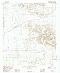
 1981 Gila Bend1996 Print · USGSSouthern Arizona in the early eighties reveals a vast desert corridor shaped by military ranges, indigenous lands, and historical mining. Genealogists and historians can trace rail-side settlements like Theba and Piedra or locate the historic Vekol Mine and Reward Mine.
 - 1982 Map of Ajo
 1982 Ajo1982 Print · USGSThe Arizona-Sonora borderlands come into focus in the early eighties, showcasing a landscape of desert mining towns and expansive tribal lands. Trace the Southern Pacific rail line through Gila Bend or explore the remote settlements of Ajo and Lukeville.
 - 1984 Map of Wintersburg
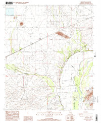
 1984 Wintersburg1984 Print · USGSMaricopa County's western desert landscape in the mid-1980s reveals a unique mix of high-tech energy production and remote rural life. Genealogists and historians can trace the footprint of Wintersburg and the Ruth Fisher Sch alongside the massive Palo Verde Nuclear Generating Station.2 unique versions available
 - 1984 Map of Gillespie
 1984 Gillespie1984 Print · USGSMaricopa County's arid basin and rail corridors are captured in the mid-1980s, showcasing a landscape of isolated outposts and high-desert infrastructure. Researchers can trace the Southern Pacific tracks past Gillespie and find historic sites like Crag (Site) and the Butte Mine.
 - 1984 Map of Tonopah
 1984 Tonopah1984 Print · USGSMaricopa County's high desert reveals its 1980s development as the community of Tonopah began to expand. Genealogists and researchers can trace local landmarks like the Winters Wells (Site) and the course of the Salome Highway.
 - 1984 Map of Arlington
 1984 Arlington1984 Print · USGSThe Gila Valley in the early eighties shows a landscape shaped by irrigation and rail. Genealogists can trace family footprints near Arlington Sch or the Hassayampa Cotton Gin, while historians can map the Southern Pacific through Arlington Station.2 unique versions available
 - 1984 Map of Salome
 1984 Salome1984 Print · USGSWestern Arizona's desert valleys and mining districts are surveyed here during the mid-eighties, centered on the railroad corridor through the McMullen Valley. Researchers can trace the rail towns of Salome and Wenden or locate historical mineral sites like the Bonanza Mine and Hercules Mine.
 - 1986 Map of Deadman Gap
 1986 Deadman Gap1986 Print · USGSThe high desert south of Gila Bend is documented here in the mid-1980s, showcasing a landscape defined by military use and volcanic geology. Researchers can trace remote desert routes like 4WD tracks past Deadman Gap and the arid reaches of Midway Wash.
 - 1986 Map of Kaka
 1986 Kaka1986 Print · USGSThe settlement of Kaka and its surrounding desert valleys are captured in the mid-1980s when military airspace and tribal land intersected. Genealogists and historians can locate the Kaka community and nearby Cem, or trace the seasonal flow of Kohatk Wash.
 - 1986 Map of Midway
 1986 Midway1986 Print · USGSMaricopa County's arid interior is captured here in the mid-1980s during a period of continued military use of the desert landscape. Researchers can trace the boundaries of the Luke Air Force Range, locate the small settlement of Midway, and identify landmarks like Lookout Mountain.
 - 1986 Map of Hat Mountain SW
 1986 Hat Mountain SW1986 Print · USGSThe Arizona desert interior is shown here in the mid-1980s, centered on the high peaks of the Sauceda Mountains. Researchers can trace the Military Reservation Boundary and the restricted landscape of the Luke Air Force Range.
 - 1986 Map of Sentinel NE
 1986 Sentinel NE1986 Print · USGSMaricopa County's arid frontier is captured in the 1980s as a landscape defined by desert ranges and vital rail infrastructure. Trace the Southern Pacific line through Quito or locate old mining sites like the Mine Shaft in Wild Horse Canyon.
 - 1986 Map of Midway SW
 1986 Midway SW1986 Print · USGSMaricopa County during the mid-eighties shows a vast intersection of military operations and protected desert. Researchers can trace land use through the Luke Air Force Range and the Cabeza Prieta National Wildlife Refuge near Midway Wash.
 - 1986 Map of South of Theba
 1986 South of Theba1986 Print · USGSThe Arizona desert south of the Gila River served as a critical training ground for pilots in the mid-eighties. Military historians and aviation enthusiasts can trace the layout of the Luke Air Force Range and identify remote Landing Strips across the arid terrain.
 - 1986 Map of Johnson Well
 1986 Johnson Well1986 Print · USGSThe high desert of southern Arizona during the mid-1980s reveals a landscape of rugged peaks and military ranges. Trace old landmarks like Johnson Well and Bender Spring near the borders of the Papago Indian Reservation.
 - 1986 Map of Oatman Mountain
 1986 Oatman Mountain1986 Print · USGSThe Gila River valley south of Montezuma is captured in the mid-1980s, documenting a desert landscape of mountain peaks and river flats. Researchers can locate specific sites of interest including a riverside Grave, the small Cem, and agricultural features like a ditch and Corral.
 - 1986 Map of South of Gila Bend
 1986 South of Gila Bend1986 Print · USGSThe Sonoran desert south of Gila Bend appears here in the mid-1980s, primarily serving as part of a massive military training facility. Local historians and researchers can locate landmarks like the Observation Tower, an isolated Grave, and the winding Quilotosa Wash.
Showing maps 1-25 of 49
Top cities of Maricopa County
- Phoenix historical maps
- Mesa historical maps
- Chandler historical maps
- Glendale historical maps
- Scottsdale historical maps
- Gilbert historical maps
See more
Frequently asked questions
- What are the different types of historical maps available for Maricopa County?
- What is the oldest map of Maricopa County?
- Where can I purchase historical maps of Maricopa County for my home or office?
- Where can I download high-res historical maps of Maricopa County?
- Are there historical topographic maps available for Maricopa County?
- Is there historical aerial imagery available for Maricopa County?
- Where are historical maps of Maricopa County sourced from?