1950s Maps of Maricopa County, Arizona
Explore 73 historic maps of Maricopa County from the 1950s. These maps offer a rare glimpse into what life looked like during the 1950s — showing old roads, neighborhoods, homes, and landmarks that have changed or disappeared over time.
Whether you're researching your family's past, planning a metal detecting trip, or studying how Maricopa County's landscape evolved across the 1950s, these high-resolution maps are a powerful tool for exploring the history of this region.
- Focus on a specific era: All maps on this page are from the 1950s, giving you a focused view of this time period.
- See what’s changed: Compare century-old streets, trails, and buildings to today's modern landscape using overlays and satellite layers.
- Research with precision: Use these maps for genealogy, historical research, land use analysis, or educational projects.
- View, download, or print: Maps are fully viewable online in high resolution, and can be downloaded or printed for your own records.
Start exploring Maricopa County's history through authentic maps from the 1950s. This is your window into the past.
Maricopa County, AZ maps
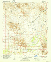
(73)- 1950 Map of Bumblebee
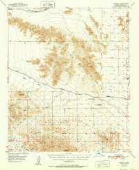
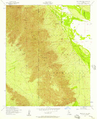
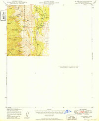 1950 Bumblebee1950 Print · USGSMining operations and remote settlements define this central Arizona landscape during the late nineteen-forties. Researchers can trace the era's mineral wealth through sites like the Thunderbolt Mine and Howard Copper Mine, or locate family landmarks near Bumblebee and Poland.
 - 1950 Map of Sentinel
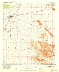
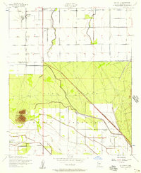
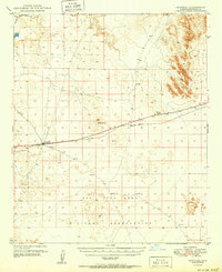 1950 Sentinel1950 Print · USGSMaricopa County's high desert reveals its mid-century transit network and military footprint as the Southern Pacific railroad cuts across the arid basin. Researchers can trace the railroad outposts of Sentinel and Midway Station alongside the Ajo Bend Military Reservation.
 - 1950 Map of Prescott, 1951 Print
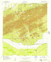
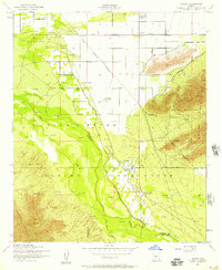
 1950 Prescott1951 Print · USGSArizona's mining and ranching frontiers were in full operation during the early fifties, from the vertical streets of Jerome to the remote western desert. Genealogists and researchers can trace rural life via the Bland School, the United Verde Mine, and stops along the Atchison Topeka and Santa Fe Railway.
 - 1950 Map of Theba, 1955 Print
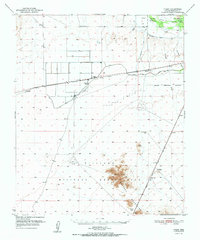
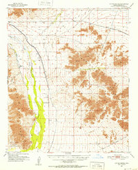
 1950 Theba1955 Print · USGSMaricopa County's arid river lands are captured here in the 1950s, showing the early infrastructure of the Gillespie Ranch and the Gila Bend Indian Res. Researchers can locate rural landmarks like Theba, the Southern Pacific railroad sidings at Smurr, and the desert peaks of the White Hills.
 - 1950 Map of Aztec, 1960 Print
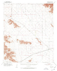
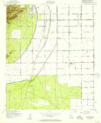
 1950 Aztec1960 Print · USGSThe Gila River valley at the mid-century reveals a landscape of desert irrigation and rail outposts along the Southern Pacific line. Researchers can trace the path of the Southern Pacific through Aztec and Stanwix or locate old water sources like Agua Caliente and Baragens Well.
 - 1951 Map of Estrella
 1951 Estrella1951 Print · USGSMaricopa County's desert backcountry is captured here during the early 1950s, showing a landscape of isolated rail stops and vast mountain ranges. Researchers can trace early water sources and settlements like Estrella, Freeman, and the A Ky Ranch.
 - 1951 Map of Gila Bend
 1951 Gila Bend1951 Print · USGSGila Bend and the surrounding Sonoran Desert are documented here in the early fifties during a period of mid-century aviation and rail expansion. Researchers can locate the Gila Bend Indian Reservation, the Southern Pacific rail line, and remote landmarks like Jack in the Pulpit.3 unique versions available
 - 1951 Map of Theba
 1951 Theba1951 Print · USGSMaricopa County's arid river valley and rail corridor are captured here in the mid-century, showing the irrigation-driven growth around Theba and Gillespie Ranch. Researchers can trace the Southern Pacific line through sidings at Smurr and Piedra, or locate the Gila Bend Indian Res.2 unique versions available
 - 1951 Map of Mobile
 1951 Mobile1951 Print · USGSRainbow Valley and the surrounding desert peaks are captured here in the early 1950s, showing a landscape shaped by rail and stage routes. You can trace the historic Butterfield Stage Line and locate small rail sidings like Mobile and Estrella.3 unique versions available
 - 1951 Map of Dendora Valley, 1952 Print
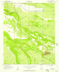
 1951 Dendora Valley1952 Print · USGSThe desert frontier of central Arizona is captured here during the early fifties, documenting the remote reaches of the Gila River. Genealogists and historians can trace the Oatman Grave at Oatman Flat, the Rawley Mine, and old ranch sites like Dendora Ranch.3 unique versions available
 - 1951 Map of Cotton Center, 1952 Print
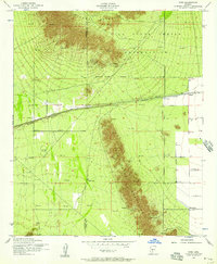
 1951 Cotton Center1952 Print · USGSMaricopa County's desert ranching and irrigation systems are captured here in the early fifties, showing the vital role of the Gila River. Researchers can trace the historic Butterfield Stage Route and explore the agricultural layouts of Cotton Center and the Enterprise Ranch.2 unique versions available
 - 1951 Map of Woolsey Peak, 1952 Print
 1951 Woolsey Peak1952 Print · USGSCentral Arizona desert ranching and irrigation are captured here in the early fifties. Researchers can trace the Gila River to find Gillespie Dam, the Buckeye Copper Mine, and Petroglyphs near the Warford Ranch.3 unique versions available
 - 1952 Map of Tempe, 1957 Print
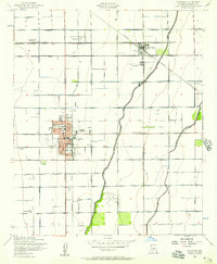
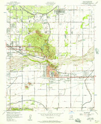 1952 Tempe1957 Print · USGSGreater Phoenix in the early fifties showcases a landscape defined by expansive irrigation canals and the rising campus of Arizona State College at Tempe. Genealogists and historians can trace the early borders of Scottsdale, the remote Tempe Airport, and the family plots within Guadalupe Cemetery.7 unique versions available
 - 1952 Map of Chandler, 1957 Print
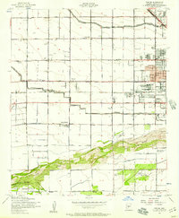
 1952 Chandler1957 Print · USGSCentral Arizona's agricultural heartland is captured here in the early fifties as irrigation and rail networks drove the expansion of the Salt River Valley. Researchers can trace the development of Chandler and Gilbert alongside smaller vanished stops like Falfa and the Water Users Camp 10.5 unique versions available
 - 1952 Map of Gila Butte NW, 1957 Print
 1952 Gila Butte NW1957 Print · USGSThe Gila River valley in the early fifties shows a landscape balancing desert geography with growing military and tribal infrastructure. Genealogists can locate residents near Snaketown, the St Francis Borgia Ch, and the Goodyear Air Force Auxiliary Airfield.3 unique versions available
 - 1952 Map of Lone Butte, 1957 Print
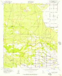
 1952 Lone Butte1957 Print · USGSThe South Mountains meet the Gila River Indian Reservation in the early fifties, showing a desert landscape during a period of institutional growth. Trace the development of the Phoenix Proving Grounds, locate the Phoenix Police Academy, and find the isolated Lone Butte.5 unique versions available
 - 1952 Map of Mesa, 1957 Print
 1952 Mesa1957 Print · USGSMid-century Mesa and the surrounding Salt River Valley are seen here during a period of agricultural productivity and steady growth. Researchers can trace the extensive irrigation network of the Consolidated Canal and locate neighborhood landmarks like the LDS Temple and Taylor Field.5 unique versions available
 - 1952 Map of Gila Butte, 1957 Print
 1952 Gila Butte1957 Print · USGSThe Pinal County desert landscape in the early fifties shows a transition from railway outposts to established reservation communities. Genealogists and historians can trace community roots at St Peters Mission Sch, the Goodyear Cem, and through settlements like Bapchule and Santan.4 unique versions available
 - 1952 Map of Laveen, 1957 Print
 1952 Laveen1957 Print · USGSThe Gila River Valley south of Phoenix comes to life in the early fifties, showing the desert as a patchwork of reservation lands and irrigation projects. Genealogists can locate specific homesteads near Komatke, the St Johns Indian Sch, and the riverside site of Gila Crossing.5 unique versions available
 - 1952 Map of Guadalupe, 1957 Print
 1952 Guadalupe1957 Print · USGSThe Salt River Valley's agricultural and industrial growth is captured here in the early fifties. Genealogists and historians can trace old settlements like Guadalupe and West Chandler alongside the Kyrene Steam Generating Plant and Southern Pacific rail line.6 unique versions available
 - 1952 Map of Pima Butte, 1957 Print
 1952 Pima Butte1957 Print · USGSThe Gila River valley south of Phoenix appears here in the early fifties, showing the desert landscape before modern urbanization. Genealogists and historians can trace the irrigation networks of the Hoover Ditch and the terrain surrounding Pima Butte and Lone Butte Ranch.3 unique versions available
 - 1952 Map of Phoenix, 1957 Print
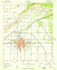
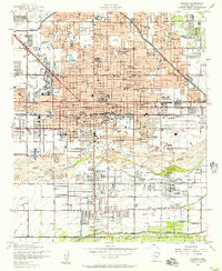 1952 Phoenix1957 Print · USGSPhoenix thrives in the early fifties as post-war growth transforms the Salt River Valley. Researchers can trace mid-century landmarks from Phoenix Municipal Airport to the historic Greenwood Cem and Encanto Park & Golf Course.5 unique versions available
 - 1952 Map of Montezuma Peak, 1957 Print
 1952 Montezuma Peak1957 Print · USGSThe Sierra Estrella range and Gila River Indian Reservation are captured here in the early fifties before modern expansion. Historians and genealogists can trace early landmarks like St Catherines Ch, the Crushed Mica Quarry, and the Santa Cruz settlement along the Santa Cruz Wash.3 unique versions available
 - 1952 Map of Fowler, 1957 Print
 1952 Fowler1957 Print · USGSThe western periphery of Phoenix was undergoing a major transition from desert ranching to irrigated farmland and industrial utility in the early fifties. Researchers can find numerous schools and cemeteries like Murphy Sch No 2, Work Circle Cem, and the specialized Valley of the Sun School.6 unique versions available
 - 1952 Map of Enid, 1957 Print
 1952 Enid1957 Print · USGSThe Pinal County desert comes into focus in the early 1950s, showing the intersection of tribal lands and railroad expansion. Researchers can trace the rail stops at Enid and Heaton or locate historical sites like Wiley Ranch and a Race Track (Aban'd).3 unique versions available
Showing maps 1-25 of 73
Top cities of Maricopa County
- Phoenix historical maps
- Mesa historical maps
- Chandler historical maps
- Glendale historical maps
- Scottsdale historical maps
- Gilbert historical maps
See more
Frequently asked questions
- What are the different types of historical maps available for Maricopa County?
- What is the oldest map of Maricopa County?
- Where can I purchase historical maps of Maricopa County for my home or office?
- Where can I download high-res historical maps of Maricopa County?
- Are there historical topographic maps available for Maricopa County?
- Is there historical aerial imagery available for Maricopa County?
- Where are historical maps of Maricopa County sourced from?