2000s (21st Century) Maps of Maricopa County, Arizona
Explore 778 historic maps of Maricopa County from the 2000s (21st Century). These maps offer a rare glimpse into what life looked like during the 2000s — showing old roads, neighborhoods, homes, and landmarks that have changed or disappeared over time.
Whether you're researching your family's past, planning a metal detecting trip, or studying how Maricopa County's landscape evolved across the 2000s, these high-resolution maps are a powerful tool for exploring the history of this region.
- Focus on a specific era: All maps on this page are from the 2000s, giving you a focused view of this time period.
- See what’s changed: Compare century-old streets, trails, and buildings to today's modern landscape using overlays and satellite layers.
- Research with precision: Use these maps for genealogy, historical research, land use analysis, or educational projects.
- View, download, or print: Maps are fully viewable online in high resolution, and can be downloaded or printed for your own records.
Start exploring Maricopa County's history through authentic maps from the 2000s. This is your window into the past.
Maricopa County, AZ maps
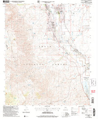
(778)- 2004 Map of Daisy Mountain, 2006 Print
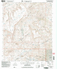
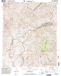
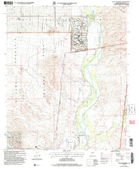
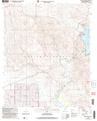
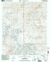 2004 Daisy Mountain2006 Print · USGSMaricopa County's northern desert frontier is captured here at a moment of rapid change in the early 2000s. Researchers can trace the legacy of mining and ranching through landmarks like the Daisy Mine and King Well alongside newer developments near Gavilan Peak.
 - 2004 Map of Table Mountain, 2006 Print
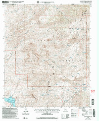
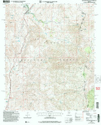
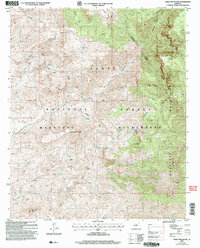 2004 Table Mountain2006 Print · USGSThe high Mazatzal range in central Arizona is captured here as it appeared in the early 2000s, showing a landscape preserved for its wild character. Hikers and historians can trace the paths of the Mazatzal Trail and Deadman Trail past remote sites like Table Mountain.
 - 2004 Map of Cooks Mesa, 2006 Print
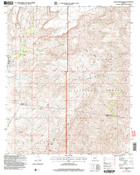
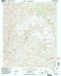 2004 Cooks Mesa2006 Print · USGSThe arid canyons of the Arizona backcountry are captured here in the mid-2000s, showing a landscape defined by water and terrain. Traces of ranching life and mining prospects appear alongside Upper Ranch, Tin Trough Spring, and Six Bar Hole.
 - 2004 Map of Rover Peak, 2006 Print
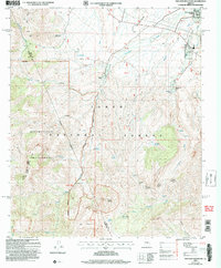
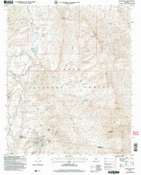 2004 Rover Peak2006 Print · USGSYavapai and Maricopa County ranchlands and mining claims are surveyed here in the early 2000s. Genealogists and historians can trace old homesteads at Holmes and the 51 Ranch, or locate the historic Red Rover Mine and the archaeological site at Indian Ruin Tank.
 - 2004 Map of New River Mesa, 2006 Print
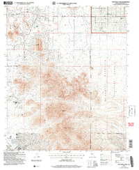
 2004 New River Mesa2006 Print · USGSThe high mesas of Maricopa County are shown here in the early 2000s, documenting a landscape of mining claims and forest land. Trace the history of desert prospecting at the Phoenix Mine or follow old routes like the Skunk Cave Trail past Elephant Mountain.
 - 2004 Map of Horseshoe Dam, 2006 Print
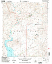
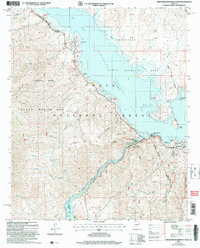
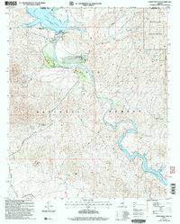 2004 Horseshoe Dam2006 Print · USGSThe Verde River canyon at the Yavapai and Maricopa county line is shown here in the early 2000s, defined by its massive reservoirs and remote wilderness. Researchers can locate ranching history at K A Ranch, recreation at the Ocotillo Boating Site, and backcountry routes like the Davenport Trail.
 - 2004 Map of Lion Mountain, 2006 Print
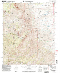
 2004 Lion Mountain2006 Print · USGSThe Mazatzal Mountains and Tonto National Forest appear here during the early 2000s, showing a rugged landscape of springs and old mining claims. Genealogists and historians can trace remote sites like the S B Cabin, the Story Mine, and the waters of Bartlett Reservoir.
 - 2004 Map of Squaw Creek Mesa, 2006 Print
 2004 Squaw Creek Mesa2006 Print · USGSYavapai and Maricopa counties meet here in the early 2000s, where high mesa terrain falls away toward the desert floor. Researchers can trace remote mining history at the Orizaba Mine or locate historic water sites like China Corral Spring and Woody Tank.
 - 2004 Map of Reno Pass, 2006 Print
 2004 Reno Pass2006 Print · USGSThe rugged high country of the Mazatzal range comes into focus at the turn of the century. Trace mining claims like the Ord Mine and remote outposts such as Cross F Ranch or the Sunflower Work Center.
 - 2004 Map of Chalk Mountain, 2006 Print
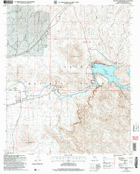
 2004 Chalk Mountain2006 Print · USGSThe Verde River corridor in central Arizona is captured here as it appeared in the early 2000s. Researchers can trace historic ranching sites like the HK Ranch and the landmark Sheep Bridge over the Verde River.
 - 2004 Map of Humboldt Mountain, 2006 Print
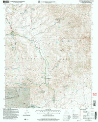 2004 Humboldt Mountain2006 Print · USGSMaricopa County's rugged backcountry is shown at the turn of the millennium, detailing a landscape where historical ranching and modern recreation intersect. Researchers can trace the footprints of Cartwright Ranch, find the Lookout Tower atop Humboldt Mountain, and locate springs like Seven Springs.
 - 2004 Map of Granite Reef Dam, 2007 Print
 2004 Granite Reef Dam2007 Print · USGSThe confluence of the Salt and Verde rivers is documented here in the early 2000s, showing a landscape defined by water engineering and tribal lands. Trace the path of the Arizona Canal from the Granite Reef Dam or locate the Jim Hart Memorial Monument.
 - 2004 Map of Iron Mountain, 2007 Print
 2004 Iron Mountain2007 Print · USGSThe Superstition Wilderness comes into sharp focus during the early 2000s, showing a rugged interior known for its ranching and mining heritage. Trace the historic Reavis Trail past remote outposts like J F Headquarters and the Silver Spur Cabin.
 - 2004 Map of Fort McDowell, 2007 Print
 2004 Fort McDowell2007 Print · USGSMaricopa County's desert river valley is captured here in the early 2000s as suburban expansion met tribal and protected lands. Trace the Verde River through the Fort McDowell Indian Reservation Boundary past Rio Verde Estates and the historic Fort McDowell Site.
 - 2004 Map of Theodore Roosevelt Dam, 2007 Print
 2004 Theodore Roosevelt Dam2007 Print · USGSGila County's massive reservoir and utility works are captured here in the early 2000s, showcasing the intersection of federal land management and desert recreation. Researchers can locate specific facilities like the Tonto Basin Ranger Station, the settlement of Roosevelt, and the rugged path of the Arizona Trail.
 - 2004 Map of Haunted Canyon, 2007 Print
 2004 Haunted Canyon2007 Print · USGSThe eastern Superstitions at the turn of the millennium remain a land of remote ranching and rugged canyons. Genealogists and historians can trace the footprints of Miles Ranch and Tony Ranch or locate old water sources like Fifty Dollar Spring.
 - 2004 Map of Mazatzal Peak, 2007 Print
 2004 Mazatzal Peak2007 Print · USGSThe Arizona high country at the turn of the millennium is revealed in this study of the Mazatzal Mountains and the surrounding wilderness. Trace the routes of the Mazatzal Divide Trail and find the remote Chilson Camp or Gowan Camp.
 - 2004 Map of Weavers Needle, 2007 Print
 2004 Weavers Needle2007 Print · USGSThe Superstition Wilderness area is shown here in the early 2000s, detailing a high-desert landscape of peaks and springs. Researchers can locate remote landmarks like the Quarter Circle U Ranch or trace the geography of Weavers Needle and Miners Needle.
 - 2004 Map of Stewart Mountain, 2007 Print
 2004 Stewart Mountain2007 Print · USGSMaricopa County's river-driven landscape is captured here during the early 2000s, showing the intersection of water management and desert recreation. Trace the infrastructure of Saguaro Lake at the Stewart Mountain Dam or locate the historic settlement of Goldfield.
 - 2004 Map of Buckhorn, 2007 Print
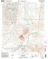
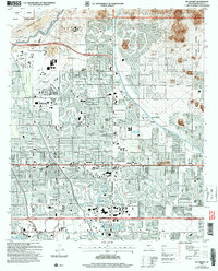 2004 Buckhorn2007 Print · USGSMaricopa County is captured here during the mid-2000s as suburban development filled the valley between the Salt River and the Superstition Mountains. Researchers can trace the expansion of Mesa and Gilbert, and locate landmarks like Buckhorn and the Mountain View Cem.
 - 2004 Map of Bartlett Dam, 2007 Print
 2004 Bartlett Dam2007 Print · USGSThe Verde River corridor and Bartlett Reservoir are captured here in the early twenty-first century as they wind through the Tonto National Forest. Researchers can locate specific access points like the Jojoba Boating Site, the settlement at Riverside, and the landmark Needle Rock.
 - 2004 Map of Two Bar Mountain, 2007 Print
 2004 Two Bar Mountain2007 Print · USGSGila County ranching and wilderness are captured in the early 2000s as development nears Roosevelt Lake. Trace the footprint of cattle operations and remote outposts like Black Brush Headquarters, Cross P Ranch, and the Roosevelt Post Office.
 - 2004 Map of McDowell Peak, 2007 Print
 2004 McDowell Peak2007 Print · USGSThe McDowell Mountains and Scottsdale foothills are captured here during a period of rapid development and recreational expansion. You can trace the proximity of newer sites like the Arabian Library to older landmarks such as Dixie Mine and Reata Pass.
 - 2004 Map of Tonto Basin, 2007 Print
 2004 Tonto Basin2007 Print · USGSTonto Basin and the slopes of the Mazatzal Mountains are captured in this early 21st-century survey of Gila County. Genealogists and historians can trace local life around Punkin Center and residential clusters near the waters of Theodore Roosevelt Lake.
 - 2004 Map of Boulder Mountain, 2007 Print
 2004 Boulder Mountain2007 Print · USGSMaricopa and Gila counties are shown here as they appeared in the early 2000s, centered on the high ranching and mining country of the Tonto National Forest. Researchers can trace the layout of the Diamond Ranch or locate historic mineral sites like the Jolene Mine and El Oso Mine.
Showing maps 1-25 of 778
Top cities of Maricopa County
- Phoenix historical maps
- Mesa historical maps
- Chandler historical maps
- Glendale historical maps
- Scottsdale historical maps
- Gilbert historical maps
See more
Frequently asked questions
- What are the different types of historical maps available for Maricopa County?
- What is the oldest map of Maricopa County?
- Where can I purchase historical maps of Maricopa County for my home or office?
- Where can I download high-res historical maps of Maricopa County?
- Are there historical topographic maps available for Maricopa County?
- Is there historical aerial imagery available for Maricopa County?
- Where are historical maps of Maricopa County sourced from?