Old Maps of Calhoun County, Arkansas for Genealogy
Trace your family roots with 136 historic maps of Calhoun County. These high-res maps reveal old neighborhoods, homesites, landmarks, and streets — helping you uncover where your ancestors lived and how the area evolved over time.
- Explore historic neighborhoods: Identify where your relatives may have lived in the 1800s or 1900s.
- Compare maps over time: Trace the changes in streets, buildings, and landmarks for multi-generational research.
- Perfect for genealogy & ancestry research: Used by family historians and researchers to map out lineage and migration.
These maps are an incredible resource for exploring your personal connection to Calhoun County's past.
Calhoun County, AR maps
(136)- 1903 Map of Camden
 1903 Camden1903 Print · USGSSouth Arkansas at the turn of the century reveals a landscape of river-bend commerce and emerging rail towns along the Ouachita River. Trace family roots in early settlements like Holly Springs, Bearden, and the industrial hub at Eagle Mills.3 unique versions available
 - 1934 Map of Moro Bay, 1960 Print
 1934 Moro Bay1960 Print · USGSSouthern Arkansas at the height of the river-and-rail era is captured here, showing the intricate wetlands of the Ouachita valley. Researchers can locate old riverside hubs like Moro Bay, the tracks of the Chicago Rock Island and Pacific, and rural landmarks like Faustina Ch.
 - 1938 Map of Moro Bay
 1938 Moro Bay1938 Print · USGSThe riverbottoms of the Ouachita and the timberlands of South Arkansas are captured here in the mid-1930s. Genealogists can locate family sites near Jersey Sch and Union Grove Ch, or trace old river traffic at Wilmington Landing.2 unique versions available
 - 1939 Map of Moro Bay, 1941 Print
 1939 Moro Bay1941 Print · USGSSouthern Arkansas was a land of river landings and remote timber camps in the late 1930s. Genealogists and local historians can trace the foundations of communities at Artesian and Moro Bay, or locate rural landmarks like Union Grove Ch and Beulah Springs Sch.2 unique versions available
 - 1951 Map of Camden
 1951 Camden1951 Print · USGSCamden and its industrial neighbors Cullendale and Fairview are captured here in the early 1950s as rail and river travel shaped south Arkansas. Researchers can trace local genealogy through Greenwood Cem or locate community hubs like Lincoln High Sch and the Bradley Ferry (Aband).2 unique versions available
 - 1953 Map of El Dorado, 1967 Print
 1953 El Dorado1967 Print · USGSSouth Arkansas in the mid-1960s was a landscape of industrial growth and river-fed commerce. Researchers can trace the extensive Oil and Gas Fields around Magnolia, the expansive U S Naval Ammunition Depot, and the busy rail lines of the Missouri Pacific.3 unique versions available
 - 1957 Map of El Dorado
 1957 El Dorado1957 Print · USGSSouth Arkansas in the mid-1950s was a critical hub of military logistics and rail-river commerce. Genealogists and historians can trace family land across the Arkansas Louisiana border and locate sites like the U.S. Naval Ammunition Depot or the rail junctions at Magnolia and Camden.
 - 1958 Map of El Dorado
 1958 El Dorado1958 Print · USGSSouthern Arkansas and the Louisiana borderlands are shown during a period of heavy rail traffic and defense industry activity. Researchers can trace the legacy of the U. S. Naval Ammunition Depot or locate family roots in Smackover, Huttig, and Nashville.3 unique versions available
 - 1960 Map of El Dorado
 1960 El Dorado1960 Print · USGSSouth Central Arkansas in the late fifties was a hub of energy production and defense industry. Researchers can trace the extensive Oil and Gas Fields around El Dorado or locate family landmarks like Old Park Cem and New Hope Church.
 - 1962 Map of Louann, 1963 Print
 1962 Louann1963 Print · USGSSouth Arkansas at the peak of the mid-century energy boom reveals a landscape shaped by the Smackover Oil and Gas Field. Researchers can trace old family sites and rail stops including Louann, Kirkland, and the Old Liberty Cem.3 unique versions available
 - 1962 Map of Smackover NE, 1963 Print
 1962 Smackover NE1963 Print · USGSThe river bottoms and timberlands of south-central Arkansas are captured here in the early sixties, just as the landscape was mapped via modern aerial photography. Genealogists and historians can trace family roots through several remote burial sites and churches, including St Paul Cem, Pickett Cem, and China Grove Ch.3 unique versions available
 - 1962 Map of Calion, 1963 Print
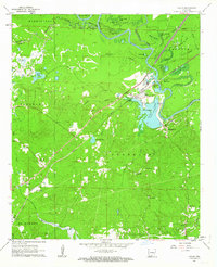 1962 Calion1963 Print · USGSUnion County during the early 1960s shows a landscape defined by the winding Ouachita River and a growing petroleum industry. Researchers can trace rural church history at Bethel Ch or explore the rail corridor of the Chicago Rock Island and Pacific.2 unique versions available
 - 1962 Map of Snow Hill, 1963 Print
 1962 Snow Hill1963 Print · USGSThe Ouachita River valley in the early 1960s reveals a mix of bottomland oxbows and industrial energy. Researchers can trace the development of the Smackover Oil and Gas Field and find landmarks like Snow Hill and the Indian Mound.3 unique versions available
 - 1964 Map of Smackover
 1964 Smackover1964 Print · USGSSouthern Arkansas in the mid-sixties was a landscape defined by the booming petroleum industry and the winding path of the Ouachita River. Genealogists and historians can locate rural landmarks like St Paul Ch, Beech Springs Camp, and the busy Smackover Oil & Gas Field.2 unique versions available
 - 1964 Map of Louann
 1964 Louann1964 Print · USGSThe oil fields and river landings of southern Arkansas are captured here in the mid-1960s. Genealogists can locate family landmarks like Silver Hill Ch, Pleasant Ridge Cem, and the riverfront at Frenchport Landing.2 unique versions available
 - 1966 Map of Kingsland, 1967 Print
 1966 Kingsland1967 Print · USGSKingsland and its surrounding timberlands are captured in the mid-1960s, a period when the river-and-rail economy still shaped south-central Arkansas. Researchers can trace family roots through several local landmarks like Kingsland Cemetery, Smith Church, and Morgan Cemetery.2 unique versions available
 - 1966 Map of Fordyce, 1967 Print
 1966 Fordyce1967 Print · USGSFordyce and the surrounding Dallas County countryside are captured in the mid-sixties at a peak of rail-based commerce. Researchers can trace family sites at Oakland Cemetery or locate the rural communities of Bucksnort and Thornton.2 unique versions available
 - 1971 Map of Camden, 1973 Print
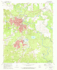 1971 Camden1973 Print · USGSCamden and its riverside suburbs are captured in the early seventies as industrial expansion and timber-hauling railroads defined the local economy. Genealogists can trace family roots at Confederate Cem and Cullendale Cem or locate old neighborhood landmarks like Lincoln High Sch.2 unique versions available
 - 1973 Map of Bearden, 1975 Print
 1973 Bearden1975 Print · USGSBearden and the rural Ouachita County timberlands are caught here during the early seventies, centered on the St Louis Southwestern rail line. Genealogists and local historians can trace old family landmarks like Macedonia Ch, Harlow Cem, and the massive East Camden and Highland Abandoned Ammunition Depot.2 unique versions available
 - 1973 Map of Eagle Mills, 1975 Print
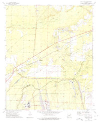 1973 Eagle Mills1975 Print · USGSOuachita and Calhoun counties appear here in the early seventies during a period of institutional transition. Researchers can trace the massive Abandoned Ammunition Depot alongside local landmarks like Evans Cem, Millville, and Eagle Mills.2 unique versions available
 - 1973 Map of East Camden, 1975 Print
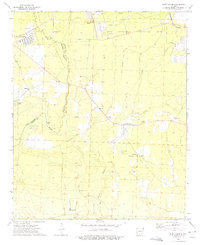 1973 East Camden1975 Print · USGSSouthern Arkansas in the early seventies shows a landscape shaped by military history and the petroleum industry. Researchers can trace rural lineages through Furr Cem and Plunkett Cem or explore the vast ABANDONED AMMUNITION DEPOT.2 unique versions available
 - 1973 Map of Hampton, 1975 Print
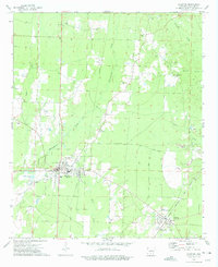 1973 Hampton1975 Print · USGSHampton and the surrounding timberlands of Calhoun County are captured here in the early 1970s as industrial pipelines and gravel extraction shaped the land. Researchers can locate the Rock Island rail line through Harrell and several rural burial sites like Macedonia Cem.2 unique versions available
 - 1973 Map of Woodberry, 1975 Print
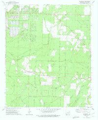 1973 Woodberry1975 Print · USGSCalhoun County's timberlands and military installations are captured here in the early 1970s. Genealogists can locate family landmarks like Dunn Cem and Paulsina Ch or trace the massive grid of the Abandoned Ammunition Depot.2 unique versions available
 - 1973 Map of Hopeville, 1975 Print
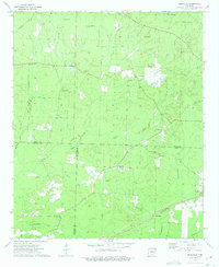 1973 Hopeville1975 Print · USGSThe borderlands of Dallas, Ouachita, and Calhoun counties are captured here in the early seventies, a landscape of rural crossroads and timbered creek bottoms. Genealogists can locate family landmarks like Stevenson Cem, Oak Grove Ch, and the settlement of Hopeville.2 unique versions available
 - 1973 Map of Tinsman, 1975 Print
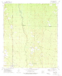 1973 Tinsman1975 Print · USGSThe timberlands and creek bottoms of southern Arkansas come alive in this early 1970s survey of the tri-county borderlands. Researchers can trace the Chicago Rock Island and Pacific rail line and locate landmarks like Williams Cem and the Old Camden Road.2 unique versions available
Showing maps 1-25 of 136
Top cities of Calhoun County
Frequently asked questions
- What are the different types of historical maps available for Calhoun County?
- What is the oldest map of Calhoun County?
- Where can I purchase historical maps of Calhoun County for my home or office?
- Where can I download high-res historical maps of Calhoun County?
- Are there historical topographic maps available for Calhoun County?
- Is there historical aerial imagery available for Calhoun County?
- Where are historical maps of Calhoun County sourced from?