Old Maps of Miller County, Arkansas for Hiking & Exploration
Hike through history with 133 historic maps of Miller County. Explore old trails, ghost towns, and forgotten backroads — perfect for outdoor adventurers and local explorers.
- Rediscover forgotten places: Map out old mining camps, roads, and footpaths that no longer exist on modern maps.
- Layer with modern tools: Combine with LiDAR or satellite views to plan hikes through historical terrain.
- Made for exploration: Popular among hikers, overlanders, and local history lovers.
Use these maps to find adventure and explore the hidden past of Miller County.
Miller County, AR maps
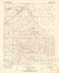
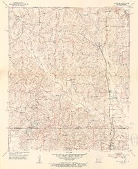
(133)- 1907 Map of Atlanta, 1954 Print
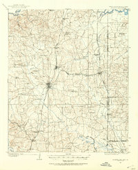 1907 Atlanta1954 Print · USGSNorthwest Louisiana and Northeast Texas meet in this early century survey of the rail-and-timber corridor surrounding Atlanta. Researchers can trace the heritage of rural communities through dozens of local landmarks like Laws Chapel, Pritchard's Gin, and the Cass Lumber Co Sawmill.2 unique versions available
 - 1909 Map of Texarkana
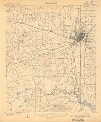 1909 Texarkana1909 Print · USGSTexarkana emerged as a bustling tri-state rail center at the dawn of the twentieth century, defined by its complex web of iron roads and river commerce. Genealogists and local historians can trace family roots at White Chapel, the Stateline Ferry, and rural sites like Alamo Mills.5 unique versions available
 - 1910 Map of Atlanta
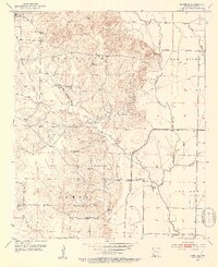
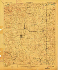 1910 Atlanta1910 Print · USGSNortheast Texas at the height of the timber boom is captured here, showing the intricate network of sawmills and rail lines crossing into Arkansas and Louisiana. Genealogists can locate family landmarks like Laws Chapel, Hosey's Store, and the Henderson Hill School among the many rural settlements.2 unique versions available
 - 1950 Map of Ogden, 1966 Print
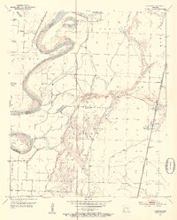
 1950 Ogden1966 Print · USGSThe riverlands of Southwest Arkansas are captured here in the mid-century, where the Red River meanders through a landscape of oxbow lakes and bayous. Researchers can trace the heritage of local communities through named schools and churches like Rosenwald Sch, Summer Hill Ch, and the settlement of Ogden.4 unique versions available
 - 1951 Map of Ogden
 1951 Ogden1951 Print · USGSThe Red River borderlands of Arkansas and Texas come alive in this mid-century survey, showcasing a landscape of shifting oxbows and rural crossings. Researchers can trace local heritage through the Rosenwald Sch, St Johns Ch, and the rail stop at Ogden.2 unique versions available
 - 1951 Map of Homan, 1952 Print
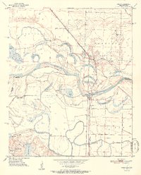
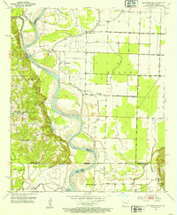
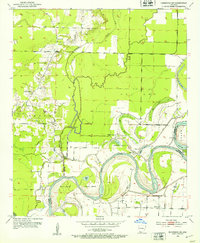
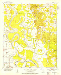
 1951 Homan1952 Print · USGSThe Red River lowlands of Miller County are captured here in the early fifties, showing a landscape shaped by water and rail. Genealogists and local historians can trace the community around Homan, Paup Cem, and the Missouri Pacific railroad corridor.6 unique versions available
 - 1951 Map of Fulton, 1952 Print
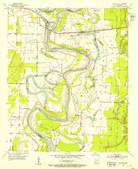
 1951 Fulton1952 Print · USGSThe Red River bottomlands of Southwest Arkansas are captured here in the early fifties, where the railroad meets a shifting river. Genealogists and local historians can trace the foundations of Fulton, locate the Old Allens Ferry site, or find rural landmarks like Galilee Ch and Red Hill Cem.6 unique versions available
 - 1951 Map of Spring Hill, 1952 Print
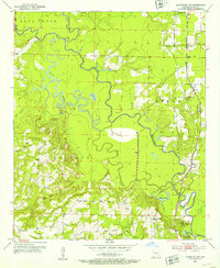
 1951 Spring Hill1952 Print · USGSHempstead County south of Hope was a region of small rural congregations and river-fed agriculture in the early fifties. Genealogists can locate specific family landmarks like Holly Spring Cem, the Ranger Station, and the abandoned Stevenson School.3 unique versions available
 - 1952 Map of Mandeville, 1953 Print
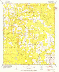
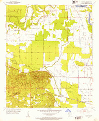
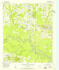
 1952 Mandeville1953 Print · USGSMiller County, Arkansas, is captured here in the early fifties as the regional rail and aviation networks were firmly established. Genealogists can trace family names at Rondo Cem and Polk Cem, or locate landmarks like Harrison Chapel.4 unique versions available
 - 1952 Map of Doddridge SE, 1953 Print
 1952 Doddridge SE1953 Print · USGSThe Red River borderlands of Arkansas and Louisiana are captured here in the early fifties, showing a landscape defined by oxbow lakes and river crossings. Genealogists can locate family landmarks like Blanton Cem, Kiblah Sch, and active river transit points at Spring Bank Ferry.4 unique versions available
 - 1952 Map of Garland, 1953 Print
 1952 Garland1953 Print · USGSIn the early fifties, the Red River floodplain near the Miller and Lafayette county line remained a landscape of oxbow lakes and rail-dependent river towns. Genealogists and historians can locate rural landmarks like Old Gum Point Ch, the Mays Cem, and the Garland City Sta along the St Louis Southwestern line.4 unique versions available
 - 1952 Map of Doddridge NW, 1953 Print
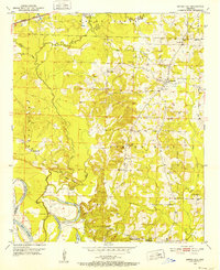
 1952 Doddridge NW1953 Print · USGSMiller County in the early fifties is defined by the winding Sulphur River and the rural communities bordering its wide basin. Researchers can trace the Texas and Pacific rail line through Ft Lynn or locate local centers like Springhill Ch and Black Diamond.4 unique versions available
 - 1952 Map of Doddridge, 1953 Print
 1952 Doddridge1953 Print · USGSThe Arkansas-Louisiana borderlands come alive in this mid-century survey of Miller County and Caddo Parish. Genealogists can locate family-named landmarks like Capps City or Brightstar and trace rural congregations at Concord Ch and Oak Grove Ch.5 unique versions available
 - 1952 Map of Fouke SE, 1953 Print
 1952 Fouke SE1953 Print · USGSSouthwestern Arkansas in the early fifties shows a landscape of bayous and rural schoolhouse junctions. Genealogists can trace family landmarks like Phylaw Cem, Rocky Mound Ch, and the grounds of Central Sch.4 unique versions available
 - 1952 Map of Doddridge NE, 1953 Print
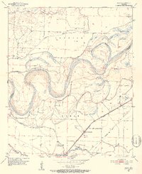
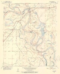
 1952 Doddridge NE1953 Print · USGSThe Red River valley at the start of the 1950s shows a landscape of winding oxbows and riverfront settlements in Miller County. Researchers can trace rural church locations like Independence Ch and Red River Ch or the river-bend geography of Slay Bend.5 unique versions available
 - 1952 Map of Fouke, 1953 Print
 1952 Fouke1953 Print · USGSMiller County's rural landscape is captured here in the early fifties, centered on the Texas and Pacific RR corridor. Genealogists can locate family landmarks like Gibson Cem and old congregation sites including Salem Ch and Boyd Ch.5 unique versions available
 - 1952 Map of Canfield, 1953 Print
 1952 Canfield1953 Print · USGSLafayette County and Miller County were still defined by the shifting oxbows of the Red River in the early fifties. Genealogists and historians can trace the riverside community around Canfield, the Union Hill Cem, and the rail siding at Burton Mill.4 unique versions available
 - 1952 Map of Fouke NE, 1953 Print
 1952 Fouke NE1953 Print · USGSMiller County river bottoms and the high ground of the Cleveland district are captured here in the early fifties. Genealogists and researchers can locate the Rock Springs Cem, the rural Hervey Sch, and the rail stop at Artex.4 unique versions available
 - 1952 Map of Boyd Hill, 1953 Print
 1952 Boyd Hill1953 Print · USGSLafayette and Miller counties meet along the winding Red River in the early fifties, showing a landscape defined by seasonal floodwaters and rural industry. Genealogists can locate family landmarks like Boyd Hill Cem, Galilee Ch, and the stop at Mayton on the St Louis Southwestern line.4 unique versions available
 - 1953 Map of Texarkana, 1964 Print
 1953 Texarkana1964 Print · USGSThe Texas-Arkansas borderlands are captured here in the mid-fifties, during a decade of massive military and hydraulic engineering projects. Genealogists and researchers can locate family landmarks like Old Boston Cem, Siloam Ch, and the vast Red River Arsenal.4 unique versions available
 - 1953 Map of El Dorado, 1967 Print
 1953 El Dorado1967 Print · USGSSouth Arkansas in the mid-1960s was a landscape of industrial growth and river-fed commerce. Researchers can trace the extensive Oil and Gas Fields around Magnolia, the expansive U S Naval Ammunition Depot, and the busy rail lines of the Missouri Pacific.3 unique versions available
 - 1954 Map of Texarkana, 1955 Print
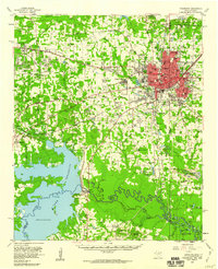
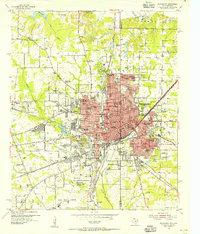 1954 Texarkana1955 Print · USGSTexarkana straddles the state line in the mid-fifties, serving as a primary crossroads for four major railroad lines. Genealogists and local historians can trace the foundations of the city through sites like the Railway Hospital, Holy Cross Cem, and Texarkana Junior College.6 unique versions available
 - 1954 Map of Domino, 1955 Print
 1954 Domino1955 Print · USGSCrossing the Texas and Arkansas border in the mid-fifties, this area shows a landscape defined by the winding Sulphur River and active gravel mining. Genealogists can locate rural landmarks like Buchanan Cem, Bright Star Ch, and the settlement of Domino.5 unique versions available
 - 1954 Map of Texarkana, 1960 Print
 1954 Texarkana1960 Print · USGSTexarkana and its surrounding borderlands are captured at a mid-century peak of industrial and suburban growth. Genealogists and historians can trace the foundations of Wake Village, locate the Red River Arsenal, and find rural landmarks like Hampton Chapel and Red Springs Cem.2 unique versions available
 - 1956 Map of Texarkana
 1956 Texarkana1956 Print · USGSThe Ark-La-Tex borderlands come alive in the mid-fifties, showing the transition from a rail-dependent rural economy to a post-war industrial landscape. Researchers can trace the massive Red River Ordnance Depot and find towns like Talco, Bogata, and Naples.
Showing maps 1-25 of 133
Top cities of Miller County
Frequently asked questions
- What are the different types of historical maps available for Miller County?
- What is the oldest map of Miller County?
- Where can I purchase historical maps of Miller County for my home or office?
- Where can I download high-res historical maps of Miller County?
- Are there historical topographic maps available for Miller County?
- Is there historical aerial imagery available for Miller County?
- Where are historical maps of Miller County sourced from?