Old Maps of Stone County, Arkansas for Academic Research
Study the evolution of Stone County with 162 high-resolution historic maps. Whether you're teaching, researching, or modeling changes in land use, these maps provide essential visual documentation of urban, environmental, and geographic change.
- Analyze long-term change: Track patterns in development, transportation, and natural features.
- Ideal for environmental or urban studies: Support academic projects with primary historical map data.
- Use in the classroom or lab: Educators and researchers rely on these maps to bring historical context to life.
These maps are a powerful tool for teaching, research, and visualizing how Stone County has changed over the decades.
Stone County, AR maps
(162)- 1890 Map of Batesville
 1890 Batesville1890 Print · USGSIndependence and Sharp counties relied on a intricate network of river ferries and rural outposts in the 1890s. Researchers can trace ancestral locations like Old Clem Place, historic church sites like Bethesda Ch, and river crossings at Walls Fy.
 - 1890 Map of Mountain Home, 1954 Print
 1890 Mountain Home1954 Print · USGSThe Ozark plateau in the late nineteenth century remains a rugged landscape of winding river valleys and isolated hilltop settlements. Genealogists can trace family footprints across Mountain Home, Buffalo City, and Calico Rock before modern dams reshaped the White River.
 - 1891 Map of Mountain Home
 1891 Mountain Home1891 Print · USGSThe Ozark wilderness around Mountain Home is shown here in the late nineteenth century, dominated by a wild river system. Researchers can trace the network of old river crossings like Traceys F'y and Nelsons F'y alongside early towns such as Buffalo City.
 - 1891 Map of Batesville
 1891 Batesville1891 Print · USGSNorthern Arkansas in the late nineteenth century centers on the White River corridor. Genealogists can trace family landmarks like Old Clem Place and early river crossings such as Grigsby Fy or the rail lines through Sulphur Rock.6 unique versions available
 - 1892 Map of Mountain View
 1892 Mountain View1892 Print · USGSThe Arkansas Ozarks are mapped here in the late nineteenth century, a time when river ferries and fords were the primary connections between isolated mountain towns. Trace the early streets of Mountain View and Clinton, or locate old crossings at Upper Fy. and Wilsons Fd.
 - 1894 Map of Mountain View
 1894 Mountain View1894 Print · USGSThe Arkansas Ozark foothills and river valleys are shown in the 1890s as a network of isolated homesteads and river landings. Genealogists can trace early families near Mountain View, Clinton, and river crossings like Upper Fy. or Goffs Cove.5 unique versions available
 - 1894 Map of Mountain Home
 1894 Mountain Home1894 Print · USGSNorthern Arkansas in the 1890s was a rugged territory defined by the winding White and Buffalo rivers. Genealogists and local historians can trace early river crossings and settlements like Traceys Fy & Fd, Ships Fy, Buffalo City, and Henderson.6 unique versions available
 - 1942 Map of Bethesda
 1942 Bethesda1942 Print · USGSIndependence County during the early 1940s reveals a landscape of ridge-top farms and river-bottom commerce. Genealogists can trace family roots through local landmarks like Gill Cem, O'Neal Sch, and the riverside crossing at Walls Ferry.4 unique versions available
 - 1942 Map of Almond, 1945 Print
 1942 Almond1945 Print · USGSThe river-and-rail corridor along the White River defines this 1940s landscape where Independence and Cleburne Counties meet. Genealogists and historians can trace old transit points like Earnhearts Ferry and the Old Cherokee Line boundary.3 unique versions available
 - 1942 Map of Mt Pleasant, 1945 Print
 1942 Mt Pleasant1945 Print · USGSIzard County in the 1940s was a landscape of deep hollows and active mining operations near the Independence County line. Genealogists and historians can trace rural family legacies through local landmarks like Gid Sch, Mt Lebanon Ch, and the Barren Fork Cem.5 unique versions available
 - 1945 Map of Harrison
 1945 Harrison1945 Print · USGSThe Ozark and Boston Mountains straddle the Missouri-Arkansas border during the mid-forties, showing a landscape of forest ridges and river valleys. Genealogists and historians can trace rail-connected towns like Monett and West Plains or early lake developments at Bull Shoals Res and Norfork Lake.
 - 1949 Map of Harrison
 1949 Harrison1949 Print · USGSThe Ozark highlands of northern Arkansas and southern Missouri are shown just after the war, when the White River still followed its original course. Genealogists and historians can trace rail lines like the Missouri & Arkansas RR and locate rural hubs like Harrison, Eureka Springs, and Mountain Home.
 - 1953 Map of Memphis, 1966 Print
 1953 Memphis1966 Print · USGSEastern Arkansas and the Memphis riverfront are shown here during the mid-century period of regional growth and river management. Local historians can trace the paths of the Chicago Rock Island & Pacific RR through Forrest City or locate river landmarks like President's Island.3 unique versions available
 - 1954 Map of Harrison
 1954 Harrison1954 Print · USGSThe Ozarks and Boston Mountains meet during a period of massive river engineering in the mid-fifties. Researchers can trace the early shorelines of Bull Shoals Lake and Table Rock Reservoir or locate inland towns like Berryville and Harrison.
 - 1956 Map of Memphis
 1956 Memphis1956 Print · USGSThe Mississippi Delta and the bluffs of West Tennessee meet in the mid-fifties, showing a landscape defined by massive river systems and rail hubs. Researchers can trace the path of Crowleys Ridge or locate vanished river landings near Centennial Island and Island No 35.
 - 1956 Map of Russellville
 1956 Russellville1956 Print · USGSThe Arkansas River valley and the surrounding Boston Mountains are captured here in the mid-fifties, showing a landscape of small timber towns and new reservoirs. Genealogists can trace family roots through upland settlements like Pelsor and Witts Springs or locate the campus of Arkansas Polytechnic College.2 unique versions available
 - 1958 Map of Harrison, 1973 Print
 1958 Harrison1973 Print · USGSThe Ozark and Boston Mountains appear in this mid-century survey as the great White River impoundments were reshaping the region. Researchers can trace the rail lines of the St Louis-San Francisco Ry and locate early settlements like Berryville and Gainesville.
 - 1964 Map of Russellville
 1964 Russellville1964 Print · USGSMid-century Central Arkansas is defined here by the river-valley towns and the surrounding mountain ranges before the full expansion of the interstate system. Genealogists and historians can trace rail-town development along the Missouri Pacific Railroad and locate landmarks like Arkansas Polytechnic College or Petit Jean State Park.
 - 1964 Map of Harrison
 1964 Harrison1964 Print · USGSThe Ozark and Boston Mountains of Arkansas and Missouri are captured here in the mid-sixties, showing the rugged highlands before extensive modern development. Genealogists and historians can trace family-named peaks like Gaither Mountain and follow the St Louis-San Francisco RR through Monett and Purdy.
 - 1964 Map of Calico Rock, 1965 Print
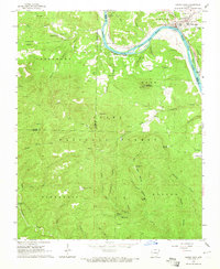 1964 Calico Rock1965 Print · USGSThe White River region at the height of the mid-sixties reveals a landscape of isolated river settlements and high Ozark ridges. Researchers can trace the river's impact through the Ghesmond Ferry and find family sites like the Old Optimus Cem or Bethel Springs Sch.4 unique versions available
 - 1964 Map of Norfork Dam South, 1965 Print
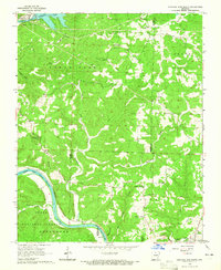 1964 Norfork Dam South1965 Print · USGSThe Ozark highlands of Baxter and Izard counties come alive in the mid-1960s as the White River winds through deep forest. Genealogists and historians can trace the Missouri Pacific rail line past Old Joe to the riverside town of Calico Rock.4 unique versions available
 - 1964 Map of Boswell, 1965 Print
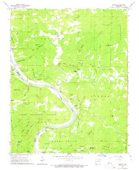 1964 Boswell1965 Print · USGSThe White River loops through the Ozarks in the mid-1960s, marking the boundary between Stone and Izard counties. Genealogists can trace family names at Mount Olive Cem and Optimus Cem or locate the old Missouri Pacific line at Boswell.4 unique versions available
 - 1964 Map of Guion, 1965 Print
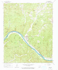 1964 Guion1965 Print · USGSThe White River valley and the industrial riverside town of Guion are captured here in the mid-1960s. Researchers can trace the Missouri Pacific rail line past numerous quarries, finding family history at Jones Bottom Cem or Arnold.
 - 1964 Map of Sylamore, 1965 Print
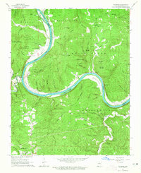 1964 Sylamore1965 Print · USGSThe White River corridor of mid-century Stone County reveals a landscape of isolated mountain settlements and riverside rail industry. Trace family history through the Jeffery Cem and Sylamore Cem, or locate the old Ferry crossing near the Missouri Pacific line.3 unique versions available
 - 1966 Map of Norfork SE, 1967 Print
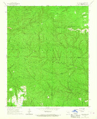 1966 Norfork SE1967 Print · USGSIn the mid-1960s, this area of the Arkansas Ozarks remained a patchwork of national forest and family landmarks near the Baxter and Stone County line. Genealogists and hikers can trace old routes like Advance Road to find the Acklin Cem and the Lookout Tower on Push Mountain.3 unique versions available
Showing maps 1-25 of 162
Top cities of Stone County
Frequently asked questions
- What are the different types of historical maps available for Stone County?
- What is the oldest map of Stone County?
- Where can I purchase historical maps of Stone County for my home or office?
- Where can I download high-res historical maps of Stone County?
- Are there historical topographic maps available for Stone County?
- Is there historical aerial imagery available for Stone County?
- Where are historical maps of Stone County sourced from?