1900s (20th Century) Maps of Yell County, Arkansas
Explore 48 historic maps of Yell County from the 1900s (20th Century). These maps offer a rare glimpse into what life looked like during the 1900s — showing old roads, neighborhoods, homes, and landmarks that have changed or disappeared over time.
Whether you're researching your family's past, planning a metal detecting trip, or studying how Yell County's landscape evolved across the 1900s, these high-resolution maps are a powerful tool for exploring the history of this region.
- Focus on a specific era: All maps on this page are from the 1900s, giving you a focused view of this time period.
- See what’s changed: Compare century-old streets, trails, and buildings to today's modern landscape using overlays and satellite layers.
- Research with precision: Use these maps for genealogy, historical research, land use analysis, or educational projects.
- View, download, or print: Maps are fully viewable online in high resolution, and can be downloaded or printed for your own records.
Start exploring Yell County's history through authentic maps from the 1900s. This is your window into the past.
Yell County, AR maps
(48)- 1955 Map of Little Rock, 1978 Print
 1955 Little Rock1978 Print · USGSCentral Arkansas in the mid-fifties exhibits a landscape of growing cities, massive military installations, and mountain reservoirs. Genealogists and historians can trace the industrial Bauxite Mines, regional rail lines, and local landmarks like Antioch Church.
 - 1956 Map of Little Rock
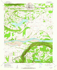
 1956 Little Rock1956 Print · USGSCentral Arkansas in the mid-fifties shows a landscape defined by burgeoning military bases and the timber-and-mineral wealth of the Ouachitas. Genealogists and researchers can trace old rail lines like the Missouri Pacific and find established communities such as Bauxite, Sheridan, and Mabelvale.
 - 1956 Map of Russellville
 1956 Russellville1956 Print · USGSThe Arkansas River valley and the surrounding Boston Mountains are captured here in the mid-fifties, showing a landscape of small timber towns and new reservoirs. Genealogists can trace family roots through upland settlements like Pelsor and Witts Springs or locate the campus of Arkansas Polytechnic College.2 unique versions available
 - 1959 Map of Mount Ida, 1960 Print
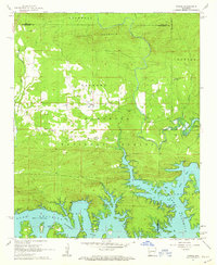
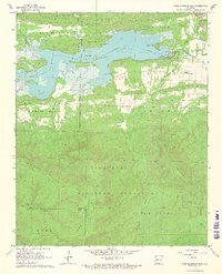
 1959 Mount Ida1960 Print · USGSThe Montgomery County interior is documented in the late fifties as the rising waters of Lake Ouachita began to reshape the river valley. Researchers can trace rural cemeteries and church sites like Crystal Hill Ch, McKinney Cem, and the village of Hog Jaw.2 unique versions available
 - 1960 Map of Little Rock
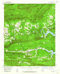
 1960 Little Rock1960 Print · USGSCentral Arkansas in the late fifties shows a landscape of growing military bases and massive new reservoirs. Local historians can trace the mid-century expansion of Little Rock and Hot Springs alongside the industrial works at Bauxite and the Pine Bluff Arsenal.
 - 1960 Map of Gravelly, 1961 Print
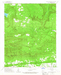
 1960 Gravelly1961 Print · USGSYell and Scott Counties appear here in the early sixties, as small rural communities thrived along the winding Fourche River. Genealogists and local historians can trace family roots through landmarks like Mt Pleasant Cem, Mulberry Ch, and the Fourche Valley Sch.3 unique versions available
 - 1961 Map of Adona, 1962 Print
 1961 Adona1962 Print · USGSCentrally located in Perry and Conway counties in the early sixties, this region reveals a rural landscape defined by the Petit Jean River. Genealogists and local historians can trace family ties at Hamilton Cem, Liberty Cem, and the small siding of Adona along the rail line.3 unique versions available
 - 1961 Map of Atkins, 1962 Print
 1961 Atkins1962 Print · USGSThe Arkansas River valley comes alive in this early 1960s survey of Pope and Yell counties, showing the transition from delta bottomlands to the heights of Petit Jean Mountain. Genealogists can trace rural roots through landmarks like Bells Chapel Cem, Gold Hill Sch, and the riverside site of Galla Rock.3 unique versions available
 - 1962 Map of Fannie, 1963 Print
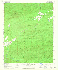
 1962 Fannie1963 Print · USGSThe northern shores of Lake Ouachita and the surrounding national forest are captured here in the early sixties. Researchers can locate family landmarks such as Breashears Cem, Mt Zion Ch, and the small settlement of Fannie.3 unique versions available
 - 1962 Map of Delaware, 1963 Print
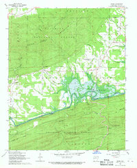
 1962 Delaware1963 Print · USGSThe Arkansas River valley was in a state of flux in the early sixties as the reservoir began to fill. Genealogists and historians can trace family ties at Chastain Cem and Pledger Cem or locate the Old Railroad Grade near Delaware.2 unique versions available
 - 1963 Map of Russellville West, 1964 Print
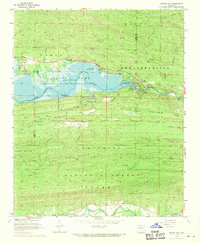
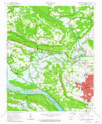 1963 Russellville West1964 Print · USGSThe river valley and western Russellville appear here during a period of major change as the Dardanelle Reservoir reshaped the landscape. Researchers can trace the INDIAN TREATY BOUNDARY, locate old family plots at Swann Cem, or study the grounds of Arkansas Polytechnic College.2 unique versions available
 - 1964 Map of Russellville
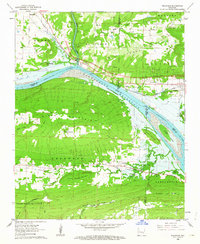
 1964 Russellville1964 Print · USGSMid-century Central Arkansas is defined here by the river-valley towns and the surrounding mountain ranges before the full expansion of the interstate system. Genealogists and historians can trace rail-town development along the Missouri Pacific Railroad and locate landmarks like Arkansas Polytechnic College or Petit Jean State Park.
 - 1964 Map of Little Rock
 1964 Little Rock1964 Print · USGSCentral Arkansas in the mid-sixties is a landscape of mountain ridges, industrial rail lines, and growing military hubs. Researchers can trace the development of Bauxite and Hot Springs or locate rural landmarks like Sparkman and the Pine Bluff Arsenal.
 - 1966 Map of Blue Mountain, 1967 Print
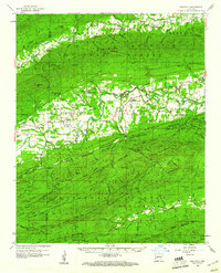
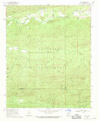
 1966 Blue Mountain1967 Print · USGSThe Arkansas high country of the mid-1960s is centered here on the summits of Magazine Mountain and Signal Hill. Genealogists and local historians can locate remote landmarks like Liberty Ch, Little Hope Cem, and the tracks of the Chicago Rock Island and Pacific.2 unique versions available
 - 1966 Map of Blue Mountain Dam, 1967 Print
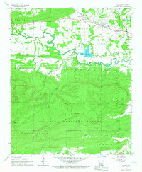
 1966 Blue Mountain Dam1967 Print · USGSThe Petit Jean River valley and the newly managed waters of Blue Mountain Lake are captured here in the mid-sixties. Researchers can trace rural church and cemetery sites like Cent Moores Chapel and Scott Cem near Waveland.3 unique versions available
 - 1966 Map of Magazine Mountain NE, 1967 Print
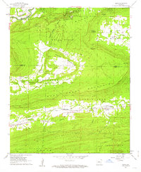
 1966 Magazine Mountain NE1967 Print · USGSThe peaks and ridges of Logan County are captured here in the mid-1960s, showing a landscape defined by the Ozark National Forest. You can trace early family roots and rural travel routes near Mt Salem Ch, Valentine Cem, and the tracks of the Chicago Rock Island and Pacific railroad.2 unique versions available
 - 1966 Map of Havana, 1967 Print
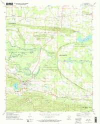
 1966 Havana1967 Print · USGSHavana and the surrounding Yell County valley are captured here in the mid-sixties, centered on the Chicago Rock Island and Pacific rail corridor. Genealogists and local historians can locate several family cemeteries, such as Davis Cem and Guinn Cem, or trace the path of the Petit Jean River.
 - 1968 Map of Plainview, 1970 Print
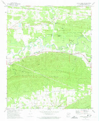
 1968 Plainview1970 Print · USGSThe Yell County timberlands and river valleys come into focus in the late 1960s, just as the regional landscape was being reshaped by water management. Genealogists and historians can locate Plainview, the Barnett Chapel Cem, and riverside landmarks like Wards Crossing.
 - 1968 Map of Onyx, 1970 Print
 1968 Onyx1970 Print · USGSIn the late sixties, the timbered ridges and river valleys of Yell and Garland counties remained a terrain of remote settlements and forest lookouts. Researchers can trace the family sites at Ballew Cem, follow the Onyx Trail, or locate the rural communities of Onyx and Aly.2 unique versions available
 - 1968 Map of Rover, 1970 Print
 1968 Rover1970 Print · USGSYell County's river valleys and forested ridges are captured in the late sixties as the local landscape transitioned with the waters of Nimrod Lake. Researchers can locate old community sites at Briggsville and Rover or find family plots at Mt Zion Cem.2 unique versions available
 - 1968 Map of Nimrod Dam, 1970 Print
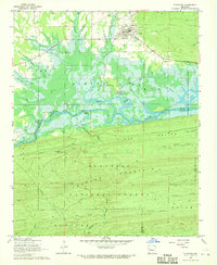
 1968 Nimrod Dam1970 Print · USGSThe Fourche River valley and Nimrod Lake are seen here in the late sixties as the area became a hub for conservation and recreation. Genealogists and local historians can locate Valley Home Ch, the Ark Sch, and family landmarks like Carter Cem.
 - 1968 Map of Steve, 1970 Print
 1968 Steve1970 Print · USGSThe northern Arkansas wilderness of the late sixties is documented here as the Ouachita National Forest meets the Fourche River valley. Local researchers can trace family landmarks like Shed Cem, Steve Ch, and the small community at Steve.
 - 1972 Map of Ola, 1974 Print
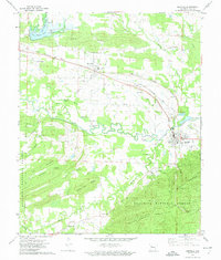
 1972 Ola1974 Print · USGSThe Yell County river bottoms and rail lines come into focus in the early 1970s, showing the town of Ola at a geographical crossroads. Researchers can trace family history at Oakland Cemetery or locate the former path of the Old RR Grade and the Mt Tabor Church.2 unique versions available
 - 1972 Map of Danville Mountain, 1974 Print
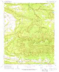
 1972 Danville Mountain1974 Print · USGSYell County in the early seventies shows a landscape shaped by the Petit Jean River and the Chicago Rock Island and Pacific railroad. Genealogists can locate family landmarks such as Salem Ch and the rural community of Mickles.
 - 1972 Map of Danville, 1974 Print
 1972 Danville1974 Print · USGSYell County in the early seventies shows a landscape of river-bottom farms and timbered ridges just as the local rail economy persisted. Genealogists and local historians can trace family locations through numerous sites like Harris Chapel, Ladd Memorial Cem, and the settlement at Macedonia.
Showing maps 1-25 of 48
Top cities of Yell County
- Dardanelle historical maps
- Danville historical maps
- Ola historical maps
- Plainview historical maps
- Belleville historical maps
- Havana historical maps
See more
Frequently asked questions
- What are the different types of historical maps available for Yell County?
- What is the oldest map of Yell County?
- Where can I purchase historical maps of Yell County for my home or office?
- Where can I download high-res historical maps of Yell County?
- Are there historical topographic maps available for Yell County?
- Is there historical aerial imagery available for Yell County?
- Where are historical maps of Yell County sourced from?