Old Maps of Yell County, Arkansas for Academic Research
Study the evolution of Yell County with 203 high-resolution historic maps. Whether you're teaching, researching, or modeling changes in land use, these maps provide essential visual documentation of urban, environmental, and geographic change.
- Analyze long-term change: Track patterns in development, transportation, and natural features.
- Ideal for environmental or urban studies: Support academic projects with primary historical map data.
- Use in the classroom or lab: Educators and researchers rely on these maps to bring historical context to life.
These maps are a powerful tool for teaching, research, and visualizing how Yell County has changed over the decades.
Yell County, AR maps
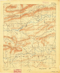
(203)- 1879 Map of Mountain Home
 1879 Mountain Home1879 Print · USGSLogan, Arkansas, is captured during the late nineteenth-century push to map the Ozark interior. Researchers can trace family-named landmarks and water sources like Cotton's Cove, Jake's Cr., and Calico Mountain before modern development.
 - 1887 Map of Magazine Mountain #4
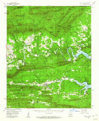
 1887 Magazine Mountain #41887 Print · USGSLogan County, Arkansas, appears in this late nineteenth-century survey during the height of the state's early geological studies. Researchers can trace the high-elevation terrain of Calico Mountain and the specific local geography of Cotton's Cove.
 - 1887 Map of Magazine Mountain
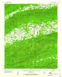
 1887 Magazine Mountain1887 Print · USGSNorthwest Arkansas in the 1880s is defined here by the river-and-rail economy along the Arkansas River valley. Genealogists and historians can trace long-forgotten post offices like Burnett Springs and early rail stops such as Coal Hill.
 - 1888 Map of Dardanelle #4
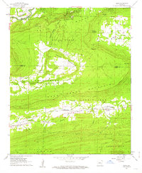
 1888 Dardanelle #41888 Print · USGSDardanelle and the Arkansas River valley are shown here in the late nineteenth century as the regional rail network began to expand. Genealogists and historians can trace early settlements and landings like Centerville, Galla Rock, and Morristown.
 - 1888 Map of Dardanelle #2
 1888 Dardanelle #21888 Print · USGSJohnson County’s river-and-rail economy is captured here in the late 1880s as the Little Rock & Fort Smith R. R. spurred growth along the Arkansas River. Genealogists and researchers can trace early homesteads near Knoxville, find the river Ferry, and locate settlements like Lutherville and Blaine.
 - 1888 Map of Dardanelle #1
 1888 Dardanelle #11888 Print · USGSPope County at the end of the 1880s was a landscape of rising ridges and vital new rail connections. Family historians can trace early homesteads near Dover and Scottsville, or follow the old tracks of the Little Rock and Fort Smith Railway.
 - 1888 Map of Dardanelle #3
 1888 Dardanelle #31888 Print · USGSYell County in the late 1880s was a land of prominent ridges and small valley settlements. Genealogists can trace family roots through rural post offices and early townships like Hobert P.O., Belleville, and the landmarks around Chickalah Mountain.
 - 1889 Map of Morrilton No. 3
 1889 Morrilton No. 31889 Print · USGSNear the end of the nineteenth century, the Arkansas River valley was defined by the massive plateau of Petit Jean Mountain. Genealogists can trace early homesteads in Atkins or near rural centers like Ada, Divide, and the river lands of Gardens Bottoms.
 - 1890 Map of Magazine Mountain
 1890 Magazine Mountain1890 Print · USGSThe Arkansas River Valley is captured here in the late nineteenth century as rail transport begins to eclipse river travel. Genealogists can trace early homesteads and community hubs like Paris, Booneville, and the remote Burnett Springs.6 unique versions available
 - 1890 Map of Mount Ida
 1890 Mount Ida1890 Print · USGSMontgomery and Scott counties are shown in the late nineteenth century, dominated by the ridges of the Ouachita Mountains and the winding Washita or Ouachita River. Genealogists and historians can trace early settlements like Mt. Ida, Oden, and the mining camp at Silver City.7 unique versions available
 - 1890 Map of Hot Springs
 1890 Hot Springs1890 Print · USGSThe Ouachita and Fourche La Fave river valleys are mapped here in the late nineteenth century, showing a landscape of isolated mountain settlements. Researchers can trace early family sites near Buckville, Cedar Glades, and the nascent streets of Hot Springs.
 - 1890 Map of Dardanelle
 1890 Dardanelle1890 Print · USGSThe Arkansas River valley was a primary corridor of settlement in the 1890s, anchored by the river towns of Dardanelle and Russellville. Genealogists can locate early homesteads near Mt. Nebo, Lutherville, or the old post office at Chickalah.7 unique versions available
 - 1892 Map of Morrillton
 1892 Morrillton1892 Print · USGSThe Arkansas River valley at the end of the nineteenth century was a landscape of vital ferry crossings and early rail expansion. Genealogists and historians can trace the foundations of Morrillton and Perryville or locate river landmarks like Galla Rock Fy. and Stouts Ldg.
 - 1894 Map of Morrillton
 1894 Morrillton1894 Print · USGSThe Arkansas River valley and the Ouachita foothills meet in the 1890s, where river traffic and the rail line define the local economy. Genealogists can trace early homesteads and crossings near Morrillton, Burnetts Ford, and the rugged heights of Cedar Falls Mt.5 unique versions available
 - 1894 Map of Hot Springs
 1894 Hot Springs1894 Print · USGSThe thermal waters of Hot Springs and the surrounding Ouachita wilderness appear here in the decade before the region’s twentieth-century expansion. Genealogists can trace early homesteading locations and vanished rural hubs like Buckville, Cedar Glades, and Wards Crossing.5 unique versions available
 - 1955 Map of Little Rock, 1978 Print
 1955 Little Rock1978 Print · USGSCentral Arkansas in the mid-fifties exhibits a landscape of growing cities, massive military installations, and mountain reservoirs. Genealogists and historians can trace the industrial Bauxite Mines, regional rail lines, and local landmarks like Antioch Church.
 - 1956 Map of Little Rock
 1956 Little Rock1956 Print · USGSCentral Arkansas in the mid-fifties shows a landscape defined by burgeoning military bases and the timber-and-mineral wealth of the Ouachitas. Genealogists and researchers can trace old rail lines like the Missouri Pacific and find established communities such as Bauxite, Sheridan, and Mabelvale.
 - 1956 Map of Russellville
 1956 Russellville1956 Print · USGSThe Arkansas River valley and the surrounding Boston Mountains are captured here in the mid-fifties, showing a landscape of small timber towns and new reservoirs. Genealogists can trace family roots through upland settlements like Pelsor and Witts Springs or locate the campus of Arkansas Polytechnic College.2 unique versions available
 - 1959 Map of Mount Ida, 1960 Print
 1959 Mount Ida1960 Print · USGSThe Montgomery County interior is documented in the late fifties as the rising waters of Lake Ouachita began to reshape the river valley. Researchers can trace rural cemeteries and church sites like Crystal Hill Ch, McKinney Cem, and the village of Hog Jaw.2 unique versions available
 - 1960 Map of Little Rock
 1960 Little Rock1960 Print · USGSCentral Arkansas in the late fifties shows a landscape of growing military bases and massive new reservoirs. Local historians can trace the mid-century expansion of Little Rock and Hot Springs alongside the industrial works at Bauxite and the Pine Bluff Arsenal.
 - 1960 Map of Gravelly, 1961 Print
 1960 Gravelly1961 Print · USGSYell and Scott Counties appear here in the early sixties, as small rural communities thrived along the winding Fourche River. Genealogists and local historians can trace family roots through landmarks like Mt Pleasant Cem, Mulberry Ch, and the Fourche Valley Sch.3 unique versions available
 - 1961 Map of Adona, 1962 Print
 1961 Adona1962 Print · USGSCentrally located in Perry and Conway counties in the early sixties, this region reveals a rural landscape defined by the Petit Jean River. Genealogists and local historians can trace family ties at Hamilton Cem, Liberty Cem, and the small siding of Adona along the rail line.3 unique versions available
 - 1961 Map of Atkins, 1962 Print
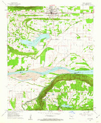 1961 Atkins1962 Print · USGSThe Arkansas River valley comes alive in this early 1960s survey of Pope and Yell counties, showing the transition from delta bottomlands to the heights of Petit Jean Mountain. Genealogists can trace rural roots through landmarks like Bells Chapel Cem, Gold Hill Sch, and the riverside site of Galla Rock.3 unique versions available
 - 1962 Map of Fannie, 1963 Print
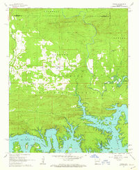 1962 Fannie1963 Print · USGSThe northern shores of Lake Ouachita and the surrounding national forest are captured here in the early sixties. Researchers can locate family landmarks such as Breashears Cem, Mt Zion Ch, and the small settlement of Fannie.3 unique versions available
 - 1962 Map of Delaware, 1963 Print
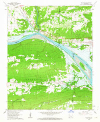 1962 Delaware1963 Print · USGSThe Arkansas River valley was in a state of flux in the early sixties as the reservoir began to fill. Genealogists and historians can trace family ties at Chastain Cem and Pledger Cem or locate the Old Railroad Grade near Delaware.2 unique versions available
Showing maps 1-25 of 203
Top cities of Yell County
- Dardanelle historical maps
- Danville historical maps
- Ola historical maps
- Plainview historical maps
- Belleville historical maps
- Havana historical maps
See more
Frequently asked questions
- What are the different types of historical maps available for Yell County?
- What is the oldest map of Yell County?
- Where can I purchase historical maps of Yell County for my home or office?
- Where can I download high-res historical maps of Yell County?
- Are there historical topographic maps available for Yell County?
- Is there historical aerial imagery available for Yell County?
- Where are historical maps of Yell County sourced from?