1800s (19th Century) Maps of Yell County, Arkansas
Explore 15 historic maps of Yell County from the 1800s (19th Century). These maps offer a rare glimpse into what life looked like during the 1800s — showing old roads, neighborhoods, homes, and landmarks that have changed or disappeared over time.
Whether you're researching your family's past, planning a metal detecting trip, or studying how Yell County's landscape evolved across the 1800s, these high-resolution maps are a powerful tool for exploring the history of this region.
- Focus on a specific era: All maps on this page are from the 1800s, giving you a focused view of this time period.
- See what’s changed: Compare century-old streets, trails, and buildings to today's modern landscape using overlays and satellite layers.
- Research with precision: Use these maps for genealogy, historical research, land use analysis, or educational projects.
- View, download, or print: Maps are fully viewable online in high resolution, and can be downloaded or printed for your own records.
Start exploring Yell County's history through authentic maps from the 1800s. This is your window into the past.
Yell County, AR maps
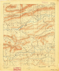
(15)- 1879 Map of Mountain Home
 1879 Mountain Home1879 Print · USGSCovers Yell County, including Havana, Blue Mountain, and other nearby areas
 - 1887 Map of Magazine Mountain #4
 1887 Magazine Mountain #41887 Print · USGSCovers Yell County, including Havana, Blue Mountain, and other nearby areas
 - 1887 Map of Magazine Mountain
 1887 Magazine Mountain1887 Print · USGSCovers Yell County, including Clarksville, Booneville, and other nearby areas
 - 1888 Map of Dardanelle #4
 1888 Dardanelle #41888 Print · USGSCovers Yell County, including Russellville, Dardanelle, and other nearby areas
 - 1888 Map of Dardanelle #2
 1888 Dardanelle #21888 Print · USGSCovers Yell County, including Clarksville, Lamar, and other nearby areas
 - 1888 Map of Dardanelle #1
 1888 Dardanelle #11888 Print · USGSCovers Yell County, including Russellville, Dardanelle, and other nearby areas
 - 1888 Map of Dardanelle #3
 1888 Dardanelle #31888 Print · USGSCovers Yell County, including Danville, Belleville, and other nearby areas
 - 1889 Map of Morrilton No. 3
 1889 Morrilton No. 31889 Print · USGSCovers Yell County, including Morrilton, Atkins, and other nearby areas
 - 1890 Map of Magazine Mountain
 1890 Magazine Mountain1890 Print · USGSCovers Yell County, including Clarksville, Booneville, and other nearby areas6 unique versions available
 - 1890 Map of Mount Ida
 1890 Mount Ida1890 Print · USGSCovers Yell County, including Mount Ida, Oden, and other nearby areas7 unique versions available
 - 1890 Map of Hot Springs
 1890 Hot Springs1890 Print · USGSCovers Yell County, including Hot Springs, Mountain Pine, and other nearby areas
 - 1890 Map of Dardanelle
 1890 Dardanelle1890 Print · USGSCovers Yell County, including Russellville, Clarksville, and other nearby areas7 unique versions available
 - 1892 Map of Morrillton
 1892 Morrillton1892 Print · USGSCovers Yell County, including Conway, Morrilton, and other nearby areas
 - 1894 Map of Morrillton
 1894 Morrillton1894 Print · USGSCovers Yell County, including Conway, Morrilton, and other nearby areas5 unique versions available
 - 1894 Map of Hot Springs
 1894 Hot Springs1894 Print · USGSCovers Yell County, including Hot Springs, Mountain Pine, and other nearby areas5 unique versions available
End of results
Showing maps 1-15 of 15
Top cities of Yell County
- Dardanelle historical maps
- Danville historical maps
- Ola historical maps
- Plainview historical maps
- Belleville historical maps
- Havana historical maps
See more
Frequently asked questions
- What are the different types of historical maps available for Yell County?
- What is the oldest map of Yell County?
- Where can I purchase historical maps of Yell County for my home or office?
- Where can I download high-res historical maps of Yell County?
- Are there historical topographic maps available for Yell County?
- Is there historical aerial imagery available for Yell County?
- Where are historical maps of Yell County sourced from?