1900s (20th Century) Maps of Imperial County, California
Explore 251 historic maps of Imperial County from the 1900s (20th Century). These maps offer a rare glimpse into what life looked like during the 1900s — showing old roads, neighborhoods, homes, and landmarks that have changed or disappeared over time.
Whether you're researching your family's past, planning a metal detecting trip, or studying how Imperial County's landscape evolved across the 1900s, these high-resolution maps are a powerful tool for exploring the history of this region.
- Focus on a specific era: All maps on this page are from the 1900s, giving you a focused view of this time period.
- See what’s changed: Compare century-old streets, trails, and buildings to today's modern landscape using overlays and satellite layers.
- Research with precision: Use these maps for genealogy, historical research, land use analysis, or educational projects.
- View, download, or print: Maps are fully viewable online in high resolution, and can be downloaded or printed for your own records.
Start exploring Imperial County's history through authentic maps from the 1900s. This is your window into the past.
Imperial County, CA maps
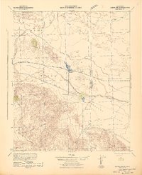
(251)- 1903 Map of Yuma, 1954 Print
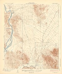
 1903 Yuma1954 Print · USGSThe desert frontier around Yuma comes alive in this survey from the early 1900s, capturing the arrival of major irrigation and rail infrastructure. Genealogists and historians can trace the foundations of the Yuma Indian Reservation, the early layout of Somerton, and remote mining sites like the Picacho Mine.2 unique versions available
 - 1904 Map of Indio
 1904 Indio1904 Print · USGSThe Conchilla Desert and San Jacinto Mountains appear here at the turn of the century as the Southern Pacific rail corridor began to transform the valley. Trace early settlements and tribal lands like Cabezon Indian Res., Figtree John, and the Asbestos Mine.7 unique versions available
 - 1905 Map of Yuma
 1905 Yuma1905 Print · USGSThe Lower Colorado River borderlands come alive in the early 1900s, showing the early infrastructure of the Imperial Valley and the Yuma crossing. Genealogists and historians can trace the foundations of Somerton, the Yuma Indian Reservation, and remote desert mining camps like Hedges and Picacho Mine.5 unique versions available
 - 1907 Map of Holtville
 1907 Holtville1907 Print · USGSThe Imperial Valley was at its first agricultural peak during the early twentieth century as irrigation transformed the desert. Researchers can trace early water engineering through the Oat Canal and locate rail stops like Gleason Switch or Brice Siding.4 unique versions available
 - 1915 Map of El Centro
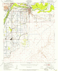
 1915 El Centro1915 Print · USGSThe Imperial Valley was rapidly developing into an agricultural powerhouse in the decade before the Great War. You can trace early irrigation networks through West Side Main Canal and locate early settlements like Dixieland, Silsbee, and 101 Ranch.
 - 1929 Map of Laguna
 1929 Laguna1929 Print · USGSThe confluence of the Colorado and Gila Rivers is captured here in the late twenties, during a period of significant water management and mining. Trace early river landings and remote desert prospects like Castle Dome Landing and the Old Senator Mine.4 unique versions available
 - 1931 Map of Vallecito
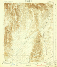
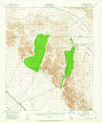
 1931 Vallecito1931 Print · USGSThe Colorado Desert and its surrounding ranges are mapped here in the early thirties, showcasing a landscape defined by scarce water and massive terrain. Genealogists can trace isolated desert outposts like Fig Tree John and Agua Dulce or the original footprint of Borego Springs.
 - 1931 Map of Carrizo, 1938 Print
 1931 Carrizo1938 Print · USGSBorderland life in the 1930s is defined by remote ranching outposts and vital desert springs along the international line. Trace old family sites and water sources like Campo P.O., Agua Caliente Hot Springs, and Laguna Ranch.
 - 1939 Map of Red Hill
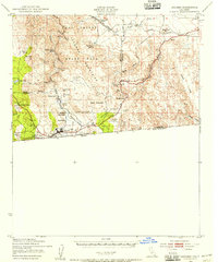
 1939 Red Hill1939 Print · USGSThe high desert of Yuma County is mapped here in the mid-1930s, showing a landscape defined by mining prospects and historic transit routes. You can trace early desert roads and name points like the Annie Mine, Red Hill, and the long Quartzite Yuma Road.3 unique versions available
 - 1939 Map of Jacumba, 1956 Print
 1939 Jacumba1956 Print · USGSThe high-desert borderlands of San Diego and Imperial counties are documented here just before the 1940s. Researchers can trace the engineering of the San Diego and Arizona Eastern railway and locate remote sites like Smugglers Cave and the Asbestos Mine.2 unique versions available
 - 1940 Map of Brawley, 1955 Print
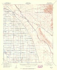
 1940 Brawley1955 Print · USGSThe Imperial Valley's complex irrigation and rail network is captured here just before the mid-century. Researchers can trace family-named schools and sidings like Lantana Sch, Silsbee Sch, and Wilsie Siding among the canals of the early valley economy.
 - 1940 Map of Kane Spring, 1956 Print
 1940 Kane Spring1956 Print · USGSThe Imperial County desert near the Salton Sea shoreline is captured here in the 1940s, showing early attempts at irrigation and settlement. Researchers can trace the Pacific Portland Cement route and find family landmarks like Elmore Desert Ranch and Roosevelt Sch.3 unique versions available
 - 1940 Map of Iris, 1956 Print
 1940 Iris1956 Print · USGSImperial County at the start of the 1940s showcases a desert undergoing industrial transformation through a vast network of irrigation canals. Genealogists and historians can trace rail sidings like Flowing Well Siding and rural landmarks such as Mulberry Sch or the settlement of Wiest.4 unique versions available
 - 1940 Map of Frink, 1956 Print
 1940 Frink1956 Print · USGSThe Imperial County desert meets the shoreline of the Salton Sea in the early 1940s as infrastructure begins to reshape the basin. You can trace the Southern Pacific rail line through remote stops at Frink, Pope, and Wister, or locate the historic Frink Spring.
 - 1940 Map of Yuma, 1956 Print
 1940 Yuma1956 Print · USGSYuma and the surrounding desert irrigation districts are captured here at the start of the 1940s as the river economy matured. Genealogists and local historians can trace the foundations of Somerton, the Indian Sch, and family-named schools like Crane Sch.3 unique versions available
 - 1940 Map of Heber, 1956 Print
 1940 Heber1956 Print · USGSThe Imperial Valley borderlands are captured here in the early 1940s, showing the complex web of irrigation and desert life. Trace the development of Heber and Calexico alongside the massive All American Canal and the family-linked Mt Signal Union Sch.
 - 1940 Map of Iris Pass, 1956 Print
 1940 Iris Pass1956 Print · USGSThe Imperial County desert at the onset of World War II shows a landscape shifting from traditional trails to military use and large-scale irrigation. Trace historic desert travel via Ehrenberg Road, Salvation Spring, and the Coachella Canal.2 unique versions available
 - 1940 Map of Plaster City, 1956 Print
 1940 Plaster City1956 Print · USGSThe Imperial Desert at the start of the 1940s reveals a unique blend of mining industry, military testing, and early irrigation. Genealogists and historians can trace the Overland Stage Route or explore the rail-dependent economy of Plaster City and the County Rock Quarry.
 - 1940 Map of Alamorio, 1956 Print
 1940 Alamorio1956 Print · USGSImperial Valley's agricultural grid is in full bloom during the 1940s, revealing a landscape defined by an extensive network of canals and laterals. Genealogists can locate numerous rural schoolhouses like Eastside Sch and trace rail lines through Sandia and Holtville.
 - 1940 Map of Coyote Wells, 1956 Print
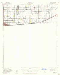
 1940 Coyote Wells1956 Print · USGSThe Colorado Desert during the early 1940s reveals a landscape of high-heat basins and essential transit corridors along the international border. Researchers can trace the path of the Old Stage Road and locate the railway stop at Coyote Wells or the geologic Shell Beds.
 - 1940 Map of Calexico, 1957 Print
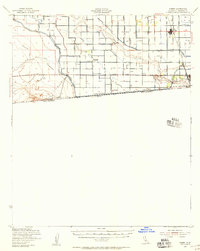
 1940 Calexico1957 Print · USGSThe Imperial Valley borderlands come into focus at the dawn of the 1940s, showing the early impact of the All American Canal. Trace the development of Calexico and rural landmarks like Bonds Corner, Jasper Sch, and the Alamo River.
 - 1940 Map of Durmid, 1964 Print
 1940 Durmid1964 Print · USGSImperial County and the desert shoreline of the Salton Sea appear here in the early 1940s, just as new water infrastructure reached the area. Researchers can trace the Southern Pacific rail line through Durmid and Bertram or follow the early Anza Trail past Truckhaven.
 - 1942 Map of Barrel Spring
 1942 Barrel Spring1942 Print · USGSThe Colorado Desert at the start of the 1940s reveals a landscape of industrial outposts and early parklands. Researchers can trace the Pacific Portland Cement Railroad leading to a remote Gypsum Mine or locate early settlements like Ocotillo and Little Borrego.2 unique versions available
 - 1942 Map of Agua Dulce
 1942 Agua Dulce1942 Print · USGSThe Colorado Desert at the start of World War II reveals a landscape of high peaks and below-sea-level basins. Trace early desert life through the Oasis Sch, the remote Seventeen-Palms oasis, and the shoreline at Fish Springs.
 - 1942 Map of El Centro
 1942 El Centro1942 Print · USGSThe Imperial Valley and the California-Mexico border are captured during the peak of World War II-era desert development. Genealogists and historians can trace defunct school districts like Meloland Sch and Sandia, or follow the path of the Inter-California Railroad across the international line.2 unique versions available
Showing maps 1-25 of 251
Top cities of Imperial County
- El Centro historical maps
- Calexico historical maps
- Brawley historical maps
- Imperial historical maps
- Calipatria historical maps
- Holtville historical maps
See more
Frequently asked questions
- What are the different types of historical maps available for Imperial County?
- What is the oldest map of Imperial County?
- Where can I purchase historical maps of Imperial County for my home or office?
- Where can I download high-res historical maps of Imperial County?
- Are there historical topographic maps available for Imperial County?
- Is there historical aerial imagery available for Imperial County?
- Where are historical maps of Imperial County sourced from?