1990s Maps of Imperial County, California
Explore 38 historic maps of Imperial County from the 1990s. These maps offer a rare glimpse into what life looked like during the 1990s — showing old roads, neighborhoods, homes, and landmarks that have changed or disappeared over time.
Whether you're researching your family's past, planning a metal detecting trip, or studying how Imperial County's landscape evolved across the 1990s, these high-resolution maps are a powerful tool for exploring the history of this region.
- Focus on a specific era: All maps on this page are from the 1990s, giving you a focused view of this time period.
- See what’s changed: Compare century-old streets, trails, and buildings to today's modern landscape using overlays and satellite layers.
- Research with precision: Use these maps for genealogy, historical research, land use analysis, or educational projects.
- View, download, or print: Maps are fully viewable online in high resolution, and can be downloaded or printed for your own records.
Start exploring Imperial County's history through authentic maps from the 1990s. This is your window into the past.
Imperial County, CA maps
(38)- 1992 Map of Acolita, 1995 Print
 1992 Acolita1995 Print · USGSImperial County's desert interior in the early nineties shows the intersection of military training and irrigation infrastructure. Trace the Niland - Glamis Road past Acolita or examine the path of the Coachella Canal through the Algodones Dunes.
 - 1992 Map of Iris, 1995 Print
 1992 Iris1995 Print · USGSThe Imperial Valley desert meets industrial agriculture in the early 1990s as the Coachella Canal cuts across the East Mesa. Researchers can trace the complex water grid of J Drain and L Drain or locate Calipatria State Prison.
 - 1992 Map of Westmorland East, 1995 Print
 1992 Westmorland East1995 Print · USGSImperial Valley's engineering is on full display in the 1990s, showing the intricate grid of canals and drains surrounding Calipatria and Westmorland. Researchers can trace the water systems of the Vail Supply Canal and locate rural landmarks like Rockwood, Hovley, and the North End Dam.
 - 1992 Map of Durmid SE, 1995 Print
 1992 Durmid SE1995 Print · USGSThe eastern shores of the Salton Sea come into sharp focus during the 1990s, showcasing a landscape divided between recreation and federal oversight. Researchers can locate the settlement of Bertram and trace the boundaries of the Salton Sea National Wildlife Refuge and the Salton Sea Test Base.
 - 1992 Map of Kane Spring, 1995 Print
 1992 Kane Spring1995 Print · USGSImperial County in the early nineties shows a stark contrast between military operations and desert agriculture near the shore of the Salton Sea. Trace the rugged terrain of the Superstition Hills or locate the historic Kane Spring and Elmore Desert Ranch.
 - 1992 Map of Kane Spring NW, 1995 Print
 1992 Kane Spring NW1995 Print · USGSImperial County at the start of the nineties reveals a landscape of desert outposts and military testing. Genealogists and researchers can trace the roads of Salton City, the layout of the Salton Sea Airport, and the remote Flowing Well.
 - 1992 Map of Frink NW, 1995 Print
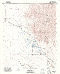 1992 Frink NW1995 Print · USGSRiverside and Imperial counties are captured in the early nineties as military and industrial interests shaped the desert. Trace the path of the Mining Railroad or locate the Hot Mineral Spa and Coachella Canal.2 unique versions available
 - 1992 Map of Wister, 1995 Print
 1992 Wister1995 Print · USGSThe shores of the Salton Sea meet an complex grid of desert irrigation and military terrain in the early 1990s. Researchers can trace the development of the Imperial State Wildlife Area and the remote rail sidings at Wister and Iris.2 unique versions available
 - 1992 Map of Niland, 1995 Print
 1992 Niland1995 Print · USGSThe Imperial Valley's shoreline and irrigation networks are on full display in the early nineties as the desert meets the sea. Genealogists and researchers can trace the development of Niland and Calipatria alongside landmarks like the Calipatria State Prison and Carbon Dioxide Wells.2 unique versions available
 - 1992 Map of Truckhaven, 1995 Print
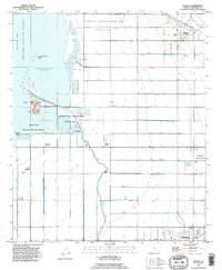
 1992 Truckhaven1995 Print · USGSThe western shores of the Salton Sea show a period of desert development in the 1990s as the grid of Salton City expanded. Researchers can trace land use from the Salton Sea Test Base B-1 to local resources like the Oil Test Wells and Gravel Pit.
 - 1992 Map of Durmid, 1995 Print
 1992 Durmid1995 Print · USGSThe Salton Sea shoreline in the early nineties reveals a rugged landscape of military ranges and desert industry. Trace the Mining Railway toward the Bertram Mine or locate historic water sites at Rancho Dos Palmas.
 - 1992 Map of Iris Wash, 1995 Print
 1992 Iris Wash1995 Print · USGSImperial County's desert landscape is defined by military and water engineering in the early nineties. Researchers can trace the Coachella Canal near the Camp Dunlap (Site) or locate the remote Imperial Buttes Mine.2 unique versions available
 - 1992 Map of Kane Spring NE, 1995 Print
 1992 Kane Spring NE1995 Print · USGSThe Imperial Valley desert meets the shore of the Salton Sea in the early nineties, revealing a landscape defined by military testing and wildlife conservation. Researchers can trace the paths of San Felipe Creek and the man-made Trifolium Drain.
 - 1992 Map of Obsidian Butte, 1995 Print
 1992 Obsidian Butte1995 Print · USGSThe Salton Sea basin in the early nineties reveals a complex landscape of desert hydrology and wildlife conservation. Researchers can trace the engineered irrigation of the Imperial Valley through the Vail 6 Drain and locate the volcanic Obsidian Butte on the shoreline.
 - 1992 Map of Harpers Well, 1995 Print
 1992 Harpers Well1995 Print · USGSImperial County’s desert landscape is captured here in the early nineties, revealing a complex intersection of natural washes and military infrastructure. Trace the path of the Old Kane Spring Road or locate the industrial footprint of the Mining Railway and Harpers Well.
 - 1992 Map of Wiest, 1995 Print
 1992 Wiest1995 Print · USGSThe Imperial Valley desert landscape is shown here in the 1990s as a high-functioning agricultural grid. Researchers can trace the flow of water through Vail Supply Canal and locate sites like Wiest Lake County Park and Finney Lake.
 - 1992 Map of Amos, 1995 Print
 1992 Amos1995 Print · USGSThe Imperial County desert is captured here in the early nineties, where the Algodones Dunes meet the rigid irrigation grids of the East Mesa. Researchers can trace the Southern Pacific line through the settlement at Amos and locate the historic Amos Cem.
 - 1992 Map of Westmorland West, 1995 Print
 1992 Westmorland West1995 Print · USGSThe Imperial Valley's desert irrigation system is on full display in the early nineties, showing the area's transformation into a productive agricultural grid. Trace the paths of the Westside Main Canal, the New River, and the shoreline of the Salton Sea.2 unique versions available
 - 1992 Map of Tortuga, 1995 Print
 1992 Tortuga1995 Print · USGSIn the 1990s, this desert landscape near the Chocolate Mountain range was defined by military training grounds and vital water canals. Trace the paths of the Old Railroad Grade and find remote sites like Tortuga and Amos.
 - 1992 Map of Salton, 1995 Print
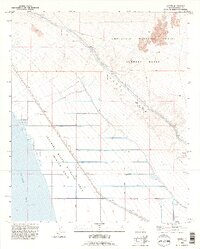
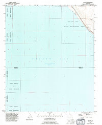 1992 Salton1995 Print · USGSThe Salton Sea shoreline in the early nineties reveals a landscape of tribal lands and desert outposts. Researchers can trace the boundaries of the Torres Martinez Indian Reservation and locate sites like Salton Beach, Betz Beach, and a lone Landing Strip.
 - 1992 Map of Frink, 1995 Print
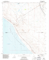
 1992 Frink1995 Print · USGSThe Salton Sea shoreline in the early nineties reveals a landscape of desert recreation and resource extraction. Researchers can trace the layout of Bombay Beach or locate the historic waters of Frink Spring and the settlement at Pope.
 - 1993 Map of Yuma
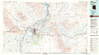 1993 Yuma1993 Print · USGSYuma and the lower Colorado River valley are documented here in the early nineties, showing a landscape defined by massive desert irrigation and military ranges. Trace the rail-and-water economy through the Southern Pacific line and sites like Imperial Dam or the Fortuna Mine.2 unique versions available
 - 1994 Map of Yuma East, 1998 Print
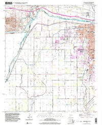
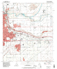 1994 Yuma East1998 Print · USGSYuma in the mid-1990s stands as a vital crossroads of river, rail, and military aviation at the Arizona-California border. Genealogists and historians can trace the urban footprint through landmarks like the City and County Cem, East Yard, and the St Thomas Yuma Indian Mission.
 - 1997 Map of Ogilby, 2002 Print
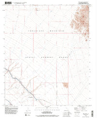
 1997 Ogilby2002 Print · USGSImperial County mining history comes to life in the late twentieth century among the desert peaks and shifting sands. Genealogists and researchers can trace the Ogilby (Site) townsite and numerous workings like the American Girl Mine and Padre Madre Mine.
 - 1997 Map of Yuma West, 2003 Print
 1997 Yuma West2003 Print · USGSThe Colorado River borderlands in the late twentieth century reveal a sophisticated landscape of desert irrigation and military presence. Researchers can trace the water works from Pilot Knob Hydro-electric Plant to the Hanlon Cem and the U S Marine Corps Air Station.
Showing maps 1-25 of 38
Top cities of Imperial County
- El Centro historical maps
- Calexico historical maps
- Brawley historical maps
- Imperial historical maps
- Calipatria historical maps
- Holtville historical maps
See more
Frequently asked questions
- What are the different types of historical maps available for Imperial County?
- What is the oldest map of Imperial County?
- Where can I purchase historical maps of Imperial County for my home or office?
- Where can I download high-res historical maps of Imperial County?
- Are there historical topographic maps available for Imperial County?
- Is there historical aerial imagery available for Imperial County?
- Where are historical maps of Imperial County sourced from?