1960s Maps of Imperial County, California
Explore 23 historic maps of Imperial County from the 1960s. These maps offer a rare glimpse into what life looked like during the 1960s — showing old roads, neighborhoods, homes, and landmarks that have changed or disappeared over time.
Whether you're researching your family's past, planning a metal detecting trip, or studying how Imperial County's landscape evolved across the 1960s, these high-resolution maps are a powerful tool for exploring the history of this region.
- Focus on a specific era: All maps on this page are from the 1960s, giving you a focused view of this time period.
- See what’s changed: Compare century-old streets, trails, and buildings to today's modern landscape using overlays and satellite layers.
- Research with precision: Use these maps for genealogy, historical research, land use analysis, or educational projects.
- View, download, or print: Maps are fully viewable online in high resolution, and can be downloaded or printed for your own records.
Start exploring Imperial County's history through authentic maps from the 1960s. This is your window into the past.
Imperial County, CA maps
(23)- 1960 Map of Santa Ana
 1960 Santa Ana1960 Print · USGSSouthern California's coastal plains and inland deserts meet in this mid-century survey of the burgeoning Orange and Riverside county corridors. Researchers can trace the layout of early freeway systems, find tribal lands like the Soboba Indian Reservation, and locate military landmarks such as March Field.2 unique versions available
 - 1960 Map of Borrego Mountain, 1961 Print
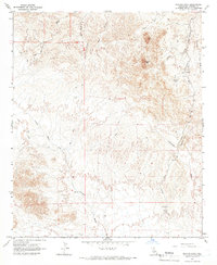
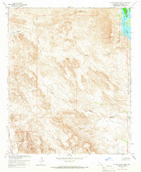
 1960 Borrego Mountain1961 Print · USGSThe Colorado Desert during the early sixties reveals a landscape of remote outposts and shifting sands within the Anza-Borrego Desert State Park. Traces of local history are preserved at the Little Borrego (Site), the USN Railroad, and the Elephant Tree Area.2 unique versions available
 - 1961 Map of El Centro
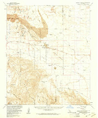
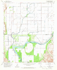
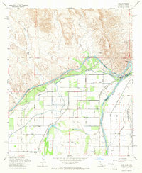
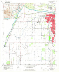
 1961 El Centro1961 Print · USGSThe California-Arizona borderlands come alive in this early sixties record of desert irrigation and military expansion. Genealogists and researchers can trace the engineering of the All American Canal and locate vanished sites like Araz and the Imperial County Tuberculosis Sanatorium.
 - 1963 Map of Salton Sea
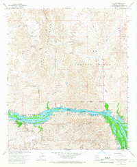
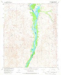
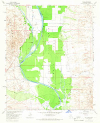
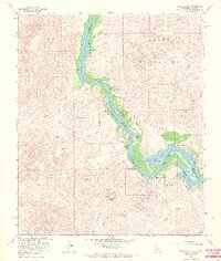
 1963 Salton Sea1963 Print · USGSThe Colorado Desert during the early sixties shows a landscape defined by massive water projects and Cold War military ranges. Trace the growth of Salton City and Brawley, or locate remote desert outposts like the Paymaster Mine and Desert Center.
 - 1963 Map of Iris Pass, 1964 Print
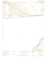
 1963 Iris Pass1964 Print · USGSThe Colorado Desert at the Imperial and Riverside county line reveals a landscape of mid-century infrastructure and mining. Trace the historic Bradshaw Road past Imperial Buttes Mine and follow the Coachella Canal through the East Mesa.2 unique versions available
 - 1963 Map of Cactus, 1965 Print
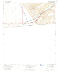
 1963 Cactus1965 Print · USGSImperial County desert life in the early sixties is defined by water and rail. Trace the Coachella Canal as it crosses East Mesa and locate the rail stop at Cactus along the Southern Pacific line.4 unique versions available
 - 1963 Map of Ogilby, 1965 Print
 1963 Ogilby1965 Print · USGSImperial County's desert mining and rail corridor is captured here in the early sixties, showing a landscape defined by the Southern Pacific line. Researchers can trace the legacy of remote camps at Ogilby and Hedges (Site) alongside dozens of named workings like the American Girl Mine.2 unique versions available
 - 1964 Map of El Centro
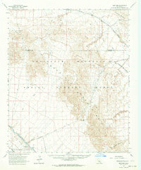
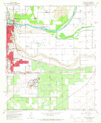
 1964 El Centro1964 Print · USGSThe agricultural heart of the California desert and the military test ranges of Arizona are revealed in this mid-century study. Genealogists and historians can trace the paths of the Southern Pacific railroad and the All American Canal near El Centro and Yuma.
 - 1964 Map of Araz, 1966 Print
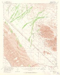
 1964 Araz1966 Print · USGSImperial County's desert borderlands appear in the 1960s as a study in irrigation and early boundary lines. Researchers can trace the Old Indian Treaty Boundary and locate the Araz (Site) near the All American Canal.4 unique versions available
 - 1964 Map of Picacho, 1966 Print
 1964 Picacho1966 Print · USGSThe Colorado River border and Trigo Mountains are mapped here in the mid-1960s, showing a landscape defined by mining and wildlife conservation. Researchers can locate remote desert workings like the Black Rock Mine or the historical Picacho Mill (Ruins).3 unique versions available
 - 1964 Map of Grays Well NE, 1966 Print
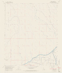
 1964 Grays Well NE1966 Print · USGSThe international border and the desert irrigation frontier meet in the mid-1960s as water infrastructure transformed the landscape. Researchers can trace the massive All American Canal and the northern edge of the Cocopah Indian Reservation near the Southern Pacific railroad.4 unique versions available
 - 1964 Map of Grays Well, 1972 Print
 1964 Grays Well1972 Print · USGSThe California-Mexico borderlands come into focus during the mid-sixties, showcasing the vital irrigation infrastructure of the Imperial Valley. Trace the paths of the All American Canal and Coachella Canal past landmarks like Gordons Well.2 unique versions available
 - 1965 Map of Santa Ana
 1965 Santa Ana1965 Print · USGSSouthern California is captured in a decade of rapid growth, showing the coastal expansion from Santa Ana down to Oceanside. Genealogists and historians can trace the mid-century development of places like Garden Grove or the rural reaches of Escondido and the Palomar Observatory.
 - 1965 Map of Salton Sea
 1965 Salton Sea1965 Print · USGSThe Colorado Desert and Imperial Valley are caught in a period of intense irrigation and military expansion during the mid-sixties. Researchers can trace the desert's industrial footprint through the Eagle Mountain Mine, the remote Desert Center, and the Salton Sea Test Base.
 - 1965 Map of Picacho NW, 1966 Print
 1965 Picacho NW1966 Print · USGSThe Colorado River corridor near the California-Arizona border comes to life in this mid-1960s survey. Researchers can trace the river's original wetlands and backwaters, locating specific historical sites like Paymaster Landing, Walters Camp, and the Clip Mill (Site).2 unique versions available
 - 1965 Map of Cibola, 1966 Print
 1965 Cibola1966 Print · USGSThe Arizona-California border comes alive in the mid-1960s as the river shapes the valley's development and conservation. Genealogists and historians can trace the settlement of Cibola, the local Cem, and desert landmarks like the Landing Strip and Davis Lake.3 unique versions available
 - 1965 Map of Picacho Peak, 1966 Print
 1965 Picacho Peak1966 Print · USGSImperial County’s desert landscape was a remote hub of mining and rugged travel during the mid-twentieth century. Local historians can trace the paths of an old Jeep Trail leading to the Picacho Mine and its nearby Cemetery nestled among the peaks.3 unique versions available
 - 1965 Map of Palo Verde, 1966 Print
 1965 Palo Verde1966 Print · USGSThe Colorado River borderlands in the mid-sixties reveal a landscape defined by industrial irrigation and desert crossings. You can trace the historic Bradshaw Trail, locate the Cibola Bridge, and explore the waterways of the Cibola National Wildlife Refuge.4 unique versions available
 - 1965 Map of Yuma East, 1966 Print
 1965 Yuma East1966 Print · USGSThe confluence of the Colorado and Gila Rivers in the mid-1960s reveals a desert landscape transformed by massive irrigation and military infrastructure. Trace the early layout of Yuma, from the Yuma Territorial Prison to the US Marine Corps Air Station.3 unique versions available
 - 1965 Map of Bard, 1966 Print
 1965 Bard1966 Print · USGSThe California-Arizona borderlands in the mid-1960s reveal a complex system of desert irrigation and tribal lands. Genealogists and historians can trace local life through features like the Potholes Cem, the Three C Mine, and the settlement at Bard.5 unique versions available
 - 1965 Map of Little Picacho Peak, 1966 Print
 1965 Little Picacho Peak1966 Print · USGSThe arid canyons and riverine wetlands of Imperial County are frozen in time during the mid-sixties, before modern developments altered the landscape. Researchers can trace the drainage of Senator Wash and Mission Wash or locate mineral sites like the Hess Mine.2 unique versions available
 - 1965 Map of Yuma West, 1966 Print
 1965 Yuma West1966 Print · USGSYuma and the lower Colorado River valley appear here in the mid-sixties, showcasing a landscape defined by intensive irrigation and military presence. Genealogists and local historians can trace the development of neighborhood schools like Pecan Grove Sch or locate the Old Araz Stage Depot and Andrade (Site).4 unique versions available
 - 1965 Map of Picacho SW, 1966 Print
 1965 Picacho SW1966 Print · USGSThe Colorado River borderlands in the mid-sixties reveal a landscape of desert washes and riverfront ranch sites. Researchers can trace historical riverside locations like Nortons Landing (Site), Hoge Ranch (Site), and the remote Carrizo Spring.3 unique versions available
End of results
Showing maps 1-23 of 23
Top cities of Imperial County
- El Centro historical maps
- Calexico historical maps
- Brawley historical maps
- Imperial historical maps
- Calipatria historical maps
- Holtville historical maps
See more
Frequently asked questions
- What are the different types of historical maps available for Imperial County?
- What is the oldest map of Imperial County?
- Where can I purchase historical maps of Imperial County for my home or office?
- Where can I download high-res historical maps of Imperial County?
- Are there historical topographic maps available for Imperial County?
- Is there historical aerial imagery available for Imperial County?
- Where are historical maps of Imperial County sourced from?