1950s Maps of Imperial County, California
Explore 105 historic maps of Imperial County from the 1950s. These maps offer a rare glimpse into what life looked like during the 1950s — showing old roads, neighborhoods, homes, and landmarks that have changed or disappeared over time.
Whether you're researching your family's past, planning a metal detecting trip, or studying how Imperial County's landscape evolved across the 1950s, these high-resolution maps are a powerful tool for exploring the history of this region.
- Focus on a specific era: All maps on this page are from the 1950s, giving you a focused view of this time period.
- See what’s changed: Compare century-old streets, trails, and buildings to today's modern landscape using overlays and satellite layers.
- Research with precision: Use these maps for genealogy, historical research, land use analysis, or educational projects.
- View, download, or print: Maps are fully viewable online in high resolution, and can be downloaded or printed for your own records.
Start exploring Imperial County's history through authentic maps from the 1950s. This is your window into the past.
Imperial County, CA maps
(105)- 1950 Map of San Diego, 1954 Print
 1950 San Diego1954 Print · USGSCoastal San Diego and the Baja California border region come alive in this mid-century survey. Trace the early layout of National City and Chula Vista, or locate historic landmarks like the San Diego and Arizona Eastern RR and Fort Rosecrans.
 - 1951 Map of Picacho, 1952 Print
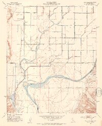
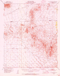
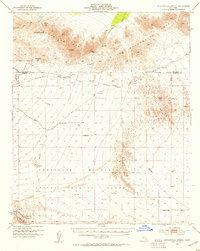
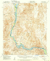 1951 Picacho1952 Print · USGSThe Colorado River corridor along the Arizona-California border is shown here in the early fifties, balancing wildlife conservation with a legacy of desert mining. Researchers can trace historic river landings and mountain operations like Nortons Landing (Site), Picacho, and the Red Cloud Mine.3 unique versions available
 - 1951 Map of Cibola, 1952 Print
 1951 Cibola1952 Print · USGSThe Colorado River borderlands in the early fifties are captured here as agriculture and mining define the local economy. Genealogists and historians can trace the legacy of Cibola, locate the Hart Gold Mine, or identify vanished landmarks like Taylor Ferry (Site).3 unique versions available
 - 1951 Map of Picacho Peak, 1953 Print
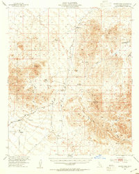
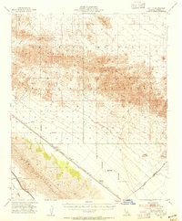
 1951 Picacho Peak1953 Print · USGSThe Lower Colorado River valley is shown in the early fifties during a period of massive hydraulic engineering. You can trace the complex irrigation networks of the Yuma Indian Reservation and locate old sites like Potholes and the Picacho Mine.2 unique versions available
 - 1952 Map of Agua Dulce
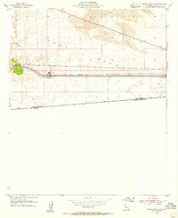
 1952 Agua Dulce1952 Print · USGSThe Coachella Valley and Santa Rosa Mountains are depicted here in the early fifties as desert travel and local industry expanded. Researchers can trace historic routes like the Truckhaven Trail and locate early landmarks such as the Flemming Saw Mill or Oasis Sch.
 - 1952 Map of Araz, 1953 Print
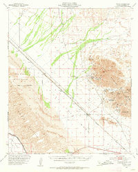
 1952 Araz1953 Print · USGSThe southeastern California desert at the start of the 1950s reveals a landscape of massive water engineering projects and mountain mining. Trace the path of the All American Canal near the Yuma Indian Reservation and find the Mine in the Cargo Muchacho Mountains.
 - 1952 Map of Yuma East, 1953 Print
 1952 Yuma East1953 Print · USGSYuma and its surrounding river valleys are captured here in the early fifties, documenting a landscape shaped by massive irrigation projects and historic western transit. Researchers can trace the Butterfield Stage Line Probable Route and locate landmarks like the Fort Yuma Indian School and Araby.
 - 1952 Map of Palo Verde, 1953 Print
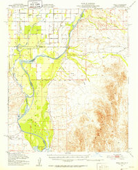
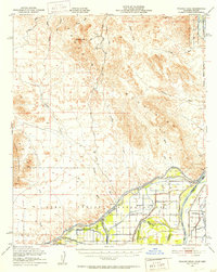
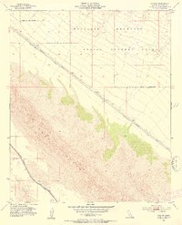
 1952 Palo Verde1953 Print · USGSThe Palo Verde Valley on the California-Arizona border reveals an intricate mid-century irrigation network as farming expanded. Trace the footprints of Rannells (Site) and Taylor Ferry (Site) along the banks of the Colorado River.3 unique versions available
 - 1952 Map of Yuma West, 1953 Print
 1952 Yuma West1953 Print · USGSThe Arizona-California borderlands were a hub of massive irrigation and transit projects in the early fifties. Local historians can trace the Butterfield Stage Route, the Southern Pacific rail lines, and the engineering of Morelos Dam.
 - 1952 Map of Bard, 1954 Print
 1952 Bard1954 Print · USGSThe California-Arizona borderlands come alive in the early 1950s as the All American Canal cuts through the desert. Trace the irrigation of the Gila Valley through landmarks like Bard, Ross Corner, and the Potholes (Site).2 unique versions available
 - 1953 Map of Calexico
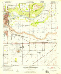
 1953 Calexico1953 Print · USGSThe borderlands of the Imperial Valley come to life in this early 1950s survey of the irrigated desert. Genealogists and local historians can trace the foundations of this agricultural hub through landmarks like Jasper Sch, Verde Sch, and the All American Canal.
 - 1953 Map of Grays Well, 1954 Print
 1953 Grays Well1954 Print · USGSIn the early 1950s, the California-Mexico border was a desert frontier shaped by massive water projects and shifting dunes. Researchers can trace the paths of the All American Canal and the Coachella Canal past isolated outposts like Gordons Well.2 unique versions available
 - 1953 Map of Palo Verde Mountains, 1954 Print
 1953 Palo Verde Mountains1954 Print · USGSThe Colorado Desert during the early 1950s reveals a landscape of volcanic peaks and historic travel corridors. You can trace the route of the Butterfield Stage Line, find the Geode Beds, and locate isolated prospects near Palo Verde Peak.5 unique versions available
 - 1953 Map of Quartz Peak, 1954 Print
 1953 Quartz Peak1954 Print · USGSImperial County's desert reaches are captured here in the early fifties, a time of active mining and military aerial training. Researchers can locate remote operations like the Paymaster Mine and Rainbow Mine or trace paths to Imperial Gables.4 unique versions available
 - 1953 Map of Ogilby, 1954 Print
 1953 Ogilby1954 Print · USGSThe Colorado Desert at mid-century reveals a landscape shaped by gold mining and massive irrigation projects. Genealogists and historians can trace the remote railroad sidings of Ogilby and Cactus or explore the many mines of the Cargo Muchacho Mountains, including the American Girl Mine and the townsite at Tumco.2 unique versions available
 - 1953 Map of Cactus, 1954 Print
 1953 Cactus1954 Print · USGSIn the mid-twentieth century, the Imperial County desert was a landscape of military testing and vital water engineering. Trace the early path of the Coachella Canal past Drop 1 or the remote Southern Pacific rail stop at Cactus.
 - 1953 Map of Acolita, 1954 Print
 1953 Acolita1954 Print · USGSImperial County's arid eastern reaches are documented here in the early fifties, showing the desert corridor before modern expansion. Trace the path of the Southern Pacific railroad through Acolita and the vast SAND HILLS toward the COACHELLA CANAL.5 unique versions available
 - 1953 Map of Chuckwalla Spring, 1954 Print
 1953 Chuckwalla Spring1954 Print · USGSThe Colorado Desert at the dawn of the 1950s reveals a transition from frontier stage routes to modern military operations. Researchers can trace the path of the historic Butterfield Stage Route and locate remote landmarks like the Pegleg Mine and Chuckwalla Well.3 unique versions available
 - 1953 Map of Grays Well NE, 1955 Print
 1953 Grays Well NE1955 Print · USGSThe California-Arizona borderlands in the early fifties show a landscape defined by desert engineering and international boundaries. Trace the massive All American Canal through the Sand Hills or locate the Cocopah Indian Reservation along the Colorado River.
 - 1953 Map of Acolita, 1955 Print
 1953 Acolita1955 Print · USGSIn the mid-fifties, the Imperial County desert was a landscape of military testing and rail transit. You can trace the Southern Pacific Road through small outposts like Acolita or locate remote mineral claims including the Black Eagle Mine.5 unique versions available
 - 1954 Map of El Centro
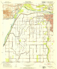
 1954 El Centro1954 Print · USGSThe Imperial Valley was at its mid-century agricultural peak when this survey recorded its vast irrigation network and desert borderlands. Researchers can trace the path of the All American Canal or locate local landmarks like Lantana School and the Tumco Mines.
 - 1954 Map of Salton Sea
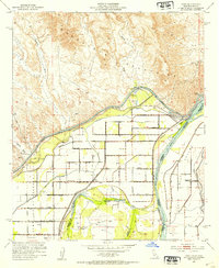
 1954 Salton Sea1954 Print · USGSThe Colorado River and Imperial Valley desert frontiers are captured here in the 1950s. Trace the irrigation networks of Calipatria and mining sites like Eagle Mountain Mine.
 - 1954 Map of San Diego
 1954 San Diego1954 Print · USGSSan Diego and the northern reaches of Baja California are captured here during a decade of rapid post-war growth and military expansion. Researchers can trace the mid-century shoreline of Mission Beach, find established tribal lands like Capitan Grande Indian Reservation, and follow the border crossing into Tijuana.
 - 1954 Map of Midway Well NW, 1955 Print
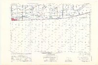
 1954 Midway Well NW1955 Print · USGSThe Imperial Valley desert comes into sharp focus during the mid-fifties as massive water projects reshaped the borderlands. Genealogists and historians can trace irrigation infrastructure like the All American Canal and the isolated Experimental Farm No 1.4 unique versions available
 - 1954 Map of Little Picacho Peak, 1955 Print
 1954 Little Picacho Peak1955 Print · USGSThe Colorado River borderlands in the mid-fifties are shown here as a rugged landscape of desert washes and mountain mines. Local history researchers can trace old desert routes like the Jeep Trail and locate early extraction sites including the Hess Mine and Copper Basin.
Showing maps 1-25 of 105
Top cities of Imperial County
- El Centro historical maps
- Calexico historical maps
- Brawley historical maps
- Imperial historical maps
- Calipatria historical maps
- Holtville historical maps
See more
Frequently asked questions
- What are the different types of historical maps available for Imperial County?
- What is the oldest map of Imperial County?
- Where can I purchase historical maps of Imperial County for my home or office?
- Where can I download high-res historical maps of Imperial County?
- Are there historical topographic maps available for Imperial County?
- Is there historical aerial imagery available for Imperial County?
- Where are historical maps of Imperial County sourced from?