1990s Maps of Upper Lake, California
Explore 3 historic maps of Upper Lake from the 1990s. These maps offer a rare glimpse into what life looked like during the 1990s — showing old roads, neighborhoods, homes, and landmarks that have changed or disappeared over time.
Whether you're researching your family's past, planning a metal detecting trip, or studying how Upper Lake's landscape evolved across the 1990s, these high-resolution maps are a powerful tool for exploring the history of this region.
- Focus on a specific era: All maps on this page are from the 1990s, giving you a focused view of this time period.
- See what’s changed: Compare century-old streets, trails, and buildings to today's modern landscape using overlays and satellite layers.
- Research with precision: Use these maps for genealogy, historical research, land use analysis, or educational projects.
- View, download, or print: Maps are fully viewable online in high resolution, and can be downloaded or printed for your own records.
Start exploring Upper Lake's history through authentic maps from the 1990s. This is your window into the past.
Upper Lake, CA maps
(3)- 1991 Map of Upper Lake, 1995 Print
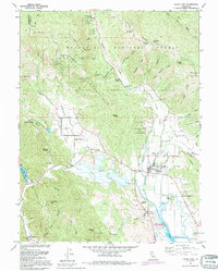 1991 Upper Lake1995 Print · USGSUpper Lake and the surrounding rancherias are shown here during the late twentieth century, before major changes to the valley drainage. You can trace local history through the Bloody Island Massacre Historical Marker, the Witter Springs P O, and several area schools like Union High Sch.
 - 1994 Map of Lakeport
 1994 Lakeport1994 Print · USGSCoastal mountains meet the fertile Sacramento Valley in the 1990s, where the waters of Clear Lake define the western landscape. Researchers can trace the industrial footprint of the Sulphur Bank Mine, follow the Southern Pacific RR tracks, or locate old settlements like Fouts Springs and Lodoga.
 - 1996 Map of Upper Lake, 2001 Print
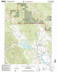 1996 Upper Lake2001 Print · USGSUpper Lake and the Mendocino foothills appear in the mid-nineties as a landscape of tribal rancherias, historic springs, and valley agriculture. Genealogists can locate family landmarks like Witter Springs, Hunter Ranch, and the Union High Sch.
End of results
Showing maps 1-3 of 3
Top cities near Upper Lake
- Clearlake historical maps
- Lakeport historical maps
- Clearlake Riviera historical maps
- Kelseyville historical maps
- Lucerne historical maps
- Nice historical maps
See more
Frequently asked questions
- What are the different types of historical maps available for Upper Lake?
- What is the oldest map of Upper Lake?
- Where can I purchase historical maps of Upper Lake for my home or office?
- Where can I download high-res historical maps of Upper Lake?
- Are there historical topographic maps available for Upper Lake?
- Is there historical aerial imagery available for Upper Lake?
- Where are historical maps of Upper Lake sourced from?