1940s Maps of Los Angeles County, California
Explore 83 historic maps of Los Angeles County from the 1940s. These maps offer a rare glimpse into what life looked like during the 1940s — showing old roads, neighborhoods, homes, and landmarks that have changed or disappeared over time.
Whether you're researching your family's past, planning a metal detecting trip, or studying how Los Angeles County's landscape evolved across the 1940s, these high-resolution maps are a powerful tool for exploring the history of this region.
- Focus on a specific era: All maps on this page are from the 1940s, giving you a focused view of this time period.
- See what’s changed: Compare century-old streets, trails, and buildings to today's modern landscape using overlays and satellite layers.
- Research with precision: Use these maps for genealogy, historical research, land use analysis, or educational projects.
- View, download, or print: Maps are fully viewable online in high resolution, and can be downloaded or printed for your own records.
Start exploring Los Angeles County's history through authentic maps from the 1940s. This is your window into the past.
Los Angeles County, CA maps
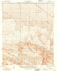
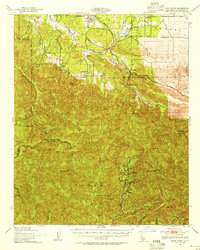
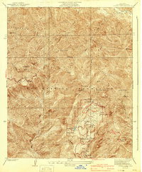
(83)- 1940 Map of Trail Canyon
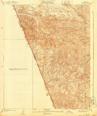
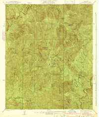
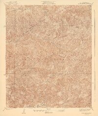 1940 Trail Canyon1940 Print · USGSThe high San Gabriel peaks and canyons are captured here in the mid-1930s, showing the early infrastructure of the Angeles National Forest. Researchers can trace old utility routes like the transmission line and local landmarks like Yerba Buena Spring and Condor Peak.4 unique versions available
 - 1940 Map of Valyermo
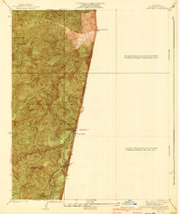
 1940 Valyermo1940 Print · USGSThe northern slopes of the San Gabriel Mountains meet the Antelope Valley in the late 1930s. Genealogists and historians can trace old homesteads and local infrastructure like the Aldrich Ranch, the Llano P O, and the Valyermo Ranger Sta.4 unique versions available
 - 1940 Map of Evey Canyon
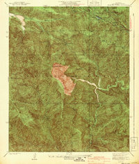
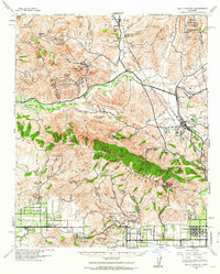
 1940 Evey Canyon1940 Print · USGSThe foothills of the San Gabriel Mts meet the growing community of Claremont in this 1940s-era survey. Genealogists and local historians can trace the early road network of the valley and find mountain landmarks like the Norton Sch and Lower San Antonio Guard Station.3 unique versions available
 - 1940 Map of La Verne
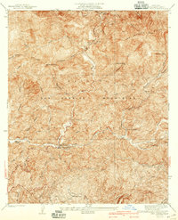
 1940 La Verne1940 Print · USGSLa Verne and Claremont are captured here just before the mid-century population boom, showing a landscape defined by foothill canyons and early college campuses. Genealogists and historians can trace local landmarks like Scripps College, the Metropolitan Aqueduct, and Wolfskill Camp.4 unique versions available
 - 1940 Map of Pico
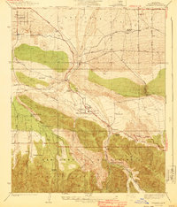
 1940 Pico1940 Print · USGSThe northern reaches of the Santa Susana Mountains appear here in the late 1930s, showing the complex canyons of the Los Angeles and Ventura county line. Researchers can trace early settlements and remote outposts like Pico and La Quinta or locate high-country landmarks such as Oat Mtn Lookout.
 - 1940 Map of Camp Baldy
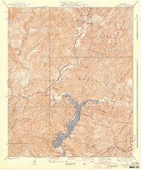
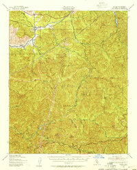
 1940 Camp Baldy1940 Print · USGSMount Baldy’s early high-altitude culture and canyon mining are frozen in time just before the mid-century. Researchers can trace the paths to the Gold Dollar Mine, locate the Camp Baldy Guard Station, and see the early route of Baldy Road.3 unique versions available
 - 1940 Map of Mt. Baden-Powell
 1940 Mt. Baden-Powell1940 Print · USGSThe high peaks and deep canyons of the San Gabriel Mountains are captured here in the 1940s, showing the early recreational and industrial footprint in the national forest. Researchers can trace the path of the San Andreas Rift Zone and locate historic sites like the Big Horn Mine and the Boy Scout Camp.4 unique versions available
 - 1940 Map of Camp Bonita
 1940 Camp Bonita1940 Print · USGSThe San Gabriel Mountains in the 1930s reveal a landscape of mining, ranching, and early forest management. Trace the historic East Fork San Gabriel River to find sites like the Allison Mine, Thompson Ranch, and Camp Bonita.3 unique versions available
 - 1940 Map of Mescal Creek
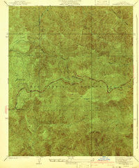
 1940 Mescal Creek1940 Print · USGSThe San Gabriel Mountains meet the Antelope Valley in the late 1940s, revealing a landscape shaped by geological forces and early ranching. Trace local history at Hagenbaugh Ranch, the San Andreas Rift Zone, and the settlement of Largo Vista.3 unique versions available
 - 1940 Map of Camp Rincon
 1940 Camp Rincon1940 Print · USGSThe San Gabriel Mountains in the 1940s showcase a landscape being transformed by flood control and forest management. Researchers can trace the early footprint of San Gabriel Dam No 1 and find isolated local landmarks like Coldbrook Camp and the Canyon Sch.4 unique versions available
 - 1940 Map of Chatsworth
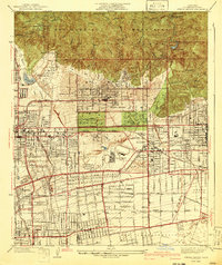
 1940 Chatsworth1940 Print · USGSThe northwest San Fernando Valley appears in the 1940s as a land of iconic movie ranches and burgeoning citrus communities. Researchers can trace the early footprints of Chatsworth and Canoga Park or locate family-named sites like Iverson Ranch and Brandies Ranch.
 - 1940 Map of Castaic
 1940 Castaic1940 Print · USGSNorth of Los Angeles in the 1940s, the canyons around the Santa Clara River supported a network of isolated waystations and small schools. Genealogists can trace family footprints at Liveoak Sch, Valverde Lodge, or the agricultural Wayside Farm No 1.3 unique versions available
 - 1940 Map of Mt. Emma
 1940 Mt. Emma1940 Print · USGSHigh in the San Gabriel Mountains during the mid-1930s, this survey captures the rugged landscape and infrastructure of the Angeles National Forest. You can trace the early path of the Angeles Forest Highway and locate remote sites like the Wagonwheel Ranch and the CCC Camp near the dam.3 unique versions available
 - 1940 Map of Rock Creek, 1955 Print
 1940 Rock Creek1955 Print · USGSHigh desert settlements and steep mountain peaks meet in this mid-century look at the eastern San Gabriel range. Researchers can trace the path of the Andreas Rift Zone and locate early ranch sites like Saunders Ranch and the community of Valyermo.
 - 1940 Map of San Fernando, 1955 Print
 1940 San Fernando1955 Print · USGSThe northern Los Angeles basin is shown here just before the postwar housing boom, as the valley floor transitioned from rural estates to suburban centers. Genealogists can trace family footprints near the San Fernando Mission or follow the rail lines through Solemint and Sylmar.2 unique versions available
 - 1940 Map of Acton, 1955 Print
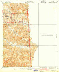
 1940 Acton1955 Print · USGSThe high canyons of the San Gabriel Mountains are captured here during the 1940s, showing the early reach of water infrastructure and mining in the region. Genealogists and historians can trace the Southern Pacific rail line through Acton and Ravenna, or locate remote sites like the Monte Cristo Mine.
 - 1941 Map of Waterman Mtn
 1941 Waterman Mtn1941 Print · USGSThe San Gabriel Mountains come into focus in the early 1940s as infrastructure begins to reach into the high country. Trace the early alignment of the Angeles Crest Highway past Newcomb Ranch and the remote Squaw Camp.2 unique versions available
 - 1941 Map of Sierra Madre
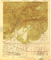
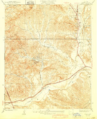
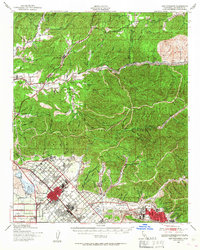
 1941 Sierra Madre1941 Print · USGSThe San Gabriel foothills and burgeoning valley floor are captured here just before the mid-century population explosion. Genealogists and local historians can trace the early layouts of Arcadia, Sierra Madre, and the historic Kinneloa Ranch near the Pacific Electric lines.2 unique versions available
 - 1941 Map of Swarthout
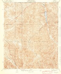
 1941 Swarthout1941 Print · USGSThe high San Gabriel Mountains come into focus during the mid-1930s as a hub for scientific observation and mountain recreation. Researchers can trace the San Andreas Rift Zone or locate early forest outposts like Smithsonian Observatory and Prairie Fork Guard Sta.3 unique versions available
 - 1941 Map of Crystal Lake
 1941 Crystal Lake1941 Print · USGSThe high San Gabriel Mountains are captured here in the early 1940s, just as mountain recreation was becoming formalized in the national forest. Researchers can trace early resort and camp footprints at Wawona Lodge and the Crystal Lake Camp Area, or locate remote landmarks like the YMCA Hut.4 unique versions available
 - 1941 Map of Zelzah
 1941 Zelzah1941 Print · USGSThe San Fernando Valley is seen here in a pivotal pre-war era of agricultural colonies and early suburban plats. Researchers can trace the layout of the Runnymede Poultry Colony, the transition at Zelzah Northridge PO and Sta, and legacy holdings like Marwyck Ranch.2 unique versions available
 - 1941 Map of Alder Creek
 1941 Alder Creek1941 Print · USGSDeep in the San Gabriel Mountains during the mid-1930s, this survey reveals a landscape of high summits and early forest infrastructure. Researchers can locate the Monte Cristo Mine, Loomis Ranch, and the Chilao Guard Station as they appeared before the war.3 unique versions available
 - 1941 Map of Las Bolsas, 1961 Print
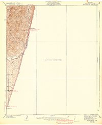
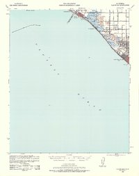 1941 Las Bolsas1961 Print · USGSCoastal Orange County appears at the brink of the war years, showing a shoreline defined by marshlands and early beach communities. Genealogists and local historians can trace the Pacific Electric line and explore landmarks like the Bolsa Chica Gun Club and Meadow Lark Country Club Sch.2 unique versions available
 - 1941 Map of Santa Susana, 1964 Print
 1941 Santa Susana1964 Print · USGSVentura and Los Angeles counties meet in this 1940s landscape of steep canyons and early oil development. Researchers can trace the ranching history of Brandeis Ranch and Iverson Ranch or locate industrial sites like the Newhall-Potrero Oil Field.2 unique versions available
 - 1942 Map of Downey
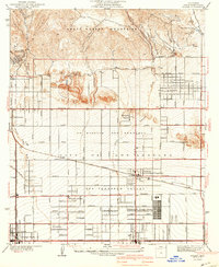
 1942 Downey1942 Print · USGSThe Los Angeles Basin and North Orange County appear here during the wartime boom, showcasing a landscape transitioning from ranchos to suburbs. Trace the historic Pacific Electric rail lines, the oil fields of Santa Fe Springs, and early settlements like Hynes and Studebaker.
Showing maps 1-25 of 83
Top cities of Los Angeles County
- Los Angeles historical maps
- Long Beach historical maps
- Glendale historical maps
- Santa Clarita historical maps
- Pomona historical maps
- Palmdale historical maps
See more
Frequently asked questions
- What are the different types of historical maps available for Los Angeles County?
- What is the oldest map of Los Angeles County?
- Where can I purchase historical maps of Los Angeles County for my home or office?
- Where can I download high-res historical maps of Los Angeles County?
- Are there historical topographic maps available for Los Angeles County?
- Is there historical aerial imagery available for Los Angeles County?
- Where are historical maps of Los Angeles County sourced from?