1970s Maps of Los Angeles County, California
Explore 26 historic maps of Los Angeles County from the 1970s. These maps offer a rare glimpse into what life looked like during the 1970s — showing old roads, neighborhoods, homes, and landmarks that have changed or disappeared over time.
Whether you're researching your family's past, planning a metal detecting trip, or studying how Los Angeles County's landscape evolved across the 1970s, these high-resolution maps are a powerful tool for exploring the history of this region.
- Focus on a specific era: All maps on this page are from the 1970s, giving you a focused view of this time period.
- See what’s changed: Compare century-old streets, trails, and buildings to today's modern landscape using overlays and satellite layers.
- Research with precision: Use these maps for genealogy, historical research, land use analysis, or educational projects.
- View, download, or print: Maps are fully viewable online in high resolution, and can be downloaded or printed for your own records.
Start exploring Los Angeles County's history through authentic maps from the 1970s. This is your window into the past.
Los Angeles County, CA maps
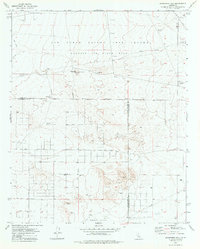
(26)- 1973 Map of Rosamond Lake, 1976 Print
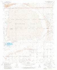 1973 Rosamond Lake1976 Print · USGSThe high desert of northern Los Angeles County in the early seventies is defined by its military aerospace footprint and dry lake beds. Trace the early layout of Edwards Air Force Base and find remote landmarks like Piute Ponds and Red Hill.2 unique versions available
 - 1973 Map of Rogers Lake South, 1976 Print
 1973 Rogers Lake South1976 Print · USGSThe High Desert at the height of the Cold War reveals a landscape of specialized aviation testing and military infrastructure. Trace the Low Altitude Speed Course across Rogers Lake or locate technical sites like the Tracking Station and Mt Mesa.2 unique versions available
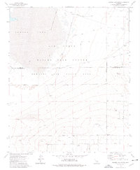
 - 1973 Map of Rosamond, 1977 Print
 1973 Rosamond1977 Print · USGSRosamond and the western edge of the Mojave Desert are captured here in the early 1970s, showing a landscape defined by aerospace and rail. Researchers can trace the Southern Pacific tracks through Rosamond and Oban, or locate landmarks like Rosamond Airport and Edwards Air Force Base.2 unique versions available
 - 1973 Map of Redman, 1977 Print
 1973 Redman1977 Print · USGSThe high desert of the Antelope Valley comes to life in this early 1970s survey, showing the vast military footprint in the Los Angeles and Kern County borderlands. Genealogists and researchers can trace the rural settlement of Redman and the Grange Hall alongside the specialized facilities of Edwards Air Force Base.2 unique versions available
 - 1973 Map of Jackrabbit Hill, 1977 Print
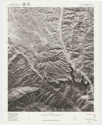
 1973 Jackrabbit Hill1977 Print · USGSIn the early 1970s, this desert landscape at the intersection of Kern, Los Angeles, and San Bernardino Counties was a hub for aerospace testing. Researchers can trace military infrastructure from Observation Tower sites to specific family-named landmarks like Houne Place and Jackrabbit Hill.
 - 1974 Map of Whittier, 1975 Print
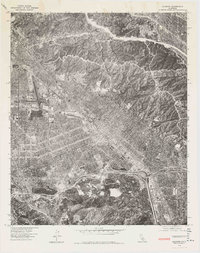
 1974 Whittier1975 Print · USGSThe residential and industrial expansion of Southeast Los Angeles is captured in this mid-seventies photographic survey. Genealogists and researchers can trace the detailed street grids and commercial development of Whittier, Downey, and Pico Rivera.
 - 1974 Map of La Habra, 1977 Print
 1974 La Habra1977 Print · USGSOrange County underwent rapid transformation in the mid-seventies, as shown in this detailed aerial study. Genealogists and local historians can trace the specific development of residential blocks and commercial corridors in La Habra and Fullerton.
 - 1974 Map of Seal Beach, 1977 Print
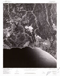
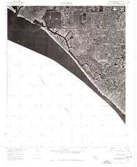 1974 Seal Beach1977 Print · USGSThe Orange County coast comes into sharp focus in the mid-1970s, showing the rapid suburbanization of the shoreline. Trace the expansion of Seal Beach and Huntington Beach through these detailed aerial photographs.
 - 1974 Map of Los Alamitos, 1977 Print
 1974 Los Alamitos1977 Print · USGSNorthern Orange County comes into sharp focus during the mid-seventies, showing the dense suburban development of Los Alamitos. Trace the growth of the region through its residential grids and industrial landmarks near Garden Grove.
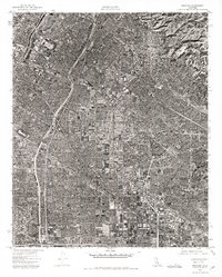
 - 1975 Map of Los Angeles, 1977 Print
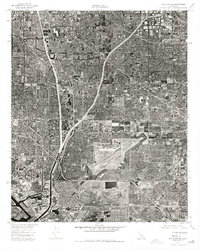
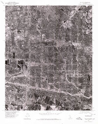
 1975 Los Angeles1977 Print · USGSSouthern California is captured in a period of significant growth during the mid-seventies, showing the urban sprawl from the coast to the high desert. Researchers can trace the development of the Pacific Coast Hwy and find aerospace landmarks like Edwards Air Force Base and the Flight Test Center (NASA).2 unique versions available
 - 1976 Map of Condor Peak
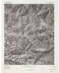
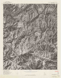 1976 Condor Peak1976 Print · USGSCovers Los Angeles County, including Los Angeles, Glendale, and other nearby areas
 - 1976 Map of Azusa
 1976 Azusa1976 Print · USGSCovers Los Angeles County, including Glendora, Azusa, and other nearby areas
 - 1976 Map of Crystal Lake
 1976 Crystal Lake1976 Print · USGSCovers Los Angeles County, including Crystal Lake, Falling Springs, and other nearby areas
 - 1976 Map of Chilao Flat
 1976 Chilao Flat1976 Print · USGSCovers Los Angeles County, including Chilao, United States, and other nearby areas
 - 1976 Map of Canoga Park, 1977 Print
 1976 Canoga Park1977 Print · USGSCovers Los Angeles County, including Los Angeles, Calabasas, and other nearby areas2 unique versions available
 - 1976 Map of Burbank, 1977 Print
 1976 Burbank1977 Print · USGSCovers Los Angeles County, including Los Angeles, Glendale, and other nearby areas
 - 1976 Map of Calabasas, 1980 Print
 1976 Calabasas1980 Print · USGSCovers Los Angeles County, including Los Angeles, Simi Valley, and other nearby areas2 unique versions available
 - 1976 Map of Van Nuys, 1980 Print
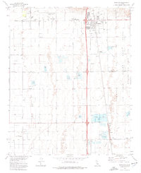
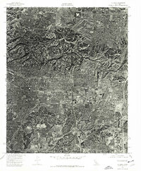
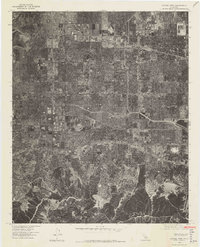
 1976 Van Nuys1980 Print · USGSThe San Fernando Valley is seen in the mid-1970s as a fully realized suburban landscape defined by its famous street grid and industrial hubs. Researchers can trace the mid-century development of Van Nuys and North Hollywood alongside the Los Angeles River.
 - 1976 Map of Oat Mountain, 1980 Print
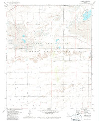
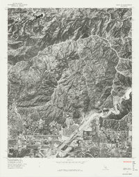
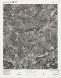
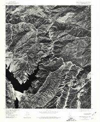
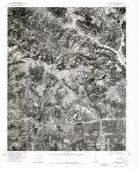 1976 Oat Mountain1980 Print · USGSThe San Fernando Valley meets the Santa Susana Mountains in the mid-seventies, showing the precise suburban edge of Granada Hills. Trace the undeveloped ridgelines around Oat Mountain and the early layout of Newhall to the north.
 - 1976 Map of Thousand Oaks, 1981 Print
 1976 Thousand Oaks1981 Print · USGSThousand Oaks is shown in the mid-seventies just as modern suburban development began to reshape the valley. Local historians can trace the early footprint of modern neighborhoods as they expanded toward Simi Peak and the natural draws of Skeleton Canyon.
 - 1976 Map of Topanga, 1981 Print
 1976 Topanga1981 Print · USGSPacific Palisades and the Santa Monica Mountains are seen from the air in the mid-seventies, showing the expansion of coastal neighborhoods. Trace mid-century development patterns across Pacific Palisades, Fernwood, and Topanga.
 - 1978 Map of Black Mtn
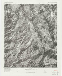
 1978 Black Mtn1978 Print · USGSCovers Los Angeles County, including Caswell, Ventura County, and other nearby areas
 - 1978 Map of Burnt Peak
 1978 Burnt Peak1978 Print · USGSCovers Los Angeles County, including Three Points, Lake Hughes, and other nearby areas
 - 1978 Map of Palmdale, 1981 Print
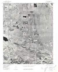 1978 Palmdale1981 Print · USGSThe Antelope Valley enters a period of significant growth in the late seventies, documented here through detailed orthophoto imagery. Researchers can trace the development of residential grids near Palmdale and Pearland or locate landmarks like Lake Palmdale.
 - 1978 Map of Warm Springs Mtn, 1981 Print
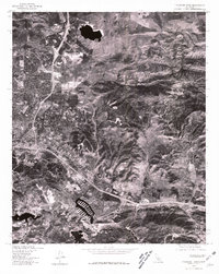
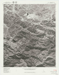
 1978 Warm Springs Mtn1981 Print · USGSNorthern Los Angeles County is captured in detailed aerial imagery during the late seventies, showing the remote high-country terrain before modern shifts. Researchers can trace the layout of Warm Springs Camp and the winding route through Francisquito Canyon.
Showing maps 1-25 of 26
Top cities of Los Angeles County
- Los Angeles historical maps
- Long Beach historical maps
- Glendale historical maps
- Santa Clarita historical maps
- Pomona historical maps
- Palmdale historical maps
See more
Frequently asked questions
- What are the different types of historical maps available for Los Angeles County?
- What is the oldest map of Los Angeles County?
- Where can I purchase historical maps of Los Angeles County for my home or office?
- Where can I download high-res historical maps of Los Angeles County?
- Are there historical topographic maps available for Los Angeles County?
- Is there historical aerial imagery available for Los Angeles County?
- Where are historical maps of Los Angeles County sourced from?