1950s Maps of Los Angeles County, California
Explore 105 historic maps of Los Angeles County from the 1950s. These maps offer a rare glimpse into what life looked like during the 1950s — showing old roads, neighborhoods, homes, and landmarks that have changed or disappeared over time.
Whether you're researching your family's past, planning a metal detecting trip, or studying how Los Angeles County's landscape evolved across the 1950s, these high-resolution maps are a powerful tool for exploring the history of this region.
- Focus on a specific era: All maps on this page are from the 1950s, giving you a focused view of this time period.
- See what’s changed: Compare century-old streets, trails, and buildings to today's modern landscape using overlays and satellite layers.
- Research with precision: Use these maps for genealogy, historical research, land use analysis, or educational projects.
- View, download, or print: Maps are fully viewable online in high resolution, and can be downloaded or printed for your own records.
Start exploring Los Angeles County's history through authentic maps from the 1950s. This is your window into the past.
Los Angeles County, CA maps
(105)- 1950 Map of San Clemente Island North
 1950 San Clemente Island North1950 Print · USGSSan Clemente Island is documented here in the mid-1940s, highlighting its role as a strategic maritime outpost. You can trace early navigational markers like the North Head Lighthouse and coastal landmarks from Wilson Cove to the Shifting Sands.
 - 1950 Map of Triunfo Pass
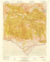
 1950 Triunfo Pass1950 Print · USGSThe coastal Santa Monica Mountains come into focus just after the war as new highways begin to carve through the canyons. Genealogists and hikers can trace the original locations of Yerba Buena Sch, Solromar, and the Triunfo Lookout.2 unique versions available
 - 1950 Map of Santa Catalina West
 1950 Santa Catalina West1950 Print · USGSWestern Santa Catalina Island in the mid-century remains a landscape of steep peaks and sheltered coves. Researchers can trace remote coastal sites like Parsons Landing, the Girl Scouts Camp, and the high summit of Mt Torquemada.
 - 1950 Map of Yorba Linda
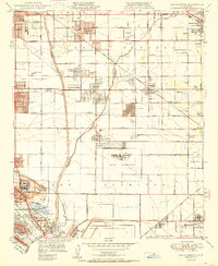
 1950 Yorba Linda1950 Print · USGSMid-century Orange County is caught in a moment of transition between its petroleum roots and growing citrus communities. Genealogists and local historians can trace the early grids of Yorba Linda and Placentia or locate sites like La Vida Mineral Springs and the Olinda Oil Field.
 - 1950 Map of San Clemente Island Central
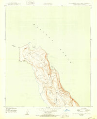
 1950 San Clemente Island Central1950 Print · USGSSan Clemente Island during the mid-century remains a landscape of high coastal ridges and primitive trails. Researchers can trace the military-era geography between Seal Cove and Black Point, locating named landmarks like Arizona and Tomb.
 - 1950 Map of Fairmont
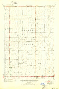
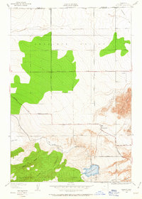 1950 Fairmont1950 Print · USGSThe northern edge of the Antelope Valley comes into focus mid-century at the boundary of Los Angeles and Kern counties. Researchers can trace the path of the Los Angeles Aqueduct and locate local landmarks like Fairmont, Fairmont Butte, and the Fairmont Reservoir.
 - 1950 Map of Santa Catalina South
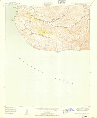 1950 Santa Catalina South1950 Print · USGSSanta Catalina's southern interior and coastline are captured in the late 1940s, showing the island's rugged ranching and maritime landscape. Researchers can trace the development of Middle Ranch and find remote coastal landmarks like China Point and Silver Canyon Landing.
 - 1950 Map of Santa Catalina East
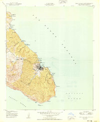 1950 Santa Catalina East1950 Print · USGSSanta Catalina Island during the mid-twentieth century reveals a landscape of isolated camps and a growing harbor town. Trace the development of Avalon near landmarks like Casino Point, or locate more remote sites like the Renton Mine and Toyon.
 - 1950 Map of San Clemente Island South
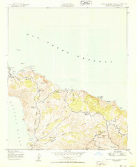
 1950 San Clemente Island South1950 Print · USGSSan Clemente Island's southern coast is captured here in the early postwar era, showing a landscape shaped by maritime navigation and military surveying. Researchers can trace the island's topography through markers like Thirst 1965 and find the coastal Lighthouse at Pyramid Cove.
 - 1950 Map of Los Alamitos
 1950 Los Alamitos1950 Print · USGSCoastal Southern California is captured here in the mid-century as citrus groves and ranches gave way to defense facilities and new suburbs. Researchers can trace the development of Hawaiian Gardens or locate family history at Artesia Cem and the Pioneer Sch.
 - 1950 Map of Seal Beach
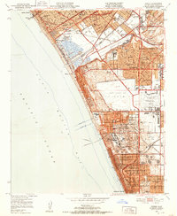
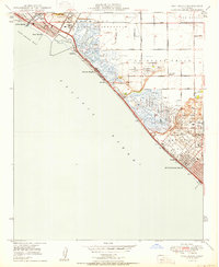 1950 Seal Beach1950 Print · USGSThe Orange County coast in the late Forties is a landscape of expansive wetlands, oil derricks, and emerging beach towns. Researchers can trace the Pacific Electric rail route or locate vanished landmarks like East Long Beach Airport and Wintersburg.
 - 1950 Map of Santa Catalina North
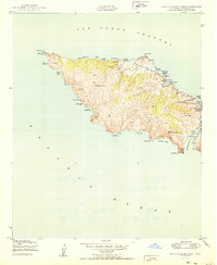
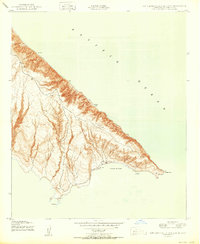
 1950 Santa Catalina North1950 Print · USGSNorthern Santa Catalina Island in the mid-forties reveals a landscape of cattle ranching and isolated coastal landings. Trace the footprint of the Wrigley Ranch, find the inland Black Jack Camp, and explore the diverse coves from Fishermans Cove to Goat Harbor.
 - 1950 Map of Beverly Hills, 1952 Print
 1950 Beverly Hills1952 Print · USGSBeverly Hills and the Westside are captured during a period of rapid post-war expansion along the base of the Santa Monica Mountains. Researchers can trace the legacy of the Soldiers Home, the early campus of UCLA, and the Pacific Electric rail lines.4 unique versions available
 - 1950 Map of Venice, 1952 Print
 1950 Venice1952 Print · USGSThe Westside and South Bay are captured here during the post-war building boom, showing the early footprint of Los Angeles International Airport. Researchers can trace the era's infrastructure through the Pacific Electric lines, old schools like Venice High Sch, and the now-defunct Culver City Airport.2 unique versions available
 - 1950 Map of La Habra, 1955 Print
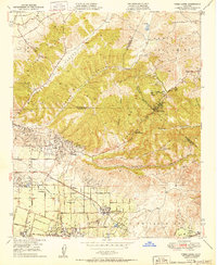
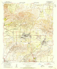 1950 La Habra1955 Print · USGSNorthern Orange County was a land of sprawling citrus ranches and active oil fields at the midpoint of the century. You can trace the transition from rural estates like Sunny Hills Ranch to the early suburban streets of La Habra and Buena Park.
 - 1950 Map of Thousand Oaks, 1955 Print
 1950 Thousand Oaks1955 Print · USGSThousand Oaks and the surrounding ranch lands are shown here in the early fifties, just as the regional highway network began to modernize. Researchers can locate early community hubs like Triunfo Corner, Greenwich Village, and the Conejo Sch.5 unique versions available
 - 1950 Map of Malibu Beach, 1955 Print
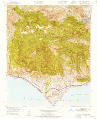
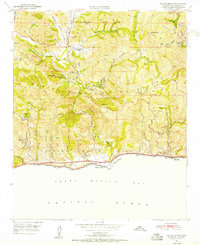 1950 Malibu Beach1955 Print · USGSCoastal Los Angeles County at mid-century reveals a landscape of private ranches and mountain retreats tucked into the canyons. Researchers can trace early property lines and landmarks like Century Ranch, the Salvation Army Camp, and Las Flores.7 unique versions available
 - 1950 Map of Point Dume, 1956 Print
 1950 Point Dume1956 Print · USGSThe coastal canyons and peaks of western Los Angeles County appear here in the early fifties, before the surge of modern residential expansion. Researchers can trace early ranch sites like Kincaid Ranch, visit Seminole Hot Springs, or locate the Castro Pk Lookout.6 unique versions available
 - 1950 Map of Inglewood, 1957 Print
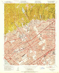
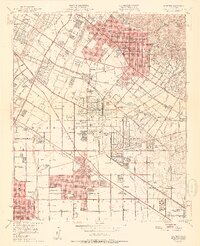
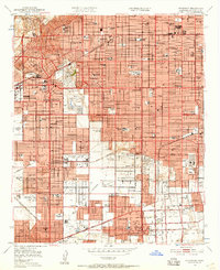 1950 Inglewood1957 Print · USGSMid-century Los Angeles County is captured here during a period of intense postwar suburban and industrial growth. Genealogists and local historians can trace the foundations of Inglewood and Hawthorne, locating landmarks like the Inglewood Park Cemetery and the Gardena Valley Airport.
 - 1950 Map of Manzana, 1957 Print
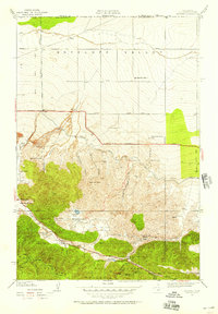 1950 Manzana1957 Print · USGSAntelope Valley and the Liebre Mountains at mid-century reveal a landscape defined by the San Andreas Rift and high-desert ranching. Genealogists can locate family holdings like Gorrindo Ranch, the Pine Canyon Sch, and the Big Chief Mine.
 - 1951 Map of Malibu Beach
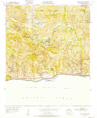 1951 Malibu Beach1951 Print · USGSThe Malibu coast and interior canyons come alive in the early 1950s, showing a landscape of remote ranches and seaside retreats. Researchers can trace early mountain landmarks like Century Ranch, find the Las Virgenes Sch, or locate coastal features like Serra Retreat.
 - 1951 Map of Point Dume
 1951 Point Dume1951 Print · USGSThe coastal mountains of Malibu and the Santa Monica range appear here in the early fifties, before the arrival of modern suburban sprawl. Researchers can trace historic landmarks like Seminole Hot Springs, the Kincaid Ranch, and the early layout of Malibu Riviera.
 - 1951 Map of Esperanza School
 1951 Esperanza School1951 Print · USGSThe Antelope Valley floor shows its early post-war development in the early 1950s, revealing a landscape of high-desert agriculture and rural schools. Genealogists and historians can trace local landmarks like West Side Union Sch and the War Eagle Airfield.2 unique versions available
 - 1951 Map of Whittier
 1951 Whittier1951 Print · USGSSoutheast Los Angeles County undergoes a massive mid-century transformation as citrus groves give way to suburban tracts and oil infrastructure. Researchers can trace the development of Santa Fe Springs and Whittier alongside landmarks like the Pio Pico Mansion State Historical Monument and Whittier College.2 unique versions available
 - 1951 Map of Santa Susana, 1952 Print
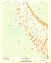
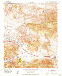
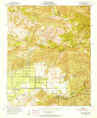 1951 Santa Susana1952 Print · USGSSimi Valley and the surrounding mountains are captured here in the early fifties, showing the region before modern suburban expansion. Researchers can trace ranching history at Tapo Ranch, locate the Santa Susana Airport, or follow the Southern Pacific line through the Santa Susana Tunnel.6 unique versions available
Showing maps 1-25 of 105
Top cities of Los Angeles County
- Los Angeles historical maps
- Long Beach historical maps
- Glendale historical maps
- Santa Clarita historical maps
- Pomona historical maps
- Palmdale historical maps
See more
Frequently asked questions
- What are the different types of historical maps available for Los Angeles County?
- What is the oldest map of Los Angeles County?
- Where can I purchase historical maps of Los Angeles County for my home or office?
- Where can I download high-res historical maps of Los Angeles County?
- Are there historical topographic maps available for Los Angeles County?
- Is there historical aerial imagery available for Los Angeles County?
- Where are historical maps of Los Angeles County sourced from?