1960s Maps of Los Angeles County, California
Explore 40 historic maps of Los Angeles County from the 1960s. These maps offer a rare glimpse into what life looked like during the 1960s — showing old roads, neighborhoods, homes, and landmarks that have changed or disappeared over time.
Whether you're researching your family's past, planning a metal detecting trip, or studying how Los Angeles County's landscape evolved across the 1960s, these high-resolution maps are a powerful tool for exploring the history of this region.
- Focus on a specific era: All maps on this page are from the 1960s, giving you a focused view of this time period.
- See what’s changed: Compare century-old streets, trails, and buildings to today's modern landscape using overlays and satellite layers.
- Research with precision: Use these maps for genealogy, historical research, land use analysis, or educational projects.
- View, download, or print: Maps are fully viewable online in high resolution, and can be downloaded or printed for your own records.
Start exploring Los Angeles County's history through authentic maps from the 1960s. This is your window into the past.
Los Angeles County, CA maps
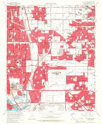
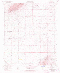
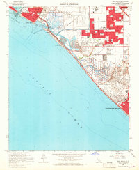
(40)- 1960 Map of Long Beach
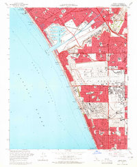
 1960 Long Beach1960 Print · USGSCoastal California at the height of post-war expansion reveals a dense network of suburban growth and maritime industry. Trace the development of the South Bay and inland neighborhoods like Lakewood Village, or explore the topography of Santa Catalina Island and Los Angeles Harbor.2 unique versions available
 - 1960 Map of Santa Ana
 1960 Santa Ana1960 Print · USGSSouthern California's coastal plains and inland deserts meet in this mid-century survey of the burgeoning Orange and Riverside county corridors. Researchers can trace the layout of early freeway systems, find tribal lands like the Soboba Indian Reservation, and locate military landmarks such as March Field.2 unique versions available
 - 1960 Map of Mint Canyon, 1961 Print
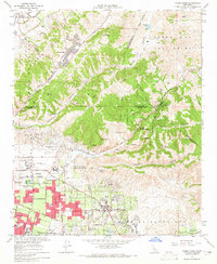
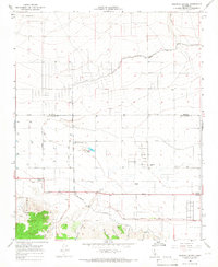
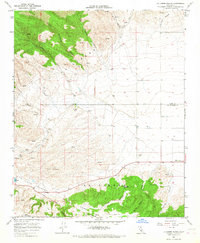
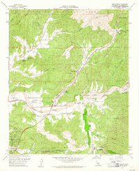 1960 Mint Canyon1961 Print · USGSLos Angeles County's northern canyons and river valleys are captured here during the early sixties, showing the rail and road network along the Santa Clara River. Genealogists and local historians can trace old settlements like Solemint, Lang, and the Sulphur Spring Sch.5 unique versions available
 - 1960 Map of Agua Dulce, 1961 Print
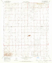
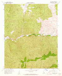 1960 Agua Dulce1961 Print · USGSAgua Dulce and the Sierra Pelona mountains are captured here in the early sixties as the Southern California backcountry remained largely rural. Local historians can trace the Southern Pacific line through Russ and Lang, and locate landmarks like Vasquez Rocks and Magic Mtn.7 unique versions available
 - 1963 Map of Redondo Beach, 1965 Print
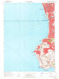 1963 Redondo Beach1965 Print · USGSThe South Bay coast and Palos Verdes Peninsula were undergoing significant suburbanization in the early sixties. Researchers can trace the era's infrastructure from the King Harbor waterfront to local landmarks like Marineland and the Atchison Topeka and Santa Fe rail line.4 unique versions available
 - 1964 Map of Inglewood, 1965 Print
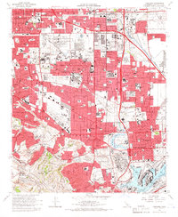
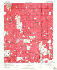 1964 Inglewood1965 Print · USGSSouthwestern Los Angeles County undergoes a mid-century suburban boom in this detailed record of the South Bay and Inglewood area. Genealogists and historians can trace neighborhood growth near Inglewood Park Cemetery, Lennox High Sch, and the local Oil Field operations.4 unique versions available
 - 1964 Map of Venice, 1965 Print
 1964 Venice1965 Print · USGSThe Los Angeles coastline undergoes a massive mid-century transformation as Marina del Rey and Los Angeles International Airport expand. Researchers can trace the growth of Westchester or find coastal landmarks like the Ocean Park Pier and Dockweiler Beach State Park.4 unique versions available
 - 1964 Map of La Habra, 1965 Print
 1964 La Habra1965 Print · USGSNorth Orange County undergoes a mid-century transformation as suburban neighborhoods rise alongside the active Oil Field landscapes of the La Habra Hills. Researchers can trace the early footprint of Calif State College at Fullerton and locate historic burial grounds like Queen of Heaven Cem.4 unique versions available
 - 1964 Map of Yorba Linda, 1965 Print
 1964 Yorba Linda1965 Print · USGSOrange County's northern hills were transitioning from oil derricks to suburban neighborhoods in the mid-sixties. Local researchers can trace early school sites like Richard M Nixon Sch, explore the grounds of La Vida Mineral Springs, or locate old landmarks in Sleepy Hollow.3 unique versions available
 - 1964 Map of San Pedro, 1965 Print
 1964 San Pedro1965 Print · USGSSan Pedro and the Palos Verdes coastline are captured in the mid-sixties, just as the Vincent Thomas Bridge reshaped the harbor's profile. Researchers can trace the extensive footprints of Fort MacArthur and the industrial layout of Terminal Island and Fish Harbor.3 unique versions available
 - 1964 Map of Los Alamitos, 1966 Print
 1964 Los Alamitos1966 Print · USGSThe Los Angeles and Orange County borderlands thrive during the mid-sixties suburban boom, characterized by massive military installations and new residential tracts. Researchers can locate vanished landmarks and early neighborhood layouts from Dairy Valley to Barber City, alongside the Naval Air Station Los Alamitos.4 unique versions available
 - 1964 Map of Torrance, 1966 Print
 1964 Torrance1966 Print · USGSMid-century Los Angeles County is captured here during a period of massive industrial and suburban growth. Genealogists and historians can locate dozens of neighborhood landmarks, from the Banning Drum Barracks to local schools like Bishop Montgomery High Sch and Casimir Sch.3 unique versions available
 - 1964 Map of South Gate, 1966 Print
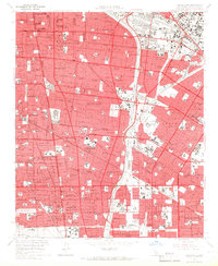 1964 South Gate1966 Print · USGSSoutheast Los Angeles County comes into focus in the mid-1960s, showing a landscape of mature suburbs and heavy rail corridors. Trace the development of local neighborhoods through sites like the Angeles Abbey Mausoleum, Old Downey Cemetery, and the Lynwood Station.4 unique versions available
 - 1964 Map of Long Beach, 1966 Print
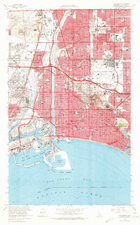 1964 Long Beach1966 Print · USGSCoastal Los Angeles County entered the mid-sixties as a powerhouse of oil production and naval activity. Researchers can trace the mid-century layout of Long Beach, the expansive Long Beach Municipal Airport, and residential areas like Bixby Knolls and Naples.5 unique versions available
 - 1965 Map of Santa Ana
 1965 Santa Ana1965 Print · USGSSouthern California is captured in a decade of rapid growth, showing the coastal expansion from Santa Ana down to Oceanside. Genealogists and historians can trace the mid-century development of places like Garden Grove or the rural reaches of Escondido and the Palomar Observatory.
 - 1965 Map of Neenach School, 1966 Print
 1965 Neenach School1966 Print · USGSAntelope Valley's high desert landscape and ranching history are frozen in time just after the mid-century. Researchers can trace the water-driven economy of the era through the Los Angeles Aqueduct, the rural Neenach School, and the Gorrindo Ranch.3 unique versions available
 - 1965 Map of Little Buttes, 1967 Print
 1965 Little Buttes1967 Print · USGSThe Antelope Valley desert comes into focus during the mid-sixties, showing a landscape defined by isolated homesteads and volcanic outcrops. Trace the early layout of Antelope Acres and find local landmarks like Rogers School or the Little Buttes.2 unique versions available
 - 1965 Map of Fairmont Butte, 1967 Print
 1965 Fairmont Butte1967 Print · USGSThe high desert of northern Los Angeles County appears in the mid-sixties as a landscape of grid-aligned roads and isolated homesteads. Genealogists and researchers can trace water infrastructure and property lines near Fairmont Butte, the Landing Strip, and Broad Canyon.2 unique versions available
 - 1965 Map of Whittier, 1967 Print
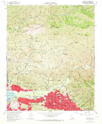
 1965 Whittier1967 Print · USGSLos Angeles County in the mid-sixties shows a landscape of rapid suburban growth and massive institutional campuses between the hills and the river. Trace the expansion of Whittier and Pico Rivera alongside landmarks like Whittier College and Rose Hills Memorial Park.5 unique versions available
 - 1965 Map of La Liebre Ranch, 1967 Print
 1965 La Liebre Ranch1967 Print · USGSNorthern Los Angeles County is captured in the mid-1960s as it transitioned between historic ranching and modern water infrastructure. Researchers can trace the Old Ridge Route or locate landmarks like La Liebre Ranch and Zana.2 unique versions available
 - 1965 Map of Seal Beach, 1967 Print
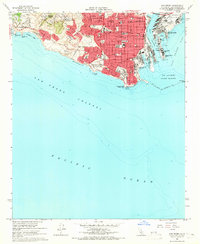
 1965 Seal Beach1967 Print · USGSCoastal Orange County undergoes significant postwar development during the mid-sixties, from the massive U S Naval Weapons Station to the developing shore. Trace local history through Meadowlark Airport, the Southern Pacific railroad, and neighborhood schools like McGaugh Sch.3 unique versions available
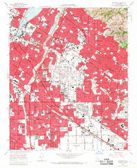
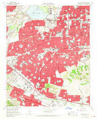
 - 1966 Map of Los Angeles
 1966 Los Angeles1966 Print · USGSSouthern California underwent a mid-century transformation as suburban grids reached the base of the San Gabriel Mountains. Researchers can trace the path of the Los Angeles Aqueduct or locate defense landmarks like Edwards Air Force Base.
 - 1966 Map of San Bernardino
 1966 San Bernardino1966 Print · USGSThe San Bernardino Valley and Mojave Desert met during a period of massive military and suburban growth in the mid-sixties. Genealogists and historians can trace the development of Edwards Air Force Base, old desert mines like the Bagdad Chase Mine, and mountain communities near Big Bear Lake.
 - 1966 Map of Baldwin Park, 1967 Print
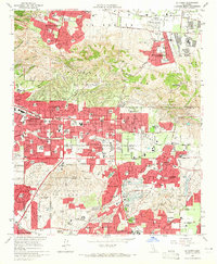
 1966 Baldwin Park1967 Print · USGSThe San Gabriel Valley is captured during its mid-century transition from industrial riverbed to suburban expanse. Researchers can trace the development of La Puente and Covina alongside specialized sites like the El Encanto Sanitarium and Oakdale Memorial Park.5 unique versions available
 - 1966 Map of Sunland, 1967 Print
 1966 Sunland1967 Print · USGSThe foothills of the Verdugo Hills and the San Gabriel Mountains meet during the suburban expansion of the mid-sixties. Researchers can trace the development of Sunland and Tujunga, locating historic sites like the Lakeview Terrace Sanitarium, Hansen Dam, and the Angeles Gun Club.3 unique versions available
Showing maps 1-25 of 40
Top cities of Los Angeles County
- Los Angeles historical maps
- Long Beach historical maps
- Glendale historical maps
- Santa Clarita historical maps
- Pomona historical maps
- Palmdale historical maps
See more
Frequently asked questions
- What are the different types of historical maps available for Los Angeles County?
- What is the oldest map of Los Angeles County?
- Where can I purchase historical maps of Los Angeles County for my home or office?
- Where can I download high-res historical maps of Los Angeles County?
- Are there historical topographic maps available for Los Angeles County?
- Is there historical aerial imagery available for Los Angeles County?
- Where are historical maps of Los Angeles County sourced from?