1930s Maps of Los Angeles County, California
Explore 145 historic maps of Los Angeles County from the 1930s. These maps offer a rare glimpse into what life looked like during the 1930s — showing old roads, neighborhoods, homes, and landmarks that have changed or disappeared over time.
Whether you're researching your family's past, planning a metal detecting trip, or studying how Los Angeles County's landscape evolved across the 1930s, these high-resolution maps are a powerful tool for exploring the history of this region.
- Focus on a specific era: All maps on this page are from the 1930s, giving you a focused view of this time period.
- See what’s changed: Compare century-old streets, trails, and buildings to today's modern landscape using overlays and satellite layers.
- Research with precision: Use these maps for genealogy, historical research, land use analysis, or educational projects.
- View, download, or print: Maps are fully viewable online in high resolution, and can be downloaded or printed for your own records.
Start exploring Los Angeles County's history through authentic maps from the 1930s. This is your window into the past.
Los Angeles County, CA maps
(145)- 1930 Map of Oban
 1930 Oban1930 Print · USGSAntelope Valley was a landscape of remote rail sidings and scattered wells during the early 1930s. Genealogists and local historians can trace the early layout of Lancaster, the location of the Lancaster Airport, and the Southern Pacific rail corridor.
 - 1930 Map of Joshua
 1930 Joshua1930 Print · USGSAntelope Valley in the early 1930s is a landscape of high desert solitude and frontier surveying. Genealogists and desert historians can trace early tracks like Well Road and locate the remote settlement of Darrwin near the southern edge of Rogers Dry Lake.
 - 1930 Map of Lovejoy Springs
 1930 Lovejoy Springs1930 Print · USGSAntelope Valley was a landscape of scattered homesteads and high-desert outposts in the early thirties. Researchers can trace the layout of early rural life near Wilsona Road, identifying the Wilsona Sch, the Yato Kya Desert Home, and Lovejoy Springs.
 - 1930 Map of Black Butte
 1930 Black Butte1930 Print · USGSAntelope Valley ranching life is frozen in time in the 1930s, showing a sparse network of family outposts and desert trails. Genealogists and historians can locate early homesteads like Hibbard Ranch and Brase Ranch or trace the old Palmdale-Victorville Road.
 - 1930 Map of Roosevelt School
 1930 Roosevelt School1930 Print · USGSAntelope Valley was a landscape of emerging rural homesteads and early water development during the 1930s. Genealogists and historians can trace family-named landmarks like Peavey Road and Hahn Road or locate the community center at Roosevelt School.
 - 1930 Map of El Mirage
 1930 El Mirage1930 Print · USGSThe high desert frontier along the Los Angeles and San Bernardino county line is captured here in the early thirties. Genealogists and desert historians can trace the isolated Walton Place and find early water sources like the lonely Well near Wilsona Road.
 - 1930 Map of Compton
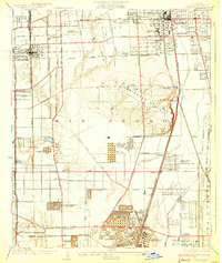 1930 Compton1930 Print · USGSThe South Bay and Gateway regions emerge as industrial powerhouses in this 1930s survey of the plains between Los Angeles and the coast. Trace the footprint of early oil operations at the Shell Oil Dominguez Refinery or locate community roots at the Gardena Japanese School and Woodlawn Cemetery.2 unique versions available
 - 1930 Map of Little Rock
 1930 Little Rock1930 Print · USGSAntelope Valley in the early thirties reveals a developing high-desert agricultural landscape defined by citrus-named routes and irrigation. Researchers can trace the layout of the Almondale settlement or locate early desert infrastructure like the Little Rock Ditch and the Apple Blossom Highway.
 - 1930 Map of Llano
 1930 Llano1930 Print · USGSAntelope Valley in the early 1930s shows a desert landscape undergoing the first major shifts of modern settlement. Researchers can trace the early road network including the Palmdale Victorville Road, the isolated Desert Relief, and the prominent Lovejoy Buttes.
 - 1930 Map of Casa Desierta
 1930 Casa Desierta1930 Print · USGSAntelope Valley was a landscape of remote homesteads and desert roads during the early 1930s. Genealogists and desert historians can trace early community hubs like Antelope Sch, Redman Sch, and the network of life-sustaining wells near Buckhorn Dry Lake.
 - 1930 Map of Ravenna
 1930 Ravenna1930 Print · USGSNorthern Los Angeles County mountainous terrain is captured in the early 1930s, showing the intersection of rail and ranching. Trace early family holdings like Jones Ranch and Mc Carthy Ranch along the SOUTHERN PACIFIC line.
 - 1930 Map of Inglewood
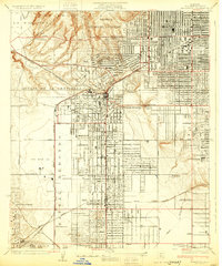 1930 Inglewood1930 Print · USGSThe South Bay and Inglewood areas are shown here during the early years of the aviation boom. You can trace the early airfields at Mines Aviation Field and Kelly's Airport or find local landmarks like the Wiseburn Sch.
 - 1930 Map of Lancaster
 1930 Lancaster1930 Print · USGSAntelope Valley during the early 1930s shows the emerging township of Lancaster as it grew along the railroad. Researchers can trace early infrastructure like the Lancaster Tubercular Rest Home and the rural footprint of Antelope Valley High Sch.
 - 1930 Map of Pearland
 1930 Pearland1930 Print · USGSThe high desert of Los Angeles County is captured here in the early thirties as the community of Pearland took shape. Genealogists and historians can trace the early orchard-district grid, from the Palmdale Cemetery to the historic Old Fort Tejon Road.
 - 1930 Map of West Alpine Butte
 1930 West Alpine Butte1930 Print · USGSHigh Desert settlement takes shape in northern Los Angeles County during the early thirties, defined by a rigid township grid. Trace early desert infrastructure along Wilsona Road and Sheldon Road, and locate vital water sources marked as Well near the base of Alpine Butte.
 - 1930 Map of Angle
 1930 Angle1930 Print · USGSThe high desert of the Antelope Valley comes into focus in 1930, capturing the region just as early roads began to define the terrain. Researchers can trace the path of the Palmdale-Victorville Road and locate an isolated desert Well.
 - 1930 Map of Wilsona
 1930 Wilsona1930 Print · USGSThe northern high desert of Los Angeles County is captured here in the early 1930s, showing the early footprint of settlement before modern expansion. Researchers can locate the small community of Wilsona and trace water sources like Eller Slough and Moody Spr.
 - 1930 Map of Tierra Bonita, 1933 Print
 1930 Tierra Bonita1933 Print · USGSThe high desert of northern Los Angeles County appears here in the early 1930s, just as the rural Antelope Valley began its modern transition. Genealogists and desert historians can trace early homesteads and landmarks like the Tierra Bonita Sch, Twin Joshua Rancho, and Little Rock Wash.
 - 1931 Map of Red Mountain
 1931 Red Mountain1931 Print · USGSLos Angeles County's northern canyons are captured in this early 1930s survey of the forest landscape and local water infrastructure. Genealogists and local historians can trace the topography of San Francisquito Canyon, Drinkwater Flat, and the Power House No 2 Reservoir.
 - 1931 Map of Whitaker Peak
 1931 Whitaker Peak1931 Print · USGSThe northwestern mountains of Los Angeles County appear here in the early 1930s, showing a landscape defined by forest service outposts and deep canyons. Researchers can trace the original locations of Agua Blanca Camp, the Piru Ranger Station, and the city-run Oak Flat Playground.
 - 1931 Map of Warm Spring
 1931 Warm Spring1931 Print · USGSThe northern reaches of Los Angeles County are captured here in the early 1930s as part of the Angeles National Forest. Researchers can trace the rugged topography of Burnt Peak and the deep cuts of Elizabeth Lake Canyon and Sawmill Canyon.
 - 1931 Map of Little Buttes
 1931 Little Buttes1931 Print · USGSAntelope Valley ranching life and early high-desert infrastructure are captured here in the early thirties. Genealogists and local historians can trace the Eric Munz Ranch, the (Esperanza School), and the path of the Old Willow Springs Road.
 - 1931 Map of Santa Felicia Canyon
 1931 Santa Felicia Canyon1931 Print · USGSCanyon ranching and cattle camps define the Ventura-Los Angeles border during the early 1930s. Genealogists and researchers can trace the locations of the Dohany Cattle Camp, Martinez Ranch, and Leckler Ranch.
 - 1931 Map of Adobe
 1931 Adobe1931 Print · USGSThe northern reaches of the Antelope Valley come into focus during the early 1930s, showing a landscape defined by county borders and early road grids. Researchers can trace the intersection of the Los Angeles Kern Co Bdy Line and local routes like Ave B.
 - 1931 Map of Castaic
 1931 Castaic1931 Print · USGSCastaic and the Santa Clara River valley appear here in the early 1930s, caught between the era of ranching and the rise of the oil industry. Researchers can find family landmarks like Sloane Ranch and the Val Verde Lodge, or trace the old U S Highway No 99.
Showing maps 1-25 of 145
Top cities of Los Angeles County
- Los Angeles historical maps
- Long Beach historical maps
- Glendale historical maps
- Santa Clarita historical maps
- Pomona historical maps
- Palmdale historical maps
See more
Frequently asked questions
- What are the different types of historical maps available for Los Angeles County?
- What is the oldest map of Los Angeles County?
- Where can I purchase historical maps of Los Angeles County for my home or office?
- Where can I download high-res historical maps of Los Angeles County?
- Are there historical topographic maps available for Los Angeles County?
- Is there historical aerial imagery available for Los Angeles County?
- Where are historical maps of Los Angeles County sourced from?