1990s Maps of Los Angeles County, California
Explore 55 historic maps of Los Angeles County from the 1990s. These maps offer a rare glimpse into what life looked like during the 1990s — showing old roads, neighborhoods, homes, and landmarks that have changed or disappeared over time.
Whether you're researching your family's past, planning a metal detecting trip, or studying how Los Angeles County's landscape evolved across the 1990s, these high-resolution maps are a powerful tool for exploring the history of this region.
- Focus on a specific era: All maps on this page are from the 1990s, giving you a focused view of this time period.
- See what’s changed: Compare century-old streets, trails, and buildings to today's modern landscape using overlays and satellite layers.
- Research with precision: Use these maps for genealogy, historical research, land use analysis, or educational projects.
- View, download, or print: Maps are fully viewable online in high resolution, and can be downloaded or printed for your own records.
Start exploring Los Angeles County's history through authentic maps from the 1990s. This is your window into the past.
Los Angeles County, CA maps
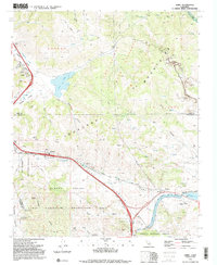
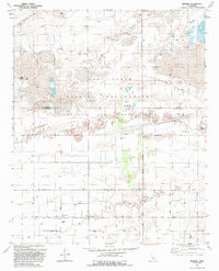
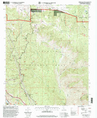
(55)- 1991 Map of Cobblestone Mtn, 1992 Print
 1991 Cobblestone Mtn1992 Print · USGSVentura County conservation and backcountry ranching history are on full display in the early nineties. Genealogists and hikers can trace Whitaker Ranch (Site) or locate remote spots like Log Cabin Campsite and Blue Point Campground.2 unique versions available
 - 1991 Map of Lebec, 1992 Print
 1991 Lebec1992 Print · USGSThe mountain passes of the Tejon area are captured here in the early nineties as a critical junction of infrastructure and recreation. Researchers can trace the San Andreas Rift Zone past Lebec and locate local landmarks like Castac Lake and the California Aqueduct.2 unique versions available
 - 1991 Map of Frazier Mtn, 1992 Print
 1991 Frazier Mtn1992 Print · USGSThe high mountain passes and tectonic rifts of Kern County are captured here in the early nineties. Researchers can trace the San Andreas Rift Zone, the grounds of Old Fort Tejon, and remote sites like Frazier Mine.2 unique versions available
 - 1991 Map of Black Mountain, 1992 Print
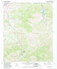
 1991 Black Mountain1992 Print · USGSSouthern California's rugged backcountry at the junction of Ventura and Los Angeles counties is shown here during the early nineties. Genealogists and local historians can locate the former Kinsey Ranch and Bailey Homestead near the shores of Pyramid Lake.2 unique versions available
 - 1991 Map of Sunland, 1995 Print
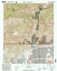
 1991 Sunland1995 Print · USGSThe San Fernando Valley meets the mountains in the early nineties as residential neighborhoods push against the Angeles National Forest. Local historians can trace institutional sites like the Lakeview Terrace Sanitarium, Verdugo Hills Cem, and Karl Holton Camp.
 - 1991 Map of Triunfo Pass, 1995 Print
 1991 Triunfo Pass1995 Print · USGSThe coastal canyons of the Santa Monica Mountains are mapped here in the early nineties as the region's parklands and remote schools were well-established. Trace the old canyon roads to find the Yerba Buena Sch, Decker Sch, and the shoreline at Solromar.
 - 1991 Map of Pacifico Mountain, 1995 Print
 1991 Pacifico Mountain1995 Print · USGSLos Angeles County's high mountain terrain and canyon ranchlands are captured in the early nineties during a period of transition for the forest landscape. Researchers can trace the path of the Southern Pacific through Soledad Pass or locate the Gold Queen Mine and Wagonwheel Ranch.
 - 1991 Map of Topanga, 1995 Print
 1991 Topanga1995 Print · USGSCoastal Los Angeles meets the steep Santa Monica Mountains in the early nineties, where dense seaside neighborhoods contrast with rugged canyon life. Local historians can trace the foundations of Pacific Palisades or locate landmarks like Trippet Ranch and Camp Josepho.2 unique versions available
 - 1991 Map of Val Verde, 1995 Print
 1991 Val Verde1995 Print · USGSThe northern Santa Susana Mountains meet the Santa Clara River in the 1990s, revealing an era of intense oil extraction and ranching. Genealogists and historians can trace family holdings like Lechler Ranch alongside industrial landmarks like Mayo Spur and the Ramona Oil Field.
 - 1992 Map of Rogers Lake South
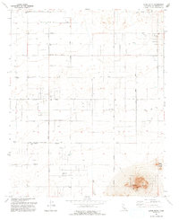
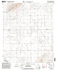
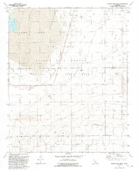 1992 Rogers Lake South1992 Print · USGSThe high desert at the Kern and Los Angeles county line in the early nineties reveals a landscape dedicated to aerospace testing. Researchers can trace military infrastructure from Mercury Boulevard to the Tracking Station and Rogers Lake shoreline.2 unique versions available
 - 1992 Map of Redman
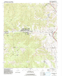
 1992 Redman1992 Print · USGSThe high desert of northern Los Angeles County is captured here in the early nineties as the military and civilian worlds converge. Trace the intersection of desert life and defense at Redman, the Air Force Flight Test Center, and the dry beds of Rogers Lake.
 - 1992 Map of Alpine Butte, 1993 Print
 1992 Alpine Butte1993 Print · USGSIn the early 1990s, the Antelope Valley high desert shows the precise grid of a region being incorporated into municipal plans. Researchers can trace the shifting limits of the Lancaster Corporate Boundary and locate landmarks like Alpine RS and the Radio Facility.
 - 1994 Map of Triunfo Pass, 1999 Print
 1994 Triunfo Pass1999 Print · USGSThe Ventura and Los Angeles county line crosses these coastal mountains during the late twentieth century as recreation areas expanded. Genealogists and historians can locate the Yerba Buena Sch, the settlement of Solromar, and the crossing at Triunfo Pass.
 - 1995 Map of Pasadena, 1999 Print
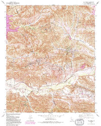
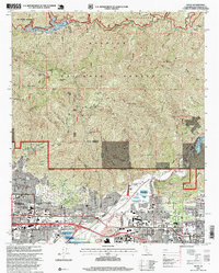
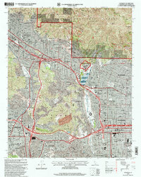 1995 Pasadena1999 Print · USGSThe San Gabriel Valley is captured in the mid-nineties as the urban sprawl of Pasadena and Glendale meets the southern canyons of the Angeles National Forest. Researchers can trace institutional landmarks like the Jet Propulsion Laboratory and the historic Rose Bowl.
 - 1995 Map of Mint Canyon, 1999 Print
 1995 Mint Canyon1999 Print · USGSThe Santa Clarita Valley was undergoing significant suburban growth in the mid-nineties, even as it remained framed by the deep canyons of the Angeles National Forest. Local researchers can trace family landmarks and community sites like Solemint, the Sulphur Spring Sch., and the historic Southern Pacific rail line.
 - 1995 Map of Fairmont Butte, 1999 Print
 1995 Fairmont Butte1999 Print · USGSThe high desert landscape along the Kern and Los Angeles county line is captured here during the 1990s. Researchers can locate remote desert infrastructure and landmarks such as Fairmont Butte, the California Aqueduct, and several private Landing Strips.2 unique versions available
 - 1995 Map of Azusa, 1999 Print
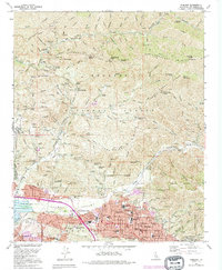
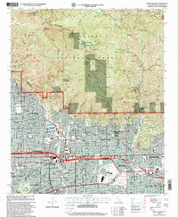
 1995 Azusa1999 Print · USGSThe foothill communities of the San Gabriel Valley meet the wilderness in the mid-1990s, showcasing a landscape of suburban growth and rugged forest. Researchers can locate long-standing institutions like Azusa Pacific University, the City of Hope National Medical Center, and the historic Liveoak Cemetery.
 - 1995 Map of Chilao Flat, 1999 Print
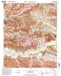
 1995 Chilao Flat1999 Print · USGSThe Angeles National Forest in the mid-nineties remains a remote haven for hikers and historians alike, where mining claims and high ranch outposts dot the San Gabriel peaks. Trace the old workings of the Monte Cristo Mine or follow the route of the Pacific Crest National Scenic Trail past Loomis Ranch.
 - 1995 Map of Mount Wilson, 1999 Print
 1995 Mount Wilson1999 Print · USGSThe San Gabriel foothills meet the suburban edges of Pasadena and Monrovia in the mid-nineties. Researchers can locate the Observatory at Mount Wilson or trace the Gabrielino Trail past Henninger Flats.
 - 1995 Map of Mount Baldy, 1999 Print
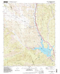
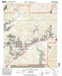
 1995 Mount Baldy1999 Print · USGSThe eastern edge of Los Angeles County meets the San Bernardino line in the mid-nineties, showing the interface of foothill suburbs and forest. Trace local landmarks like the Padua Hills Theater and Webb Sch, or explore the complex watershed around San Antonio Dam.
 - 1995 Map of Beverly Hills, 1999 Print
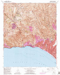
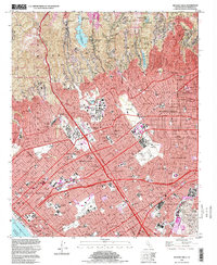 1995 Beverly Hills1999 Print · USGSBeverly Hills and the Westside of Los Angeles appear in detail during the late nineties, from the canyons of the Santa Monica Mountains to the coast. Researchers can trace the development of iconic sites like the UCLA campus, MGM Studios, and the Santa Monica Pier.2 unique versions available
 - 1995 Map of Val Verde, 1999 Print
 1995 Val Verde1999 Print · USGSNorth of Los Angeles in the mid-nineties, the Santa Clara River valley remained a landscape of active oil fields and sprawling ranches. Genealogists and local historians can trace the foundations of Val Verde, locate the Cem near Hasley, and explore the legacy of Stanley Ranch.
 - 1995 Map of Malibu Beach, 1999 Print
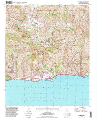 1995 Malibu Beach1999 Print · USGSThe Santa Monica Mountains and the Malibu coastline appear here in the late twentieth century as academic and residential growth shaped the canyons. Researchers can trace the layout of Pepperdine University, find the Las Virgenes Sch (Aband), and locate the historic Malibu Pier.
 - 1995 Map of Liebre Mountain, 1999 Print
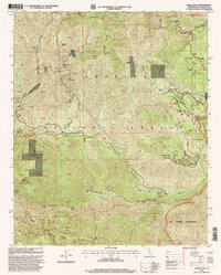
 1995 Liebre Mountain1999 Print · USGSThe Angeles National Forest during the late twentieth century reveals a rugged landscape shaped by the San Andreas Rift Zone and historic travel routes. Genealogists and hikers can trace the Old Ridge Route to historic stops like Sandberg and the Tumble Inn.
 - 1995 Map of Mescal Creek, 1999 Print
 1995 Mescal Creek1999 Print · USGSPinon Hills and the high-desert transition of the San Gabriel foothills are captured here in the mid-1990s. Genealogists and historians can trace legacy holdings at Hagenbaugh Ranch, early mountain recreation at Camp Jubilee, and the namesake waters of Mescal Creek.
Showing maps 1-25 of 55
Top cities of Los Angeles County
- Los Angeles historical maps
- Long Beach historical maps
- Glendale historical maps
- Santa Clarita historical maps
- Pomona historical maps
- Palmdale historical maps
See more
Frequently asked questions
- What are the different types of historical maps available for Los Angeles County?
- What is the oldest map of Los Angeles County?
- Where can I purchase historical maps of Los Angeles County for my home or office?
- Where can I download high-res historical maps of Los Angeles County?
- Are there historical topographic maps available for Los Angeles County?
- Is there historical aerial imagery available for Los Angeles County?
- Where are historical maps of Los Angeles County sourced from?