1940s Maps of Mariposa County, California
Explore 43 historic maps of Mariposa County from the 1940s. These maps offer a rare glimpse into what life looked like during the 1940s — showing old roads, neighborhoods, homes, and landmarks that have changed or disappeared over time.
Whether you're researching your family's past, planning a metal detecting trip, or studying how Mariposa County's landscape evolved across the 1940s, these high-resolution maps are a powerful tool for exploring the history of this region.
- Focus on a specific era: All maps on this page are from the 1940s, giving you a focused view of this time period.
- See what’s changed: Compare century-old streets, trails, and buildings to today's modern landscape using overlays and satellite layers.
- Research with precision: Use these maps for genealogy, historical research, land use analysis, or educational projects.
- View, download, or print: Maps are fully viewable online in high resolution, and can be downloaded or printed for your own records.
Start exploring Mariposa County's history through authentic maps from the 1940s. This is your window into the past.
Mariposa County, CA maps
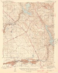
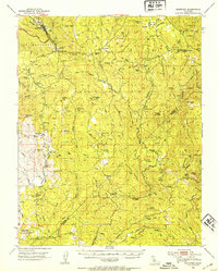
(43)- 1942 Map of Raymond
 1942 Raymond1942 Print · USGSMadera County ranching and mining operations are captured here during the early 1940s as the foothills transitioned from wilderness to industry. Researchers can trace the Southern Pacific rail line to Raymond or locate the Daulton Copper Mine and Savage Monument.
 - 1944 Map of Merced Falls
 1944 Merced Falls1944 Print · USGSThe California foothills in the early forties reveal a landscape of active river dredging and massive reservoirs. Trace the historic Coulterville Road through the mines at Solambo Mine Ridge or locate the dredging Tailings near Snelling.2 unique versions available
 - 1944 Map of Raymond
 1944 Raymond1944 Print · USGSMadera County ranching and mining operations are captured in detail during the early 1940s, just as the regional economy transitioned. Genealogists and historians can trace family landmarks like Sixmile House and Bates Station, or locate the Daulton Copper Mine and Union High School.2 unique versions available
 - 1946 Map of Le Grand, 1953 Print
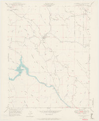
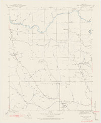
 1946 Le Grand1953 Print · USGSThe San Joaquin Valley agricultural heartland comes into focus during the mid-forties, showing the vital rail corridors and watercourses that shaped the region. Genealogists and local researchers can trace early settlements and rural school sites like Dixieland School, Fairmead, and the northern hub of Le Grand.2 unique versions available
 - 1946 Map of Le Grand, 1961 Print
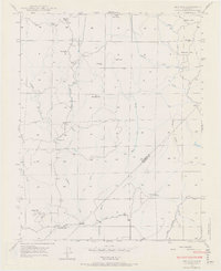
 1946 Le Grand1961 Print · USGSLe Grand and the surrounding Central Valley ranch lands are captured here just after the war as the region's agricultural footprint matured. Researchers can trace the path of the Atchison Topeka and Santa Fe through Le Grand and Marguerite, or locate early industrial sites like the Gravel Pit near Mariposa Creek.
 - 1947 Map of Le Grand
 1947 Le Grand1947 Print · USGSThe Central Valley agricultural landscape of Merced and Madera counties comes into focus just after the war. Researchers can trace the Sharon Atchison Topeka and Santa Fe line through Le Grand and Marguerite, past Ash Slough and dozens of rural windmills.
 - 1947 Map of Raynor Creek
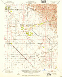
 1947 Raynor Creek1947 Print · USGSMadera and Merced counties meet along the Chowchilla River during the late 1940s, a period of ranching and rural development. Genealogists can trace early routes like Buchanan Road and family-named landmarks such as Raynor Creek.2 unique versions available
 - 1947 Map of Mariposa
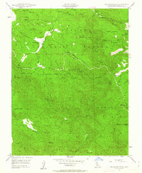
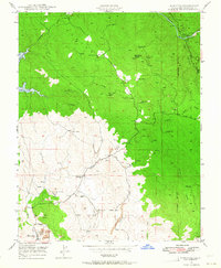
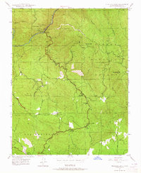
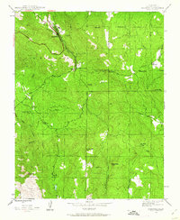 1947 Mariposa1947 Print · USGSMariposa and its surrounding gold-country foothills are documented here in the late 1940s as the town grew along the Yosemite All-Year Highway. Researchers can locate old mining operations like the Mariposa Mine and small community hubs like Mormon Bar and the Sebastopol Sch.5 unique versions available
 - 1947 Map of El Portal
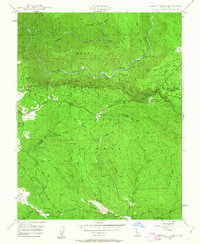
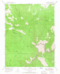
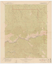 1947 El Portal1947 Print · USGSThe Merced River canyon in the late 1940s stands as a rugged gateway where Yosemite National Park meets several national forests. Genealogists and historians can trace the foundations of El Portal, the rail connections at Incline, and mountain roads like the Old Coulterville Road.6 unique versions available
 - 1947 Map of San Jose, 1948 Print
 1947 San Jose1948 Print · USGSNorthern California's heartland is captured here just after the war, showing the rapid growth of the Santa Clara and Central Valleys. Researchers can trace the legacy of rail and water at Castle Air Force Base, Stockton, and the Hetch Hetchy Aqueduct.
 - 1947 Map of Mariposa, 1948 Print
 1947 Mariposa1948 Print · USGSThe High Sierra and Owens Valley transition is captured here in the late 1940s, just as the region’s hydroelectric and tourism infrastructure was maturing. Genealogists and historians can trace old ranger stations, the Casa Diablo Mine, and rail stops along the Southern Pacific like Benton Station and Zurich.2 unique versions available
 - 1947 Map of El Portal, 1953 Print
 1947 El Portal1953 Print · USGSMariposa County in the late 1940s serves as the rugged threshold to Yosemite, defined by deep river canyons and early forest service outposts. Genealogists and historians can trace the foundations of mountain life at the Colorado Sch, Buffalo Mine, and the McCauley Ranch (Old Stage Sta).4 unique versions available
 - 1947 Map of Coulterville, 1953 Print
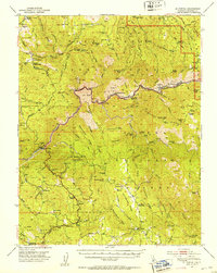
 1947 Coulterville1953 Print · USGSIn the late 1940s, this portion of the Mother Lode still shows a landscape dense with gold mining and ranching activity. Researchers can trace the heritage of Coulterville and Hornitos or locate numerous historic workings like the Mary Harrison Mine and Red Cloud Mines.4 unique versions available
 - 1947 Map of Mariposa, 1953 Print
 1947 Mariposa1953 Print · USGSMariposa and its surrounding Sierra foothills are shown here just after the war, when the local economy was rooted in ranching and gold-era mining. Genealogists can locate family-named sites like John Allen Flat and several rural schoolhouses including Oakgrove Sch and Chowchilla Sch.3 unique versions available
 - 1947 Map of Jawbone Ridge, 1963 Print
 1947 Jawbone Ridge1963 Print · USGSThe Stanislaus National Forest in the late 1940s reveals a rugged landscape of water tunnels and gold mines. Trace family history at Smith Station and Smith Cem, or locate historic sites like the Gold Queen Mine and Buck Meadows.3 unique versions available
 - 1947 Map of Buckhorn Peak, 1963 Print
 1947 Buckhorn Peak1963 Print · USGSMariposa and Tuolumne counties are documented here in the late 1940s, highlighting a high-country landscape of active mining and forest management. Researchers can trace historic claims like the Bondurant Mine or find small settlements and school sites like Cat Town and Bull Creek Sch.4 unique versions available
 - 1947 Map of Groveland, 1964 Print
 1947 Groveland1964 Print · USGSThe foothills of the Sierra Nevada are surveyed here in the late 1940s, documenting the legacy of the Gold Rush in Tuolumne County. Genealogists and historians can locate the Bret Harte Cabin, the old settlement at Second Garrotte, and rural landmarks like the Red Jacket Mine.4 unique versions available
 - 1947 Map of Hornitos, 1964 Print
 1947 Hornitos1964 Print · USGSMariposa County gold country is mapped here just after the war, showing the industrial footprint of the local mining district. Genealogists can locate old family sites like Williams Ranch or trace the legacy of the Mt Gaines Mine and Quartzburg Sch.3 unique versions available
 - 1947 Map of Buckingham Mtn, 1964 Print
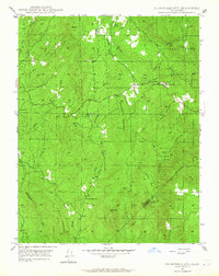
 1947 Buckingham Mtn1964 Print · USGSMariposa County settlement and industry are captured here in the late 1940s as mountain communities like Jerseydale thrived. Trace the legacy of timber and gold through sites like the Buckingham Mtn Sch, Early Mine, and several local sawmills.5 unique versions available
 - 1947 Map of Coulterville, 1964 Print
 1947 Coulterville1964 Print · USGSMariposa County gold country is preserved here in the late 1940s, showing the early expansion of the Merced River's reservoirs. Researchers can locate vanished infrastructure like the Split Rock Ferry and historic mining sites such as the Mary Harrison Mine and Virginia Mine.6 unique versions available
 - 1947 Map of Stumpfield Mtn., 1965 Print
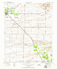
 1947 Stumpfield Mtn.1965 Print · USGSThe Mariposa and Madera County borderlands appear here in the late 1940s, centered on the complex watersheds of the Chowchilla River. Genealogists and historians can locate remote mountain landmarks such as Indian Peak Sch, the Cem near Magoon Hill, and the settlement at Elliott Corner.4 unique versions available
 - 1947 Map of Feliciana Mtn., 1965 Print
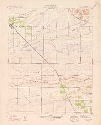
 1947 Feliciana Mtn.1965 Print · USGSMariposa County during the post-war era shows a landscape defined by its mining heritage and the transition into a recreational gateway. You can trace old gold prospects like the King Solomon Mine or locate historic schoolhouses including Colorado Sch and Bear Creek Sch.3 unique versions available
 - 1947 Map of Kinsley, 1967 Print
 1947 Kinsley1967 Print · USGSThe Sierra foothills in the late 1940s show a landscape moving from its mining past toward modern forest management. Locate the McCauley Ranch, trace the Garibaldi Mine, and follow the Merced River canyon.3 unique versions available
 - 1947 Map of Bear Valley, 1968 Print
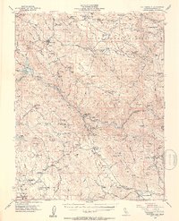
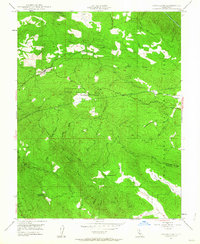
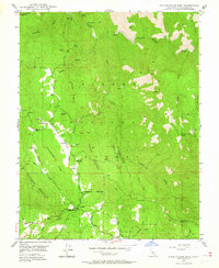
 1947 Bear Valley1968 Print · USGSMariposa County in the late 1940s reveals a landscape shaped by historical mining operations and the Merced River canyon. Local historians can trace family ties to Mt Bullion, locate the Bear Valley Sch, or map the many lodes including the Josephine Mine and Golden Key Mine.5 unique versions available
 - 1947 Map of Ben Hur, 1970 Print
 1947 Ben Hur1970 Print · USGSIn the mid-1940s, the California foothills near the Madera County line supported a network of small schoolhouses and remote ranches. Genealogists and local historians can trace the foundations of the community through Ben Hur Sch, Oakgrove Sch, and the high fire Lookout at Green Mtn.6 unique versions available
Showing maps 1-25 of 43
Frequently asked questions
- What are the different types of historical maps available for Mariposa County?
- What is the oldest map of Mariposa County?
- Where can I purchase historical maps of Mariposa County for my home or office?
- Where can I download high-res historical maps of Mariposa County?
- Are there historical topographic maps available for Mariposa County?
- Is there historical aerial imagery available for Mariposa County?
- Where are historical maps of Mariposa County sourced from?