1990s Maps of Mariposa County, California
Explore 44 historic maps of Mariposa County from the 1990s. These maps offer a rare glimpse into what life looked like during the 1990s — showing old roads, neighborhoods, homes, and landmarks that have changed or disappeared over time.
Whether you're researching your family's past, planning a metal detecting trip, or studying how Mariposa County's landscape evolved across the 1990s, these high-resolution maps are a powerful tool for exploring the history of this region.
- Focus on a specific era: All maps on this page are from the 1990s, giving you a focused view of this time period.
- See what’s changed: Compare century-old streets, trails, and buildings to today's modern landscape using overlays and satellite layers.
- Research with precision: Use these maps for genealogy, historical research, land use analysis, or educational projects.
- View, download, or print: Maps are fully viewable online in high resolution, and can be downloaded or printed for your own records.
Start exploring Mariposa County's history through authentic maps from the 1990s. This is your window into the past.
Mariposa County, CA maps
(44)- 1990 Map of Ascension Mountain
 1990 Ascension Mountain1990 Print · USGSThe High Sierra backcountry of Tuolumne County is captured here in the late twentieth century as it borders Yosemite. Researchers can trace the path of the Hetch Hetchy Aqueduct (Tunnel) and locate historic sites like Harden Flat and the Old RR Grade.
 - 1990 Map of Merced Peak
 1990 Merced Peak1990 Print · USGSThe High Sierra backcountry of Yosemite comes into focus during the late 1980s, documenting the rugged drainage basins and seasonal camps of the Clark Range. Researchers can trace the high-altitude John Muir Trail and locate remote outposts like Merced Lake High Sierra Camp or the Merced Lake Ranger Station.
 - 1990 Map of Ten Lakes
 1990 Ten Lakes1990 Print · USGSHigh Yosemite backcountry comes into focus during the late twentieth century, showing the remote trails and river canyons of the Sierra Nevada. Backpackers and historians can trace the rugged path of the Tuolumne River past Muir Gorge to the heights of Ten Lakes Pass.
 - 1990 Map of Tamarack Flat
 1990 Tamarack Flat1990 Print · USGSYosemite's high country is captured in the early nineties, showing the transition from the developed corridor of Tioga Road to the primitive backcountry. Trace the path of the South Fork Tuolumne River or locate remote landmarks like White Wolf and McSwain Meadows.
 - 1990 Map of Ackerson Mountain
 1990 Ackerson Mountain1990 Print · USGSThe high Sierras near the Tuolumne and Mariposa county line are documented here during the 1990s as modern park management met old mountain settlements. Researchers can locate remote outposts like Hazel Green Ranch, the Carlon FS Station, and the historic sequoias of the Tuolumne Grove.
 - 1990 Map of El Capitan
 1990 El Capitan1990 Print · USGSYosemite's high country and the Merced gateway are captured here in the late twentieth century. Researchers can trace the infrastructure of Badger Pass Ski Area and the remote settlements at Yosemite West and Foresta.
 - 1990 Map of Yosemite Falls
 1990 Yosemite Falls1990 Print · USGSYosemite Valley and its surrounding high country are captured here in the late 1980s, detailing the valley floor and the peaks above. Trace the trails around Yosemite Village and find remote landmarks like Snow Creek Ranger Cabin, Basket Dome, and Lehamite Falls.
 - 1990 Map of Mariposa Grove
 1990 Mariposa Grove1990 Print · USGSThe southern reaches of Yosemite come alive in this late twentieth-century survey of the giant sequoias and granite peaks. Hikers and historians can trace the paths to Grizzly Giant, locate the Star Mine, or follow the South Fork Merced River.
 - 1990 Map of Mount Lyell
 1990 Mount Lyell1990 Print · USGSHigh Sierra wilderness reaches its peak at the junction of three counties in the 1990s, where the headwaters of the Merced and Lyell Fork emerge. Trace remote alpine routes through Isberg Pass, across the Lyell Glacier, and past Mount Ansel Adams.
 - 1990 Map of Vogelsang Peak
 1990 Vogelsang Peak1990 Print · USGSYosemite's high country is documented in the 1990s as it appeared before modern climate shifts impacted its alpine ice and remote camps. Backcountry researchers can trace the intersection of the John Muir Trail and the Pacific Crest National Scenic Trail near Vogelsang High Sierra Camp and the Maclure Glacier.
 - 1990 Map of Tenaya Lake
 1990 Tenaya Lake1990 Print · USGSHigh Sierra wilderness and alpine lakes define this Mariposa County landscape during the late twentieth century. Hikers and historians can trace the John Muir Trail past Sunrise High Sierra Camp or locate the Tenaya Lake Campground.
 - 1990 Map of Fish Camp
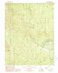
 1990 Fish Camp1990 Print · USGSThe Sierra Nevada high country at the start of the nineties reveals a landscape of forest service history and timber heritage. Researchers can trace the boundary of Yosemite National Park and locate historic sites like Harris Ranch Mill and Wassama Roundhouse State Historical Park.
 - 1990 Map of Half Dome
 1990 Half Dome1990 Print · USGSThe Yosemite Valley floor and its iconic granite summits are documented here during the late eighties. Researchers can trace the development of Yosemite Village and historic sites like the Ahwahnee Hotel alongside the Half Dome Trail.2 unique versions available
 - 1990 Map of White Chief Mountain
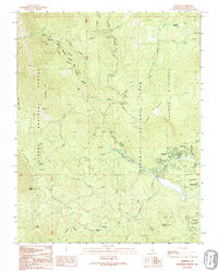
 1990 White Chief Mountain1990 Print · USGSMadera County’s high country is captured here during the 1990s as the Sierra wilderness met growing recreational use. Researchers can trace forest management and early outpost sites like Soquel Meadow Ranch, the ancient sequoias of Nelder Grove, and the iconic Fresno Dome.
 - 1990 Map of Wawona
 1990 Wawona1990 Print · USGSWawona and the southern reaches of Yosemite are captured in the late 1980s, documenting the intersection of protected wilderness and local community. Genealogists and historians can locate the Wawona School, the landmark Covered Bridge, and various campsites along the South Fork Merced River.
 - 1992 Map of Wawona, 1995 Print
 1992 Wawona1995 Print · USGSYosemite's southern gateway comes into focus in the early nineties, centered on the historic mountain community of Wawona. Researchers can trace local infrastructure from the Wawona Sch and Covered Bridge to the remote sites of Stovepipe Campground and Summit Campground.
 - 1992 Map of El Capitan, 1995 Print
 1992 El Capitan1995 Print · USGSYosemite National Park and the surrounding Sierra National Forest are shown here in the early nineties, centered on the iconic monolith of El Capitan. Researchers can trace the layout of Badger Pass Ski Area, the historic Old Coulterville Road, and the community at Foresta.
 - 1992 Map of Feliciana Mtn., 1995 Print
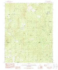
 1992 Feliciana Mtn.1995 Print · USGSMariposa County in the early nineties reveals a rugged landscape where historical mining interests met burgeoning mountain tourism. Genealogists and historians can trace family locations near Colorado Sch, the Feliciana Mine, or the mid-century lodges of Midpines.
 - 1992 Map of Half Dome, 1995 Print
 1992 Half Dome1995 Print · USGSYosemite Valley in the early 1990s reveals the intricate balance between famous landmarks and a vast trail network. Trace the routes to Half Dome, locate the historic Ahwahnee Hotel, and follow the Merced River through Yosemite Village.
 - 1992 Map of Ten Lakes, 1995 Print
 1992 Ten Lakes1995 Print · USGSThe high Sierra backcountry within Yosemite National Park is captured here during the 1990s before modern digital shifts in wilderness mapping. Hikers and historians can trace the steep routes through the Grand Canyon of the Tuolumne River and find remote water bodies like Ten Lakes and Saddle Horse Lake.
 - 1992 Map of Kinsley, 1995 Print
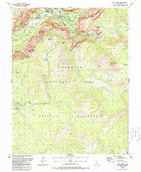
 1992 Kinsley1995 Print · USGSThe Stanislaus and Sierra National Forest boundary comes into focus in the early 1990s, showcasing the canyons of the Merced River. Trace family ranching roots and mining history at McCauley Ranch, the Garibaldi Mine, and Jenkins Ranch.2 unique versions available
 - 1992 Map of Tenaya Lake, 1995 Print
 1992 Tenaya Lake1995 Print · USGSYosemite's high country during the early 1990s reveals a wilderness of granite peaks and seasonal backcountry camps. Hikers and historians can trace the John Muir Trail past Cathedral Peak or locate the May Lake High Sierra Camp.
 - 1992 Map of Tamarack Flat, 1995 Print
 1992 Tamarack Flat1995 Print · USGSHigh Sierra wilderness and the upper reaches of the Tuolumne River define this landscape in the early 1990s. Hikers and historians can trace high-altitude routes along Tioga Road to Tamarack Flat and the White Wolf Campground.
 - 1992 Map of Yosemite Falls, 1995 Print
 1992 Yosemite Falls1995 Print · USGSMariposa and Tuolumne counties are captured here in the early nineties, showcasing the intersection of park management and wild sierra terrain. Researchers can locate the Courthouse at Yosemite Village, trace the route of Tioga Road, and identify remote landmarks like the Snow Creek Ranger Cabin.
 - 1992 Map of Ascension Mountain, 1995 Print
 1992 Ascension Mountain1995 Print · USGSTuolumne and Mariposa counties are shown in the late eighties as they transition from industrial timber lands to protected forest. Researchers can locate the Hetch Hetchy Aqueduct (Tunnel), the Pilot Peak Lookout, and an Old RR Grade.
Showing maps 1-25 of 44
Frequently asked questions
- What are the different types of historical maps available for Mariposa County?
- What is the oldest map of Mariposa County?
- Where can I purchase historical maps of Mariposa County for my home or office?
- Where can I download high-res historical maps of Mariposa County?
- Are there historical topographic maps available for Mariposa County?
- Is there historical aerial imagery available for Mariposa County?
- Where are historical maps of Mariposa County sourced from?