2000s (21st Century) Maps of Mariposa County, California
Explore 182 historic maps of Mariposa County from the 2000s (21st Century). These maps offer a rare glimpse into what life looked like during the 2000s — showing old roads, neighborhoods, homes, and landmarks that have changed or disappeared over time.
Whether you're researching your family's past, planning a metal detecting trip, or studying how Mariposa County's landscape evolved across the 2000s, these high-resolution maps are a powerful tool for exploring the history of this region.
- Focus on a specific era: All maps on this page are from the 2000s, giving you a focused view of this time period.
- See what’s changed: Compare century-old streets, trails, and buildings to today's modern landscape using overlays and satellite layers.
- Research with precision: Use these maps for genealogy, historical research, land use analysis, or educational projects.
- View, download, or print: Maps are fully viewable online in high resolution, and can be downloaded or printed for your own records.
Start exploring Mariposa County's history through authentic maps from the 2000s. This is your window into the past.
Mariposa County, CA maps
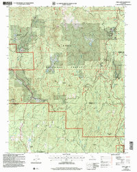
(182)- 2001 Map of Coulterville, 2004 Print
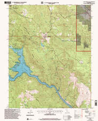 2001 Coulterville2004 Print · USGSThe Mother Lode foothills around Coulterville and Greeley Hill are shown here as they appeared at the start of the new millennium. Researchers can trace historic mining sites like the Mary Harrison Mine, locate the local cemetery, and follow the winding shoreline of Lake McClure.2 unique versions available
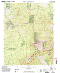
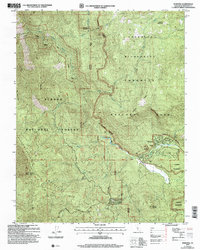
 - 2001 Map of Jawbone Ridge, 2004 Print
 2001 Jawbone Ridge2004 Print · USGSThe Stanislaus National Forest comes into sharp focus during this period of modern forest management and recreation. Researchers can trace the layout of the Argo Mine and Groveland Ranger Station, or locate seasonal retreats like the San Jose Family Camp.
 - 2001 Map of Kinsley, 2004 Print
 2001 Kinsley2004 Print · USGSMariposa County at the turn of the millennium shows a landscape shaped by the Merced River and legacy ranching. Genealogists and historians can trace family-named sites like McCauley Ranch, the settlement at Kinsley, and the Ferguson Dump.2 unique versions available
 - 2001 Map of Ascension Mountain, 2004 Print
 2001 Ascension Mountain2004 Print · USGSThe high Sierra foothills of Tuolumne County are captured here at the turn of the century, showing the forest and river systems just west of Yosemite. Researchers can locate seasonal sites like Camp Tawonga, trace the old Coulterville Road, and find mining history at Sawmill Quarry.2 unique versions available
 - 2001 Map of Ackerson Mountain, 2004 Print
 2001 Ackerson Mountain2004 Print · USGSThe Yosemite high country and Stanislaus forest interface are captured here just after the turn of the millennium. Researchers can trace historic ranching sites like Peach Growers and Hazel Green Ranch or locate the Big Oak Flat Ranger Sta.
 - 2001 Map of Buckhorn Peak, 2004 Print
 2001 Buckhorn Peak2004 Print · USGSMariposa County's mining and forest history is preserved in this late-century survey of the rugged Stanislaus region. Researchers can locate remote sites like the Red Cloud Mine, trace the winding Coulterville Old Yosemite Road, or explore the drainages around Cat Town.2 unique versions available
 - 2001 Map of Groveland, 2004 Print
 2001 Groveland2004 Print · USGSGroveland and the Stanislaus National Forest area are shown at the start of the new millennium, balancing historical mining roots with modern resort life. Trace the sites of the Red Jacket Mine, Tenaya Sch, and the legendary Bret Harte Cabin.
 - 2004 Map of Stumpfield Mountain, 2007 Print
 2004 Stumpfield Mountain2007 Print · USGSMariposa and Madera counties are captured here in the early 2000s as the Sierra foothills transitioned into the high forest. Researchers can locate remote landmarks like the Indian Peak School, the cemetery near Fox Creek, and the small settlement at Elliott Corner.
 - 2004 Map of Mariposa Grove, 2007 Print
 2004 Mariposa Grove2007 Print · USGSYosemite's high country is captured here during the early 2000s, showing the intersection of national park wilderness and forest lands. Researchers can trace the groves and landmarks of the Mariposa Grove, including the Grizzly Giant and the remote Star Mine.
 - 2004 Map of Mount Lyell, 2007 Print
 2004 Mount Lyell2007 Print · USGSThe High Sierra near the Yosemite-Madera border is captured here during the early 2000s, showcasing a landscape of glaciers and alpine summits. Trekkers and historians can trace routes through Isberg Pass, locate the Maclure Glacier, or find the source of the Merced River.
 - 2004 Map of El Portal, 2007 Print
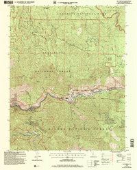 2004 El Portal2007 Print · USGSMariposa County at the start of the millennium shows the critical park gateway at El Portal and the surrounding wilderness of the Stanislaus National Forest. Researchers can trace old mining prospects and find historic settlements like Hite Cove, Incline, and Foresta.
 - 2004 Map of White Chief Mountain, 2007 Print
 2004 White Chief Mountain2007 Print · USGSMadera County ranchlands and Sierra timber stands are detailed here at the start of the millennium. Researchers can trace historic land use at the Sivils Ranch (Site), the ancient sequoias of Shadow of the Giants, and the Soquel Meadow Ranch.
 - 2004 Map of Feliciana Mountain, 2007 Print
 2004 Feliciana Mountain2007 Print · USGSMariposa County gold country and the Merced River corridor are captured here during a period of modern forest management. Metal detectorists and researchers can locate numerous historical extraction sites like King Solomon Mine and the Historical Bear Creek Sch.
 - 2004 Map of Buckingham Mountain, 2007 Print
 2004 Buckingham Mountain2007 Print · USGSMariposa County's mining and forest history are preserved here in the Sierra foothills as they appeared in the early 2000s. Genealogists and researchers can trace the Buckingham Mountain Sch and old mining operations like Early Mine and Hite Cove (Site).
 - 2004 Map of Fish Camp, 2007 Print
 2004 Fish Camp2007 Print · USGSThe borderlands of Mariposa and Madera Counties are captured here during the early 2000s, showcasing the intersection of timber history and park land. Researchers can trace the legacy of mountain industry and indigenous sites at Harris Ranch Mill, Sugar Pine, and the Wassama Roundhouse State Historical Park.
 - 2004 Map of El Capitan, 2007 Print
 2004 El Capitan2007 Print · USGSMariposa County, California, is captured here in the early 2000s, showcasing the high-elevation meadows and sheer granite faces of the Yosemite valley. Researchers can trace historic access routes like Old Coulterville Road or locate the Hennes Ridge Lookout and the Badger Pass Ski Hill.
 - 2004 Map of Wawona, 2007 Print
 2004 Wawona2007 Print · USGSThe mountain community of Wawona is captured at the start of the 21st century, where the national park and national forest boundaries meet. Genealogists and historians can locate the Wawona School, trace the path over Battalion Pass, or find the historic Covered Bridge.
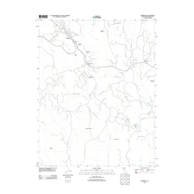
 - 2012 Map of Raymond, 2012 Print
 2012 Raymond2012 Print · USGSCovers Mariposa County, including Raymond, Knowles Junction, and other nearby areas
 - 2012 Map of Ten Lakes, 2012 Print
 2012 Ten Lakes2012 Print · USGSCovers Mariposa County, including Tuolumne County, United States, and other nearby areas
 - 2012 Map of Yosemite Falls, 2012 Print
 2012 Yosemite Falls2012 Print · USGSCovers Mariposa County, including Tuolumne County, United States, and other nearby areas
 - 2012 Map of Horsecamp Mountain, 2012 Print
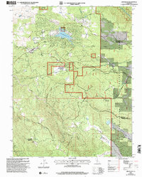
 2012 Horsecamp Mountain2012 Print · USGSCovers Mariposa County, including Madera County, United States, and other nearby areas
 - 2012 Map of Mariposa, 2012 Print
 2012 Mariposa2012 Print · USGSCovers Mariposa County, including Bootjack, Mariposa, and other nearby areas
 - 2012 Map of Buckhorn Peak, 2012 Print
 2012 Buckhorn Peak2012 Print · USGSCovers Mariposa County, including United States, California, and other nearby areas
 - 2012 Map of Jawbone Ridge, 2012 Print
 2012 Jawbone Ridge2012 Print · USGSCovers Mariposa County, including Buck Meadows, East Greeley Hill, and other nearby areas
 - 2012 Map of El Capitan, 2012 Print
 2012 El Capitan2012 Print · USGSCovers Mariposa County, including Yosemite West, United States, and other nearby areas
Showing maps 1-25 of 182
Frequently asked questions
- What are the different types of historical maps available for Mariposa County?
- What is the oldest map of Mariposa County?
- Where can I purchase historical maps of Mariposa County for my home or office?
- Where can I download high-res historical maps of Mariposa County?
- Are there historical topographic maps available for Mariposa County?
- Is there historical aerial imagery available for Mariposa County?
- Where are historical maps of Mariposa County sourced from?