1990s Maps of Mammoth Lakes, California
Explore 10 historic maps of Mammoth Lakes from the 1990s. These maps offer a rare glimpse into what life looked like during the 1990s — showing old roads, neighborhoods, homes, and landmarks that have changed or disappeared over time.
Whether you're researching your family's past, planning a metal detecting trip, or studying how Mammoth Lakes's landscape evolved across the 1990s, these high-resolution maps are a powerful tool for exploring the history of this region.
- Focus on a specific era: All maps on this page are from the 1990s, giving you a focused view of this time period.
- See what’s changed: Compare century-old streets, trails, and buildings to today's modern landscape using overlays and satellite layers.
- Research with precision: Use these maps for genealogy, historical research, land use analysis, or educational projects.
- View, download, or print: Maps are fully viewable online in high resolution, and can be downloaded or printed for your own records.
Start exploring Mammoth Lakes's history through authentic maps from the 1990s. This is your window into the past.
Mammoth Lakes, CA maps
(10)- 1990 Map of Bloody Mountain, 1995 Print
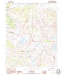 1990 Bloody Mountain1995 Print · USGSHigh Sierra mining history and wilderness recreation intersect in the 1990s near the crest of the Sierra Nevada. Trace old mineral workings at Old Mammoth Mine and the Mill City (Site) alongside high-altitude waters like Duck Lake and Bloody Lake.
 - 1990 Map of Whitmore Hot Sprs, 1995 Print
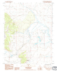 1990 Whitmore Hot Sprs1995 Print · USGSMono County's hydrothermal landscape is captured here in the early nineties, showing a region defined by its volcanic geology and high-desert hydrology. Researchers can locate the State Fish Hatchery, the isolated Cashbaugh Ranch, and the waters of Big Alkali Lake.
 - 1992 Map of Mammoth Mtn, 1995 Print
 1992 Mammoth Mtn1995 Print · USGSThe high Sierra landscape near the Mono and Madera county line is captured here in the early nineties, showing a mix of primitive wilderness and developed recreation. Trace the route of the Pacific Crest National Scenic Trail past Devils Postpile and the seasonal camps at Agnew Meadows.
 - 1992 Map of Crystal Crag, 1995 Print
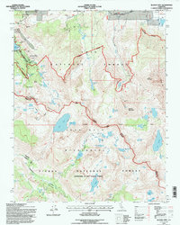
 1992 Crystal Crag1995 Print · USGSThe High Sierra backcountry of Madera and Mono Counties is documented here in the early nineties, centered on the unique basalt columns of Devils Postpile. Trace the historic routes of the John Muir Trail past Reds Meadow and the alpine shores of Lake Mary.
 - 1994 Map of Convict Lake, 1997 Print
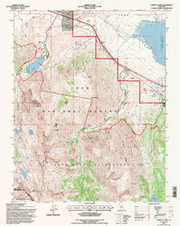 1994 Convict Lake1997 Print · USGSThe High Sierra meets the basin of Long Valley in the mid-nineties, capturing the interface of recreation and scientific research. Trace high-altitude industrial history at the Scheelore Mine or explore the drainage basins of Convict Lake and Lake Crowley.
 - 1994 Map of Whitmore Hot Sprs, 1997 Print
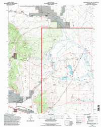 1994 Whitmore Hot Sprs1997 Print · USGSThe geothermal Long Valley region during the 1990s highlights a landscape of alkali flats and thermal springs. Genealogists and researchers can locate Cashbaugh Ranch, Whitmore Hot Sprs, and the Hot Creek State Fish Hatchery along the Owens River.
 - 1994 Map of Crystal Crag, 1997 Print
 1994 Crystal Crag1997 Print · USGSThe High Sierra backcountry is documented here in the mid-nineties, showing the intersection of wilderness areas and alpine lake resorts. Trace the volcanic geology of Devils Postpile and locate historical landmarks like Reds Meadow Hot Springs and Rainbow Falls.
 - 1994 Map of Mammoth Mtn, 1997 Print
 1994 Mammoth Mtn1997 Print · USGSThe High Sierra near the Mono and Madera county line is captured in the mid-1990s as it supports both protected wilderness and growing recreation. Trace the paths of the John Muir Trail and Pacific Crest National Scenic Trail past Soda Springs and Agnew Meadows.
 - 1994 Map of Old Mammoth, 1997 Print
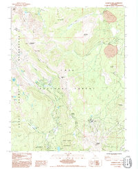
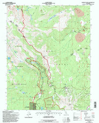
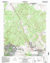 1994 Old Mammoth1997 Print · USGSMammoth Lakes and the high Sierra foothills are captured in the mid-nineties during a period of significant recreational growth. Researchers can locate original sites at Old Mammoth, trace the Earthquake Fault, or find the historic Arcularius Ranch.
 - 1994 Map of Bloody Mtn., 1997 Print
 1994 Bloody Mtn.1997 Print · USGSThe High Sierra near the Mono and Fresno county line is captured here in the mid-1990s as a landscape of mining history and alpine wilderness. Trace the footprints of the gold era at the Old Mammoth Mine or the Mill City (Site) before heading into the high basins of Duck Lake and Purple Lake.
End of results
Showing maps 1-10 of 10
Top cities near Mammoth Lakes
Top neighborhoods of Mammoth Lakes
Frequently asked questions
- What are the different types of historical maps available for Mammoth Lakes?
- What is the oldest map of Mammoth Lakes?
- Where can I purchase historical maps of Mammoth Lakes for my home or office?
- Where can I download high-res historical maps of Mammoth Lakes?
- Are there historical topographic maps available for Mammoth Lakes?
- Is there historical aerial imagery available for Mammoth Lakes?
- Where are historical maps of Mammoth Lakes sourced from?