Old Maps of Folsom, California for Academic Research
Study the evolution of Folsom with 36 high-resolution historic maps. Whether you're teaching, researching, or modeling changes in land use, these maps provide essential visual documentation of urban, environmental, and geographic change.
- Analyze long-term change: Track patterns in development, transportation, and natural features.
- Ideal for environmental or urban studies: Support academic projects with primary historical map data.
- Use in the classroom or lab: Educators and researchers rely on these maps to bring historical context to life.
These maps are a powerful tool for teaching, research, and visualizing how Folsom has changed over the decades.
Folsom, CA maps
(36)- 1891 Map of Sacramento
 1891 Sacramento1891 Print · USGSNorthern California foothills and the valley plains emerge in the late nineteenth century as the rail-and-road network expands. Trace early family landmarks and river crossings like Mormon Island, Whitney Ranch, and the historic Rattlesnake Bridge.
 - 1892 Map of Sacramento
 1892 Sacramento1892 Print · USGSThe rail-and-river economy of Northern California is on full display in the 1890s as the Central Pacific Railroad links the valley to the foothills. Genealogists and historians can trace early settlements like Mormon Island, Salmon Falls, and the Whitney's Ranch before modern development changed the landscape.5 unique versions available
 - 1893 Map of Sacramento, 1900 Print
 1893 Sacramento1900 Print · USGSThe Sacramento Valley and Sierra foothills come alive in this late nineteenth-century survey during the height of the railroad era. Researchers can trace the early layout of Roseville, locate family landmarks like Whitney's Ranch, or follow the Placerville Road through the gold country.
 - 1908 Map of Buffalo Creek
 1908 Buffalo Creek1908 Print · USGSSacramento County ranching and rail history converge in this early century survey of the Rio De Los Americanos. Trace the old Sacramento and Jackson Road and find the Highland School near Deer Creek.
 - 1914 Map of Folsom
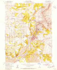
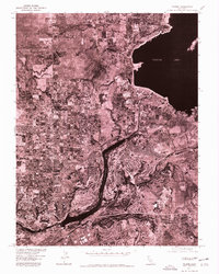
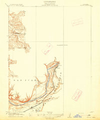 1914 Folsom1914 Print · USGSThe American River gold country comes alive in this early century survey of the region surrounding Folsom. Researchers can trace the path of the Placerville Branch railroad or locate early industrial sites like the Power House and a large river Dredge.2 unique versions available
 - 1916 Map of Buffalo Creek
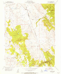
 1916 Buffalo Creek1916 Print · USGSSacramento County ranch lands appear here in the early twentieth century, showing the shift from historic land grants to rural townships. Researchers can trace the Highland School and the early path of the Sacramento and Jackson Road.2 unique versions available
 - 1941 Map of Folsom, 1957 Print
 1941 Folsom1957 Print · USGSThe foothills of the Sierra Nevada meet the Central Valley in the early 1940s, showing the river and rail corridors before major reservoirs were built. Researchers can trace the original tracks of the Southern Pacific and locate historic rural hubs like Natoma, Clarksville, and Mormon Island Sch.2 unique versions available
 - 1944 Map of Folsom
 1944 Folsom1944 Print · USGSThe American River region around Folsom thrives in the early 1940s, marked by dredging bars and early rail transport before major reservoirs transformed the valley. Researchers can find many schoolhouses like Mormon Island Sch and landmarks such as the State Prison Represa.2 unique versions available
 - 1947 Map of Sacramento, 1948 Print
 1947 Sacramento1948 Print · USGSThe Sacramento Valley meets the high Sierra during a period of post-war expansion. Trace the historic river delta islands like Grand Island or locate early airfield footprints at McClellan Air Force Base and Mather Air Force Base.2 unique versions available
 - 1948 Map of Sacramento, 1951 Print
 1948 Sacramento1951 Print · USGSPost-war Northern California comes alive in this regional survey, capturing the era of expansion between the Central Valley and the High Sierra. Researchers can trace the rail networks of the Central California Traction and Sacramento Northern RR or locate landmarks like the State Capitol and University of California Davis.
 - 1953 Map of Clarksville, 1955 Print
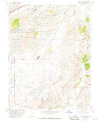
 1953 Clarksville1955 Print · USGSEl Dorado County was undergoing a major transformation in the mid-1950s as the Folsom Reservoir project began to submerge the local landscape. Genealogists and historians can locate the Live Oak Sch, trace the Southern Pacific rail line, and find old settlements like Clarksville.7 unique versions available
 - 1954 Map of Buffalo Creek, 1955 Print
 1954 Buffalo Creek1955 Print · USGSSacramento County in the mid-1950s shows a landscape still defined by gold-era industry and large land grants. Researchers can trace the massive Dredge Tailings near the Southern Pacific tracks or locate the Blodgett Reservoir and old windmill sites.2 unique versions available
 - 1954 Map of Folsom, 1955 Print
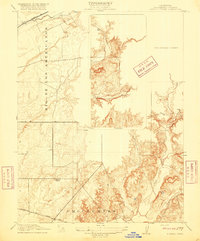
 1954 Folsom1955 Print · USGSThe American River region undergoes a massive transformation in the mid-fifties as the new Folsom and Nimbus dams begin to reshape the valley. Genealogists and historians can trace the foundations of Orangevale or find the soon-to-be-submerged Mormon Island (Site) and Prairie City (Site).2 unique versions available
 - 1954 Map of Folsom SE, 1955 Print
 1954 Folsom SE1955 Print · USGSThe Gold Country foothills of Sacramento and El Dorado counties are shown here during the mid-1950s. Genealogists and historians can trace old mining sites near Walltown, the path of the Southern Pacific, and the Carson Creek Sch (Aban'd).5 unique versions available
 - 1956 Map of Sacramento
 1956 Sacramento1956 Print · USGSMid-century California unfolds from the delta to the high Sierra, capturing a landscape of growing valley cities and burgeoning military airbases. Genealogists and historians can trace the rail lines and river towns from Woodland to Lodi, or explore the foothill settlements of Placerville and Jackson.2 unique versions available
 - 1957 Map of Sacramento, 1966 Print
 1957 Sacramento1966 Print · USGSIn the mid-twentieth century, the California heartland was a hub of river transport, rail lines, and military airbases. Genealogists and historians can trace the development of Gold Country towns like Angels Camp and Sonora or follow the path of the Southern Pacific RR through the growing suburbs of Sacramento.4 unique versions available
 - 1967 Map of Folsom, 1968 Print
 1967 Folsom1968 Print · USGSThe American River corridor was undergoing rapid transformation in the late sixties as suburban growth met industrial history. Researchers can locate Folsom State Prison, trace the old Prairie City (Site), and see the extensive Dredge Tailings left from gold mining days.4 unique versions available
 - 1967 Map of Buffalo Creek, 1968 Print
 1967 Buffalo Creek1968 Print · USGSSacramento County in the late sixties shows a landscape transformed by gold dredging and military expansion. Genealogists and researchers can trace the margins of Mather Air Force Base, find the Frye settlement, or locate Carson Creek High Sch among the expansive dredge tailings.6 unique versions available
 - 1975 Map of Folsom, 1978 Print
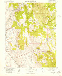
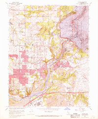
 1975 Folsom1978 Print · USGSGreater Sacramento's transition toward modern suburban development is captured in the mid-1970s through this detailed aerial survey. Trace the growth of Folsom and Orangevale alongside the massive engineering of Folsom Lake and Lake Natoma.
 - 1994 Map of Sacramento
 1994 Sacramento1994 Print · USGSThe Sacramento valley was a landscape of massive flood control and military aviation during the mid-nineties. Researchers can trace the complex network of the Yolo Bypass and the Sacramento River alongside McClellan Air Force Base and Zamora.2 unique versions available
 - 2012 Map of Folsom SE, 2012 Print
 2012 Folsom SE2012 Print · USGSCovers Folsom, including El Dorado Hills, Malby Crossing, and other nearby areas
 - 2012 Map of Buffalo Creek, 2012 Print
 2012 Buffalo Creek2012 Print · USGSCovers Folsom, including Rancho Cordova, Sacramento County, and other nearby areas
 - 2012 Map of Folsom, 2012 Print
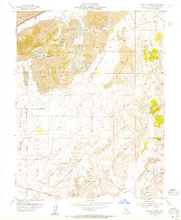
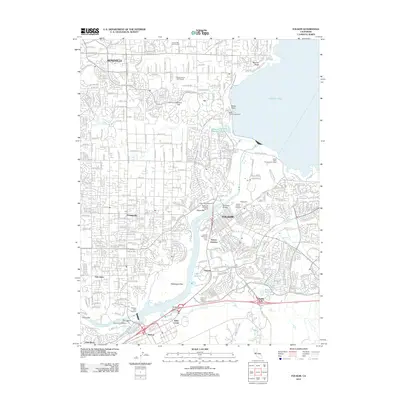 2012 Folsom2012 Print · USGSCovers Folsom, including Roseville, Citrus Heights, and other nearby areas
 - 2012 Map of Clarksville, 2012 Print
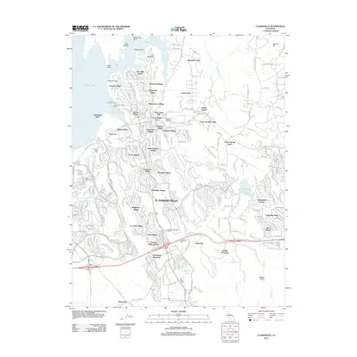 2012 Clarksville2012 Print · USGSCovers Folsom, including El Dorado Hills, Bar J Ranch, and other nearby areas
 - 2015 Map of Folsom SE, 2015 Print
 2015 Folsom SE2015 Print · USGSCovers Folsom, including El Dorado Hills, Malby Crossing, and other nearby areas
Showing maps 1-25 of 36
Top cities near Folsom
- Sacramento historical maps
- Roseville historical maps
- Citrus Heights historical maps
- Rancho Cordova historical maps
- Rocklin historical maps
- El Dorado Hills historical maps
See more
Top neighborhoods of Folsom
- Folsom Junction historical maps
- Natoma historical maps
- White Rock historical maps
- Represa historical maps
- Prairie Oaks historical maps
- Folsom Meadows historical maps
See more
Frequently asked questions
- What are the different types of historical maps available for Folsom?
- What is the oldest map of Folsom?
- Where can I purchase historical maps of Folsom for my home or office?
- Where can I download high-res historical maps of Folsom?
- Are there historical topographic maps available for Folsom?
- Is there historical aerial imagery available for Folsom?
- Where are historical maps of Folsom sourced from?